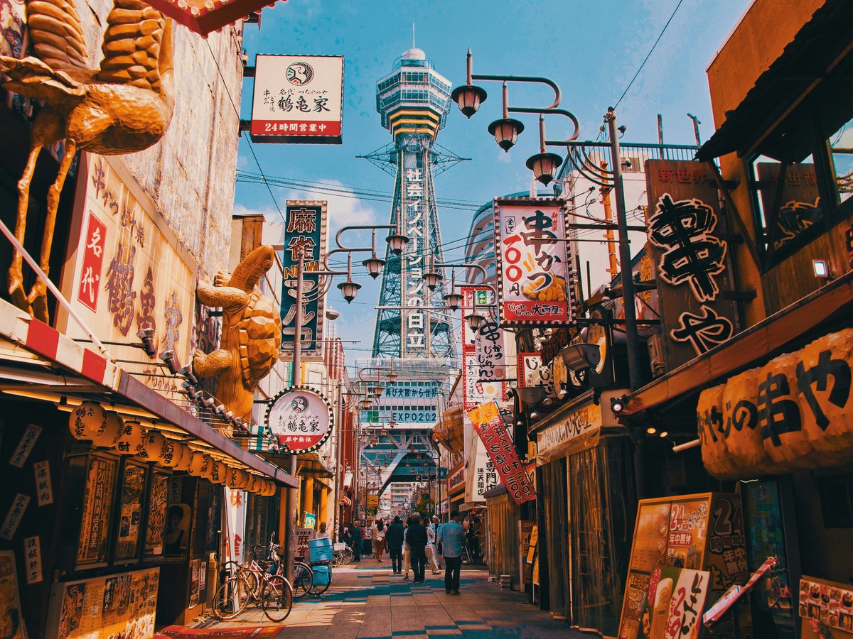
Osaka sits on a coastal plain at the eastern end of the Inland Sea, hemmed in by low mountains to the north and east — the Rokko range, the Ikoma hills, Mount Kongo to the south. It's not a city people associate with outdoor pursuits, which is part of what makes it interesting. You can be standing in the crush of Namba station and forty minutes later find yourself on a quiet ridge trail with views of the Kii Peninsula. The Yodo River system threads through the urban core, and the old canal network — remnants of Osaka's merchant-city past — still shapes how the city breathes. Summers are brutally humid, the kind of wet heat that soaks through your shirt before you finish tying your boots. But spring and autumn are genuinely pleasant, and even winter stays mild enough for comfortable hiking. The city's relationship with its surrounding mountains feels different from Tokyo's — the hills are closer, lower, more approachable. You can day-hike seriously without a car, which is something not every Japanese city offers.
Outdoor activities
-
Cycling the Yodogawa River Path
A flat, paved cycling path runs along the Yodo River from central Osaka north toward Kyoto. The stretch from Umeda to Hirakata is roughly 25 kilometers one way, mostly car-free, with the river on one side and baseball diamonds and allotment gardens on the other. You'll pass under a series of bridges, each one a little different. Rental cycles are available from various stations through the Osaka city bike-share system. The path gets busy on weekend mornings — serious road cyclists mixed with families on mamacharis. The wind tends to come off the river, which helps in summer but can slow you down heading north.
- Difficulty
- Easy
- Duration
- 2-4 hours one way depending on pace and stops
- Best season
- March to May, October to November
-
Rock Climbing at Geyzan Rock (Sennan Area)
South of the city near Izumi, there are several granite crags that local climbers have been using for decades. Geyzan in the Sennan area has bolted sport routes ranging from 5.8 to 5.12. The rock tends to be rough on skin — coarse granite — so bring tape. Access requires a short uphill walk from parking areas. The climbing community in Kansai is tight-knit and generally welcoming, though route information is still mostly in Japanese guidebooks. Worth noting: some crags have access agreements with local landowners, so check current conditions on Japanese climbing forums before showing up.
- Difficulty
- Moderate to difficult depending on route
- Duration
- Half day to full day
- Best season
- October to April — summer is too hot and humid for comfortable climbing
-
Trail Running on Mount Ikoma
The trails on Ikoma, the ridge separating Osaka Prefecture from Nara, work well for trail running. The Ikoma Sanjo Amusement Park area has several interconnected trails that roll along the ridgeline with gentle elevation changes. Total elevation from Kintetsu Ikoma Station to the summit is around 400 meters. The footing is mostly packed earth and some stone steps — slippery after rain. You'll hear the cable car humming and occasionally smell the food stalls at the top. It's not wilderness, but the tree cover is dense enough that you forget the city for stretches.
- Difficulty
- Moderate
- Duration
- 2-3 hours for a loop from the station
- Best season
- March to May, October to November
-
SUP on the Osaka Canals
Stand-up paddleboarding on the canals around Nakanoshima and Dotonbori has become a thing in the past few years. Several outfitters run guided tours, particularly along the Tosabori and Higashiyokobori rivers. Paddling under the stone bridges with the city rising up on both sides gives you a completely different perspective — you notice the old warehouse facades and the way the light hits the water in late afternoon. The water is calmer than you might expect, though boat wakes from tour vessels can catch you off guard. Not the cleanest water, mind you, but you're not swimming in it.
- Difficulty
- Easy — prior SUP experience helps but isn't required
- Duration
- 1.5 to 2 hours for a guided tour
- Best season
- April to October, though summer mornings before the heat builds are ideal
-
Paragliding at Katsuragi Kogen
On the slopes of Mount Katsuragi, south of Osaka near the Wakayama border, tandem paragliding flights operate from a highland area with good thermals. The launch site looks out over the Osaka plain toward the sea, and on clear days the view stretches a long way. Flights typically last 10 to 15 minutes depending on conditions. You'll need to book through a local operator — this isn't a walk-up situation. Wind conditions matter, so cancellations happen. The drive from central Osaka takes about an hour and a half.
- Difficulty
- Easy for tandem — the pilot does the work
- Duration
- Half day including travel and briefing
- Best season
- March to May, September to November — stable air, decent visibility
Day hikes
-
Minoo Falls Trail to Mount Tenjo
Start at Minoo Station on the Hankyu line and follow the river path up to the falls — that's the standard tourist walk, about 2.5 kilometers. But you can keep going past the falls on a trail that climbs to Mount Tenjo (the ridge above the valley). The trail narrows, the tourists thin out, and you're suddenly in proper forest — cedar and oak, with wild boar warning signs that you should take seriously. The ridge gives intermittent views north toward the Kita-Settsu mountains. You can loop back down to a different station or retrace your steps. Footing gets muddy after rain, and some sections are steep with exposed roots.
- Difficulty
- Easy to falls, moderate to Mount Tenjo
- Duration
- 3-4 hours round trip including the falls
- Best season
- April to May for new growth, November for autumn color — avoid July-August humidity
-
Mount Ikoma Traverse
Take the Kintetsu line to Ikoma Station in Nara Prefecture, then climb the west face of Mount Ikoma (642m) on a well-marked trail. The ascent is steady — stone steps for much of it, built by generations of shrine pilgrims. At the top there's the slightly surreal Ikoma Sanjo Amusement Park, which has been here since the 1920s. You can descend the Osaka side to Ishikiri or Nunobiki stations. The traverse gives you views of both the Nara basin and the Osaka plain on clear days. Bring water — there's a vending machine at the top, but nothing on the trail itself.
- Difficulty
- Moderate — steady climb, well-maintained trail
- Duration
- 3-4 hours one way including summit time
- Best season
- March to May, October to December
-
Mount Kongo via the Ropeway Trail
Mount Kongo (1,125m) is the highest peak in Osaka Prefecture, south of the city near Chihayaakasaka. You can cheat with the ropeway, but the hiking trail from the base is the real experience — about 5 kilometers up through dense forest with some steep switchbacks. The summit has a small shrine and, in winter, a modest snow play area. This is one of the few places near Osaka where you might actually see snow. The Chihaya route is the most popular, with stone steps and wooden bridges. On clear days you can see Awaji Island from the top. It gets legitimately cold at the summit even when Osaka city is mild.
- Difficulty
- Moderate to strenuous depending on route — elevation gain is around 700m from the trailhead
- Duration
- 4-5 hours round trip without the ropeway
- Best season
- Year-round — spring wildflowers, autumn leaves, winter frost gardens at the summit
-
Diamond Trail (Partial Section)
The Diamond Trail is a long-distance hiking path that runs along the ridges south and east of Osaka. Walking the full thing takes multiple days, but you can section-hike it. The stretch from Mount Kongo south to Mount Yamato-Katsuragi (959m) is a good day section — ridgeline walking through beech and oak forest, with less foot traffic than Kongo's main routes. The trail is well-marked with distance posts. Some sections are exposed to wind along the ridge, so bring a layer even in mild weather. Access via Nankai line to Kawachinagano, then bus to the trailhead.
- Difficulty
- Moderate to strenuous — ridgeline hiking with some steep sections
- Duration
- 5-7 hours for the Kongo to Katsuragi section
- Best season
- April to May, October to November — ridge can be icy in winter
-
Katsuoji Temple Forest Walk
North of Minoo, Katsuoji Temple sits in a forested valley that feels surprisingly remote given how close it is to the city. The temple is known for its daruma dolls — thousands of them, scattered across the grounds in various states of weathering. The walking trails through the surrounding forest loop through bamboo groves and secondary growth. It's not a strenuous hike — more of a long, meditative walk through hilly terrain. The bus from Senri-Chuo takes about 30 minutes, and the area is noticeably cooler than central Osaka in summer, which is reason enough to come.
- Difficulty
- Easy to moderate — hilly but not steep
- Duration
- 2-3 hours including temple grounds
- Best season
- November for autumn color, June for hydrangeas — avoid Golden Week crowds
Water activities
-
Kayaking on the Kizu River
The Kizu River south of Osaka, near where it meets the old Yamato River system, offers flatwater kayaking through a landscape that alternates between reed beds and low embankments. Several outfitters in the area rent sit-on-top kayaks by the hour. The current is gentle, and the bird life is surprisingly good — egrets, cormorants, the occasional kingfisher. It's not scenic in a dramatic way, but there's something pleasant about paddling through the outskirts of a major city and hearing mostly water and wind. Check tide schedules if paddling near the river mouth — tidal influence reaches further upstream than you'd expect.
- Difficulty
- Easy — flatwater, suitable for beginners
- Duration
- 2-3 hours
- Best season
- April to June, September to October — midsummer heat is punishing on open water
-
Swimming at Nishikinohama Beach
Down in Kaizuka, south of Osaka proper, Nishikinohama is one of the closer legitimate swimming beaches to the city center. It's not tropical — think grey-brown sand, moderate waves, and a view of Kansai Airport on the horizon — but the water is clean enough for swimming and the beach has facilities including showers and changing rooms. It opens for swimming season typically from July to August. Gets crowded on weekends and holidays, naturally. The sunset from here can be quite good, with the sun dropping behind Awaji Island.
- Difficulty
- Easy — gentle waves, lifeguards during swimming season
- Duration
- Half day
- Best season
- July to August for swimming, year-round for walking
-
Canoeing on Lake Sayama
A reservoir in the southern suburbs of Osakasayama city, Lake Sayama permits non-motorized boating in designated areas. The lake is surrounded by low wooded hills, and the water is still enough for comfortable canoeing. It's a quiet spot — more local fishermen than tourists. Some local outfitters offer canoe and kayak rentals on weekends during warmer months, though availability can be inconsistent. Worth calling ahead. The surrounding walking paths make for a pleasant loop if you combine paddling with a short hike around the lake's perimeter.
- Difficulty
- Easy — sheltered water, no current
- Duration
- 2-3 hours
- Best season
- April to October
-
River Cruising and Boat Tours on the Okawa River
Not paddling per se, but the Okawa River — the stretch of the old Yodo River through Nakanoshima and the Mint Bureau area — offers boat tours that get you onto the water without getting wet. In cherry blossom season, the evening cruises under the illuminated trees along the Kema Sakuranomiya Park stretch are genuinely atmospheric. The boats are small enough to pass under the low bridges, and you'll smell yakitori smoke drifting from the riverside stalls. Several operators run tours from docks near Tenmabashi. Outside sakura season, sunset cruises still run but with smaller crowds and better prices.
- Difficulty
- Easy — you're a passenger
- Duration
- 1-1.5 hours
- Best season
- Late March to early April for cherry blossoms, year-round for sunset cruises
Parks & gardens
-
Osaka Castle Park (Osaka-jo Koen)
FreeThe big one, and for good reason. Over 100 hectares of open ground wrapping around the castle, with a moat system that still holds water and supports turtles, carp, and herons. The inner grounds are manicured — plum groves, cherry trees, the Nishinomaru Garden — but the outer areas feel more like a public commons. Runners circle the moat path in the mornings, tai chi groups occupy the open lawns, and on weekends the whole south side becomes an impromptu picnic ground. The plum grove blooms in late February, weeks before the cherry blossoms steal the show.
Highlights: Nishinomaru Garden for cherry blossoms, the plum grove in February, the moat-side running loop, and the view from the stone walls at sunset
-
Nagai Park
FreeDown in Higashisumiyoshi-ku, Nagai feels like a neighborhood park that grew up. It wraps around the Nagai Stadium complex and includes a botanical garden, a natural history museum, and long stretches of tree-lined paths. Less tourist traffic than Osaka Castle Park, more local families. The botanical garden inside the park (small entry fee for that section) has a decent collection of native Kansai plants and a greenhouse. Weekday mornings it's quiet enough to hear the birds properly.
Highlights: The botanical garden's seasonal flower displays, the stadium plaza for running, and the tree-lined southern paths
-
Sumiyoshi Taisha Grounds
FreeThe shrine itself is old — one of the oldest in Japan, predating the influence of Chinese architectural styles — and the grounds have that particular quality of light filtered through mature camphor trees. It's not a park in the conventional sense, but the green space around the shrine functions as one for the surrounding neighborhood. The arched Taikobashi bridge over the pond, the stone lanterns lining the approach, the sound of gravel underfoot. Come early morning before the tour groups arrive and it's meditative without trying to be.
Highlights: Taikobashi arched bridge, the camphor tree canopy, early morning quiet, and the unusually straight-line shrine architecture
-
Tsurumi Ryokuchi Park
FreeBuilt for the 1990 International Garden and Greenery Exposition and still going strong. It's large — windmill gardens, a rose garden, a Japanese garden, international garden sections, and a big central pond with rental boats. Feels less curated than some parks, which is part of the appeal. The international garden section has miniature gardens representing different countries, some better maintained than others. Good for a half-day wander, especially with kids. The wind garden and the waterfall area are pleasant in warm weather.
Highlights: The international garden section, windmill gardens, the central pond with swan boats, and the Japanese garden for quiet contemplation
-
Minoo Park (Minoh Park)
FreeTechnically at the northern edge of the city in Minoo, but reachable by Hankyu train from Umeda in about 30 minutes. The park follows a river valley upstream to Minoo Falls, a 33-meter waterfall that's genuinely impressive after rain. The path is paved and gentle for the first kilometer, then gets a bit more rugged. In autumn the maple trees along the valley turn vivid — reds and oranges reflecting in the stream. Street vendors near the entrance sell momiji tempura, deep-fried maple leaves dusted with sugar. It tastes better than it sounds.
Highlights: Minoo Falls, the autumn maple corridor, momiji tempura vendors, and the Ryuanji temple partway up the trail
-
Expo '70 Commemorative Park (Banpaku Kinen Koen)
Out in Suita, on the site of the 1970 World's Fair. The Tower of the Sun still stands at the center — Taro Okamoto's surreal sculpture — and the surrounding parkland is extensive. The Japanese garden here is one of the better ones in the Osaka area, with a pond circuit walk that takes about 45 minutes. The national museum of ethnology sits on the grounds too. Spring cherry blossoms draw crowds, but on a weekday in October you might have whole sections to yourself. The grass lawns are some of the best-maintained in Osaka, good for just lying down and doing nothing.
Highlights: The Japanese garden pond circuit, Tower of the Sun sculpture, cherry blossom lawns in April, and the ethnology museum
Practical tips
- Sun and heat
- Osaka summers are not just hot — they're swampy. Temperatures regularly hit 35°C with humidity above 70%, and the heat radiates off concrete well into the evening. If you're hiking between June and September, start at dawn. Carry at least a liter of water per person per hour of activity. A wet towel around the neck helps more than sunscreen for comfort, though you'll want both. Convenience stores everywhere sell frozen sports drinks — these are your best friend. Heatstroke is a genuine risk, not a travel-guide disclaimer.
- Gear
- For the trails around Osaka — Minoo, Ikoma, even Kongo — you don't need serious mountaineering boots. Trail runners or light hiking shoes with decent grip work for most conditions. Bring trekking poles for Kongo if your knees complain on descents. Rain gear is non-negotiable from June through July (tsuyu rainy season) and again during typhoon season in September. A packable rain jacket takes up no space and saves you from a miserable descent. The 100-yen shops sell surprisingly decent emergency ponchos if you get caught out.
- Trail conditions
- Most trails around Osaka are well-marked with signposts, though they're primarily in Japanese. The Yamap app is what Japanese hikers use — it works offline with downloaded maps and shows real-time GPS position on trail. Worth installing even if your Japanese is limited, as the map overlays are visual. After heavy rain, trails on the south side of Ikoma and the lower sections of Kongo can get slippery with clay mud. Wild boar are present in the hills — they're generally more scared of you than vice versa, but don't leave food out and make noise on blind corners. Bear bells aren't necessary for the Osaka area.
- Water and supplies
- Japan's network of vending machines extends further into the mountains than you might expect — you'll often find one at trailheads and sometimes at ridgeline rest points. That said, don't count on it. Carry your own water, especially on Kongo and the Diamond Trail where gaps between machines can be several hours. Convenience stores at train stations near trailheads (Minoo, Ikoma, Kawachinagano) are well-stocked for onigiri, trail snacks, and drinks. Stock up before you leave the station area — once you're on the trail, options disappear quickly.
- Getting to trails
- One of the best things about hiking near Osaka is that you rarely need a car. Minoo is 30 minutes from Umeda on the Hankyu line. Ikoma is 20 minutes from Namba on the Kintetsu. Kongo requires the Nankai line to Kawachinagano then a bus, but total transit time is still under 90 minutes. An ICOCA card covers all of it. Weekend morning trains heading toward trailheads fill up with hikers carrying poles and daypacks — follow the crowd if you're unsure where to get off. Return trains in the evening can be standing-room only, so consider timing your descent to avoid the 5-6pm rush.
FAQ
Is Osaka a good base for day hiking, or should I stay somewhere else in Kansai?
Osaka works well as a hiking base, honestly better than most visitors expect. Mount Ikoma and Minoo are both under 40 minutes from central stations by train, and even Mount Kongo — the highest peak in Osaka Prefecture — is reachable in about 90 minutes by public transit. Kyoto and Nara have their own nearby trails too, but Osaka's train network means you can reach most Kansai trailheads without a car. The main advantage of basing in Osaka is the food and nightlife when you get back — Kyoto largely shuts down by 9pm.
When is the worst time of year for outdoor activities around Osaka?
Late June through mid-July is tsuyu — the rainy season — when trails are muddy, visibility is poor, and the humidity is thick enough to feel. Late July through August is brutally hot and humid, which makes anything beyond early-morning or evening activities uncomfortable. Typhoon season runs roughly September through October, though individual typhoons are episodic rather than constant. If you can only come in summer, plan water activities or early-morning hikes that finish by 10am. Spring (March-May) and autumn (October-November) are genuinely excellent.
Do I need to speak Japanese to navigate hiking trails near Osaka?
Not really, though it helps. Major trails like Minoo and Ikoma have clear physical markers — you're mostly following a single path. The Yamap app provides offline trail maps with GPS that work regardless of language. Signposts at junctions are usually in Japanese only, so learning the kanji for basic directions (mountain, valley, north, south) is useful. On weekends you'll likely encounter other hikers who can point you right if you look lost. The trails aren't remote enough that a wrong turn becomes a survival situation — you'll end up at a different train station, not stranded.
Are there any outdoor gear shops in Osaka worth visiting?
Montbell has its flagship store in the Namba area — it's a Japanese outdoor brand and the prices are competitive, especially for rain gear and base layers designed for humid Asian climates. Good Day in Umeda carries a mix of Japanese and international brands. For budget gear, Workman (a workwear chain) has expanded into outdoor clothing with surprisingly functional pieces at a fraction of brand-name prices. There's a cluster of outdoor shops in the Namba-Shinsaibashi area. Second-hand gear shops exist but are harder to find — check around Nipponbashi.
Can I swim in the ocean near Osaka, and is the water clean?
The beaches south of the city — Nishikinohama, Tannenohama, and further south toward Misaki — are open for swimming in July and August. Water quality has improved significantly over the past couple of decades, though Osaka Bay itself is still not where you'd choose to swim if given other options. The designated swimming beaches are monitored and generally safe. For cleaner water, head south to the Wakayama coast — Shirahama is about two hours by train and the water there is a different world. The inland rivers and reservoirs around Osaka aren't designated for swimming.
Are the parks and trails around Osaka wheelchair or stroller accessible?
Osaka Castle Park and Expo '70 Park have paved paths that are largely accessible, and both have accessible restrooms. Nagai Park is mostly flat and paved as well. For trails, the first kilometer of the Minoo Falls path is paved and relatively gentle, though it does have some incline — manageable with a sturdy stroller or powered wheelchair, though it gets steeper further up. The mountain trails to Ikoma, Kongo, and along the Diamond Trail are not accessible — they involve steps, uneven terrain, and significant elevation change. Tsurumi Ryokuchi Park is flat and mostly paved, making it one of the more accessible green spaces.
Last verified by automated review (v1.7.2) on June 4, 2026. What is automated review?