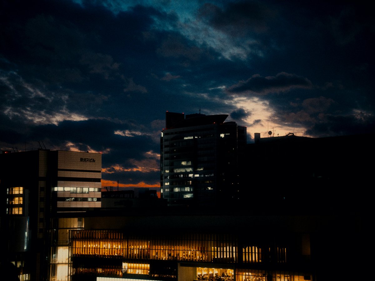
Nagoya spreads across the Nobi Plain, where the Kiso, Nagara, and Ibi rivers drain south into Ise Bay roughly 20 km from the city center. The urban core is flat, but forested hills begin within 30 minutes east by train, and the Suzuka Mountains along the Mie Prefecture border offer real alpine terrain within 90 minutes of Nagoya Station. The catch is Nagoya's summer humidity, with temperatures regularly crossing 35°C from late June through mid-September. Winters stay mild, with central Nagoya rarely dropping below 0°C, so trails remain walkable 12 months a year. The city scores 8.5 out of 10 for solo-traveler safety (see the TTDI Solo-Safety Index), which makes reaching trailheads alone, even on evening Meitetsu trains, feel routine. You might not immediately associate Nagoya with outdoor recreation the way you would Kamakura or Hakone. The Suzuka range alone has several peaks above 1,000 m, all reachable by Kintetsu train from Nagoya.
Outdoor activities
-
Cycling the Shonai River Greenway
The Shonai River cuts north-to-south through western Nagoya, and a paved cycling path follows both banks for roughly 15 km from Kita-ku down toward Minato-ku and the port area. The surface stays flat, with dedicated lanes separated from car traffic for most of the route. Weekend mornings between 6:00 and 9:00 draw local cycling clubs, though the path rarely feels crowded. Rental cycles are available at several stations along the Nagoya municipal bike-share system, with 30-minute rides costing about 160 JPY (around 1 USD at current exchange rates). You'll pass under a series of bridges and alongside small neighborhood parks, with views of the port cranes at the southern end.
- Difficulty
- Easy
- Duration
- 1.5 to 3 hours depending on pace and stops
- Best season
- October through May, before summer humidity peaks
-
Running Laps at Mizuho Athletic Stadium and Park
Mizuho Athletic Stadium, built in 1941, sits inside a broader sports complex in Mizuho-ku with running paths that loop through the surrounding green space. The outer perimeter path measures roughly 2 km and attracts local runners before work, starting around 5:30 in summer. The surface is a mix of asphalt and packed gravel. Several water fountains dot the route, and vending machines line the stadium entrance selling sports drinks for around 150 JPY. The park connects to quieter residential streets in Mizuho-ku if you want to push past 10 km.
- Difficulty
- Easy to moderate depending on distance
- Duration
- 30 minutes to 2 hours
- Best season
- March through May and October through November for comfortable temperatures
-
Road Cycling to Inuyama Along the Kiso River
A popular day ride heads north from central Nagoya along the Kiso River toward Inuyama, roughly 30 km one way. The riverside route stays mostly flat with gentle grades approaching Inuyama, and traffic thins once you leave the Nishi-ku suburbs. Inuyama Castle, which dates to 1469, sits above the river gorge at the turnaround point. Convenience stores appear every 5 to 8 km for water and onigiri stops. The return ride tends to be slightly faster with the prevailing wind. You can also load your bike onto a Meitetsu train for a one-way option.
- Difficulty
- Moderate (60 km round trip, mostly flat)
- Duration
- 4 to 6 hours round trip with a lunch stop in Inuyama
- Best season
- Late October through early December, when fall color lines the Kiso River valley
-
Walking Museum Meiji-mura's Grounds
Museum Meiji-mura, established in 1965, is an open-air architectural museum near Inuyama spread across hilly terrain overlooking Iruka Pond. The grounds cover roughly 1 million square meters, and walking the full circuit among the 60-plus relocated Meiji-era buildings takes a solid half day. Elevation changes between sections keep the legs working, and the smell of old timber hangs in the air around the restored structures. It functions as a low-key hike disguised as a museum visit. The SL steam locomotive and a Kyoto streetcar run short routes within the park for tired feet.
- Difficulty
- Easy (paved and gravel paths, moderate hills)
- Duration
- 3 to 5 hours for a full circuit
- Best season
- April for cherry blossoms around the pond, or November for autumn foliage
-
Indoor and Outdoor Rock Climbing
Aichi Prefecture has a small but active climbing community. The Shinshiro area, about 90 minutes northeast of Nagoya by car, offers natural rock faces and riverside bouldering along the Toyo River valley. Bring your own crash pad since there is no rental infrastructure at the outdoor spots. For wet days or warmer-up sessions, Nagoya city has several indoor climbing gyms in Naka-ku and Chikusa-ku, with day passes typically running 1,800 to 2,500 JPY. The indoor gyms stay open year-round and make a solid rainy-season alternative.
- Difficulty
- Moderate to difficult depending on route selection
- Duration
- Half day to full day including travel for outdoor spots
- Best season
- October through April, when cooler temperatures improve friction on rock
Day hikes
-
Mt. Sanage (Sanageyama, 629 m)
Mt. Sanage sits on the border of Toyota City and Seto City, about 40 minutes by car from central Nagoya. The most popular route starts from the Sanage Shrine trailhead and follows a well-marked path through cedar forest. You'll cross several streams and pass a modest waterfall about 45 minutes up, where the air cools noticeably and smells of wet stone. The summit has partial views east toward the Mikawa highlands. The trail sees enough weekend traffic from families and older hikers that you'll encounter someone every 10 to 15 minutes. A loop route is possible by descending the eastern ridge toward Sarukubo trailhead.
- Difficulty
- Easy to moderate (well-maintained trail, about 500 m elevation gain)
- Duration
- 3 to 4 hours round trip via the main route
- Best season
- Late October through November for fall foliage, or April for fresh green
-
Mt. Gozaisho (Gozaishoyama, 1,212 m)
The tallest peak in the Suzuka range, Mt. Gozaisho rises in Komono, Mie Prefecture, roughly 75 minutes from Nagoya by Kintetsu train to Yunoyama-Onsen Station plus a short bus ride. The Nakamichi trail climbs steeply through granite boulders and exposed rock scrambles before emerging onto an open summit plateau. The summit is windy. Mind you, the mountain sees snow from December through March, and crampons are advisable in winter. A ropeway runs to near the summit for those who want the panorama without the 3-hour climb, and several hot spring ryokan near the base station offer post-hike soaking with the smell of sulfur and cedar lingering in the changing rooms.
- Difficulty
- Moderate to difficult (steep rock sections, 780 m elevation gain from the trailhead)
- Duration
- 4 to 5 hours round trip on the Nakamichi route, or 6 hours via the more technical Ura-michi
- Best season
- Mid-October through November for fall color on the granite slopes, or May through June before summer heat
-
Mt. Hongu (Honguyama, 789 m)
Located in eastern Aichi near Toyokawa, Mt. Hongu requires about 90 minutes from Nagoya Station via JR to Toyokawa-Inari and then a local bus or taxi. The trail starts from the Toga Shrine (Toga-jinja) area at the base and ascends steadily through dense forest. The upper sections thin into mixed pine and rock, with views west toward the Nobi Plain on clear days. The mountain has a long history as a sacred site, with small stone markers and torii gates appearing along the trail. A different valley descent route loops back with fewer hikers.
- Difficulty
- Moderate (steady climb, roughly 600 m elevation gain)
- Duration
- 3.5 to 4.5 hours round trip
- Best season
- November for maples, or March through April when wildflowers emerge along the lower trail
-
Tokai Nature Trail (Aichi Section, Seto to Kasugai)
The Tokai Nature Trail runs over 1,700 km from Tokyo to Osaka, and its Aichi Prefecture section passes through the forested hills east of Nagoya. A manageable day segment runs from Seto City north toward Kasugai, covering roughly 12 km through secondary forest and past old pottery kilns. Trail markers are brown wooden posts with the Tokai Shizen Hodo emblem. You can pick up or exit the trail at several points where it crosses local roads, so the distance is adjustable. The path rolls gently without any sustained steep sections, and birdsong tends to be the dominant sound once you're past the Seto suburbs.
- Difficulty
- Easy to moderate (rolling terrain, no major elevation gains)
- Duration
- 4 to 6 hours depending on the segment length chosen
- Best season
- April through May or October through November for temperate conditions
-
Togokusan (198 m, Nagoya City)
If you want a short hike without leaving the city, Togokusan in Moriyama-ku is the highest point in Nagoya proper at 198 meters. The walk from the base at Togokusan Fruits Park to the summit takes about 30 minutes on a wide forest path. The park at the base grows regional fruit trees and charges 300 JPY admission, though the trail itself is free. It is not a serious hike by any measure, but the canopy provides shade on hot days and the summit offers a modest view north toward Kasugai. The Yutorito Line (Guideway Bus) stops at Kozoji, from which the park is a 20-minute walk.
- Difficulty
- Easy (gentle slope, short distance, suitable for families with small children)
- Duration
- 1 to 2 hours including the park visit
- Best season
- Late March for plum and cherry blossoms at the Fruits Park, or any mild-weather month
Water activities
-
Kiso River Rafting Near Inuyama
Commercial rafting operators run half-day trips on the Kiso River north of Inuyama, where Class II to III rapids thread between forested gorge walls. The put-in points sit about 50 minutes by car from central Nagoya, or you can reach them by Meitetsu train plus a short transfer. Trips typically cover 7 to 10 km and last about 2.5 hours on the water. Water temperatures feel comfortable without a wetsuit from July through September. Operators provide helmets, PFDs, and paddles. Expect to pay around 7,000 to 10,000 JPY per person (roughly 44 to 63 USD).
- Difficulty
- Easy to moderate (Class II-III, no prior experience needed)
- Duration
- Half day including transport and safety briefing
- Best season
- July through September for warm water, though May snowmelt can raise levels for more energetic rapids
-
Chita Peninsula Beaches
The Chita Peninsula extends south from Nagoya into Ise Bay and the Pacific, with sandy beaches along both coasts. Utsumi Beach on the peninsula's southern tip is reachable in about 70 minutes by Meitetsu from Nagoya and is the closest proper swimming beach to the city. The sand is coarse but clean, and the bay-side water tends to be calm. Seasonal beach houses (umi-no-ie) open from late June through August, renting umbrellas and floats for around 1,500 JPY. From the port at Morozaki, ferries run to Himakajima and Shinojima islands, where the beaches are quieter and the water clearer.
- Difficulty
- Easy (swimming in sheltered bay waters)
- Duration
- Full day trip from Nagoya
- Best season
- July and August for swimming; June tends to be too cool and the tsuyu rains can wash out plans
-
Fishing at Iruka Pond
Iruka Pond (Iruka-ike) is a large agricultural reservoir near Inuyama and one of the biggest man-made bodies of water in Aichi Prefecture. Bass fishing and wakasagi (pond smelt) fishing draw regulars from across the Chubu region, particularly in winter when wakasagi season opens and small dome-shaped heated boats dot the pond surface. The shoreline path runs roughly 7 km and makes a pleasant flat walk even if you have no interest in a rod. The open-air museum mentioned in the activities section borders the pond's northeast shore.
- Difficulty
- Easy (shore fishing or boat rental, no technical skill required)
- Duration
- Half day to full day
- Best season
- November through February for wakasagi; bass fishing runs March through October
-
Sea Kayaking in Mikawa Bay
Mikawa Bay lies southeast of Nagoya, sheltered by the Atsumi and Chita peninsulas. The calm, shallow waters suit sea kayaking, and a few outfitters based around Gamagori (about 55 minutes by JR Rapid from Nagoya) offer guided half-day paddles. You'll likely spot oyster rafts, wading birds, and the silhouette of Takeshima Island, a small tidal island connected to shore by a long pedestrian bridge. Rental kayaks run about 5,000 JPY for a half day. The water stays warm enough for comfortable paddling from May through October.
- Difficulty
- Easy to moderate (sheltered bay, minimal current)
- Duration
- 3 to 4 hours on the water
- Best season
- May through June before the rainy season, or September through October after summer crowds thin
Parks & gardens
-
Meijo Park (Nagoya Castle Grounds)
FreeMeijo Park wraps around the north side of Nagoya Castle, which dates to 1532, and covers about 80 hectares of open lawns, sports fields, and tree-lined walkways. The park draws joggers, dog walkers, and picnicking families on weekends. Spring brings roughly 2,500 cherry trees into bloom, making it one of the largest hanami spots in the Chubu region. Worth noting, the castle's Honmaru Palace reconstruction (completed 2018) sits at the park's south end but requires separate admission of 500 JPY.
Highlights: Cherry blossoms in late March to early April, the Dutch-style flower garden on the north side, and open lawns for picnicking with views toward the castle turrets
-
Tokugawa Garden (Tokugawa-en)
A traditional Japanese stroll garden in Higashi-ku, Tokugawa Garden sits adjacent to the Tokugawa Art Museum (founded 1935) and follows a classic pond-and-stream design. A central pond catches reflections of the surrounding maples, fed by an artificial waterfall called Ryusen-en. Wisteria trellises hang over the walking paths in late April. The maples turn deep red by mid-November. Admission runs 300 JPY for adults. The garden stays quieter than the castle grounds even on weekends, likely because it sits a 10-minute bus ride from the Sakae core.
Highlights: The botan (peony) garden peaking in May and a teahouse overlooking the central pond where matcha costs 500 JPY
-
Tsuruma Park (Tsurumai Koen)
FreeNagoya's oldest Western-style park, Tsuruma opened in 1909 in Showa-ku. The west side has Meiji-era landscaping with a stone fountain and rose garden, while the east side holds a Japanese-style pond garden with koi and turtles. Tsuruma is the city's most reliable spot for hydrangeas in June, with hundreds of bushes lining the paths. Tsurumai Station on the JR Chuo Line sits directly adjacent, so access from Nagoya Station takes about 6 minutes.
Highlights: Rose garden peaking in May and October, the ajisai (hydrangea) corridor in June, and a quiet reading garden near the Tsuruma Central Library
-
Shirotori Garden (Shirotori Teien)
A 3.7-hectare Japanese garden in Atsuta-ku, Shirotori Garden interprets the landscapes of the old Tokaido road in miniature. Gravel paths wind past a tidal flat representation, a tea garden, and stands of black pine pruned in the Aichi regional style. Egrets wade the shallow streams in summer, and the crunch of raked gravel underfoot sets the pace. The garden sits about 600 meters south of Atsuta Shrine, making the two a natural pair for a walking afternoon. Admission is 300 JPY.
Highlights: Illuminated evening openings during fall foliage season in mid-November, the suhama-style shoreline garden, and free English audio guides at the entrance
-
Hisaya Odori Park
FreeHisaya Odori runs as a 2 km linear park down the center of Nagoya's main north-south avenue, from the TV Tower (built in 1953) at the north end through the Sakae shopping district. The park was redeveloped in 2020 with lawns, retail pavilions, and seating areas under zelkova trees. Food trucks line the south end on weekends, and you can sit on the grass with a konbini bento without drawing a second glance. The park functions less as a nature escape and more as Sakae's outdoor living room.
Highlights: The TV Tower end has the best open-sky views in central Nagoya, the Rayard Hisaya-odori shops and cafes at ground level, and seasonal markets through December
Practical tips
- Hydration and Heat Management
- Nagoya's summers are punishing. From late June through September, afternoon heat often exceeds 35°C with humidity above 70%. Carry at least 1.5 liters of water per person for any hike, and plan early starts before 7:00 to avoid peak heat. Vending machines appear along most urban trails and at many trailheads, stocking cold sports drinks and water for 130 to 160 JPY. Salt tablets (shio-ame, or salt candy) sold at convenience stores help with electrolyte loss on long days.
- Sun Protection
- UV levels in the Nagoya area peak from May through August, and the flat Nobi Plain offers minimal natural shade on cycling paths and riverbank routes. A wide-brimmed hat, SPF 50 sunscreen, and UV-blocking arm sleeves (sold at Uniqlo and outdoor shops in Sakae for around 1,500 JPY) are standard gear for local hikers. Most Japanese outdoor enthusiasts treat sun protection as non-negotiable. You will notice significantly more covered skin on Aichi trails than on comparable hikes in North America or Europe.
- Gear and Outdoor Shops
- Montbell operates a store in Sakae, and the Loft building near Nagoya Station carries Montbell and Snow Peak selections. For budget gear, Workman Plus stores (a Japanese workwear chain that crossed into outdoor apparel) sell functional hiking pants, rain shells, and base layers at roughly half the price of dedicated brands. A decent rain jacket at Workman runs about 2,500 JPY. IBS Ishii Sports in the Meieki area stocks higher-end technical gear for climbing and alpine pursuits.
- Trail Conditions and Navigation
- Aichi Prefecture trails tend to be well-maintained but can have sparse signage compared to trails in the Japanese Alps. Download offline maps via Yamap, a Japanese hiking app with GPS trail data and recent user condition reports. After heavy rain, trails on Mt. Sanage and the Tokai Nature Trail sections develop muddy patches and slippery root sections. Gaiters help during the tsuyu rainy season. Mountain huts are rare since most regional peaks are day-hike scale, so pack everything you need.
- Getting to Trailheads by Public Transit
- Most hikes around Nagoya involve a Meitetsu or JR train ride followed by a local bus, and bus frequency drops sharply outside peak hours. Check the last bus time before you start hiking; missing it can mean an expensive taxi (about 5,000 to 10,000 JPY) back to a station. IC cards (Manaca, Toica, or Suica) work on nearly all local transit in the Chubu region. For the Suzuka range, the Kintetsu line from Nagoya to Yunoyama-Onsen runs roughly every 30 minutes during daytime.
- Family Safety
- The area scores 8.5 out of 10 for family friendliness (see the TTDI Family-Friendliness Index), and trails feel safe even for solo hikers. That said, mamushi pit vipers live in the underbrush on lower-elevation trails, particularly near streams from April through October. Watch where you place hands when scrambling over rocks. Wild boar sightings occur occasionally near Seto and in the Sanage area. They tend to avoid people but give them space. Mountain rescue operates through the local police; dialing 110 works from any mobile phone with reception.
FAQ
What is the best time of year for outdoor activities around Nagoya?
Late October through November tends to be the sweet spot. Temperatures settle around 15 to 20°C, humidity drops, and fall foliage peaks on the Suzuka range and the hills east of the city. Spring (late March through May) is the second-best window, with cherry blossoms in early April and fresh green by May. Avoid July and August for hiking unless your activity is water-based. The combination of 35°C heat and 80% humidity makes non-shaded trail time genuinely risky without very early starts and plenty of water.
Can I reach good hiking trails from Nagoya without a car?
Several of the best day hikes are accessible by train and bus. Mt. Gozaisho is reachable via Kintetsu to Yunoyama-Onsen. Mt. Sanage requires a bus from Toyota City, which connects to Nagoya by Meitetsu Toyota Line in about 35 minutes. The Tokai Nature Trail crosses multiple train lines in the Seto and Kasugai area northeast of the city. Bus schedules can be thin on weekdays, so verify departure times in advance on the Navitime or Jorudan apps and note the last return bus before you start walking.
Are there outdoor activities suitable for families with young children?
Tsuruma Park and Meijo Park both have open lawns and flat paths for small children. The Shonai River cycling path works for kids who can ride, and bike-share stations make it easy to return bikes early. Iruka Pond near Inuyama has a flat 7 km shoreline loop, and the adjacent museum grounds provide a gentler alternative to mountain trails. The bay-side beaches on the Chita Peninsula have gentle waves suitable for wading. Togokusan in Moriyama-ku offers a 30-minute walk to a summit that even younger hikers can manage.
Is it safe to hike solo around the Nagoya area?
Solo hiking on the popular trails is common and low-risk in Aichi Prefecture. Trails like Sanage and the Tokai Nature Trail see enough weekend traffic that you will encounter other hikers every 10 to 30 minutes. Cell reception holds on most ridgelines but can drop in valleys and gorges. Register your hiking plan (tozan todoke) at the trailhead boxes where available. Telling your accommodation your planned route and expected return time is standard practice in Japan.
How much should I budget for a day of outdoor activities near Nagoya?
A self-guided hiking day costs very little beyond transit. Round-trip train fare to trailheads like Yunoyama-Onsen or Toyota runs 1,000 to 2,000 JPY (roughly 6 to 13 USD). Add 500 to 1,000 JPY for trail snacks and drinks from vending machines. Guided activities cost more: Kiso River rafting runs 7,000 to 10,000 JPY, and sea kayak rentals in Mikawa Bay start around 5,000 JPY. A full day including lunch at a local restaurant near the trailhead typically lands between 5,000 and 15,000 JPY.
What should I do if caught in sudden rain on a trail?
Rain squalls arrive fast in the Chubu region from May through October, especially during tsuyu season and late-summer typhoon weeks. Pack a lightweight rain shell even on clear mornings. If lightning starts, descend below the ridgeline immediately and stay off exposed summits. Most Aichi trails have enough tree cover for temporary shelter, but granite sections on Mt. Gozaisho become slippery within minutes of rainfall. Check the Japan Meteorological Agency forecast the morning of your hike for thunderstorm warnings covering the Tokai region.
Last verified by automated review (v1.7.2) on . What is automated review?