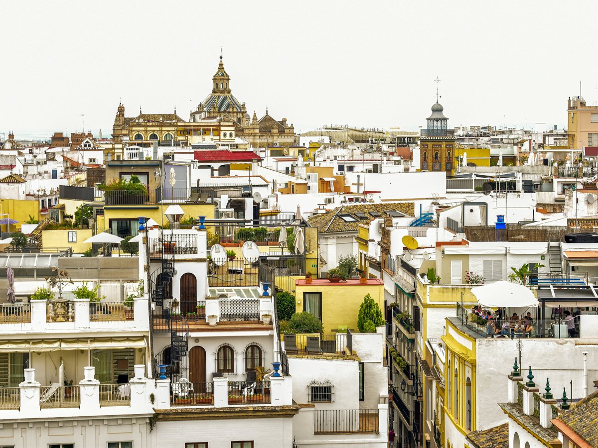
Seville sits in the broad, flat basin of the Guadalquivir river, surrounded by the agricultural lowlands of the Vega del Guadalquivir to the north and the rolling foothills of the Sierra Morena to the northwest. The city itself hovers around 7 meters above sea level. That matters because summer heat here is serious, regularly pushing past 40°C from late June through August. The outdoor calendar in Seville tends to split into two real seasons. October through May is when most locals hike, cycle, and paddle. Mid-summer shifts activity to early mornings, river-focused pursuits, and the coast. The Guadalquivir cuts through the center of the city, still tidal this far inland, still brown with silt from the Cazorla headwaters 330 kilometers upstream. You'll notice that Sevillanos treat their parks less as weekend destinations and more as daily infrastructure. The orange trees lining the streets drop fruit nobody eats (too bitter for anything but marmalade), and the city's green spaces fill up by 7pm on any evening below 35°C. To be fair, the flat terrain means cycling is genuinely practical here, not performative. The Sevici bike-share stations are everywhere, and the 10-kilometer riverside cycling path from the Triana bridge south to the Parque del Alamillo loop is one of the better urban rides in southern Spain.
Outdoor activities
-
Road cycling on the Vía Verde de la Sierra
This 36-kilometer rail trail runs between Olvera and Puerto Serrano, about 90 minutes by car from Seville. The route follows the old Jerez-Almargen railway line through limestone gorges and past the Peñón de Zaframagón, one of Europe's largest griffon vulture colonies. The surface is compacted gravel, rideable on a road bike with 28mm tires though 32mm or wider is more comfortable. You'll pass through 30 tunnels and over 4 viaducts. The gradient is gentle, rarely above 2%, which makes it manageable as an out-and-back or a one-way with a car shuttle. Bike rental is available in Olvera and Puerto Serrano, typically around 15-20 EUR for a full day.
- Difficulty
- Easy to moderate
- Duration
- 3-5 hours one way depending on pace and stops
- Best season
- October through May. Summer is possible but start before 8am.
-
Mountain biking in the Sierra Norte de Sevilla
The Sierra Norte natural park, centered around Cazalla de la Sierra and Constantina about 80 kilometers north of the city, has a network of marked trails through dehesa woodland. These cork oak and holm oak forests are open and shady, with pigs rooting beneath in autumn. The terrain is rolling rather than steep, with rocky singletrack sections mixed into wider forestry tracks. The Sendero de las Laderas route near Cazalla runs about 18 kilometers with 400 meters of climbing. You'll hear woodpeckers and might spot deer in the early morning. Trail markers can be faded in places, so download the GPX tracks beforehand from the Junta de Andalucía website.
- Difficulty
- Moderate
- Duration
- Half day for most loops
- Best season
- October through April. Spring wildflowers peak in March.
-
Rock climbing at El Chorro (El Caminito del Rey area)
El Chorro sits about 2.5 hours southeast of Seville near Álora in Málaga province. The limestone walls of the Desfiladero de los Gaitanes offer over 600 sport routes across all grades, from 4a warm-ups to 8c+ projects. The main sectors include Makinodromo, Frontales, and the Swiss Sector. The rock is typically sharp, pocketed limestone. Winter temps at the crag hover around 12-18°C, which is comfortable for redpointing. Several hostels and a campsite operate near the reservoir. Worth noting that the famous Caminito del Rey walkway is separate from the climbing and requires advance booking at around 10 EUR per person.
- Difficulty
- All levels, from 4a to 8c+
- Duration
- Full day trip from Seville
- Best season
- November through March for comfortable climbing temperatures
-
Running the Guadalquivir riverside path
A flat, paved path runs along both banks of the Guadalquivir through central Seville. The most popular loop starts at the Puente de San Telmo, heads south along the east bank past the Torre del Oro and the university, crosses at Puente de las Delicias, and returns north through the Triana side. That loop measures roughly 6 kilometers. Extending south toward the Parque del Alamillo adds up to 16 kilometers round trip. The path is lit in the central sections, and you'll find water fountains near the Puente de Isabel II. Expect company on weekend mornings. The surface is smooth asphalt, flat the entire way.
- Difficulty
- Easy
- Duration
- 30 minutes to 2 hours depending on distance
- Best season
- Year-round, though summer runs should finish by 9am
-
Horseback riding in Doñana's buffer zone
Several stables near El Rocío, about 75 kilometers south of Seville, offer guided rides through the pine forests and marshland edges of the Doñana area. The sandy trails are soft and flat, passing through umbrella pine woodland where you can smell resin in warm weather. Rides typically last 1.5 to 3 hours and cost between 30 and 60 EUR per person. The horses are Andalusian crosses, sturdy and calm. The landscape opens into marshes where flamingos and spoonbills wade. Mind you, the ground can be waterlogged from November through February, so winter rides tend to stick to the higher sandy paths.
- Difficulty
- Easy, suitable for beginners with a guide
- Duration
- 1.5 to 3 hours
- Best season
- March through May and September through November
-
Birdwatching in Doñana National Park
Doñana, at the mouth of the Guadalquivir about 90 minutes south of Seville, holds one of Europe's most significant wetland bird populations. The park currently hosts breeding populations of Spanish imperial eagle, with 15-20 territorial pairs recorded in recent surveys. Greater flamingos gather in flocks of several thousand at the marismas during winter months. Guided 4x4 tours depart from the El Acebuche visitor center and last about 4 hours, covering roughly 70 kilometers through the restricted interior. You'll need binoculars, at minimum 8x42. That said, the free visitor centers at El Acebuche, José Antonio Valverde, and La Rocina each have hides where you can spot waders and raptors without the 4x4 tour.
- Difficulty
- Easy
- Duration
- Half day for guided tour, full day recommended
- Best season
- October through March for wintering migrants. April for breeding colonies.
Day hikes
-
Sendero de las Cascadas, Huéznar River (Sierra Norte)
This trail follows the Huéznar river upstream from the village of San Nicolás del Puerto, about 90 kilometers north of Seville. The route passes a series of travertine cascades where the river tumbles over calcium-carbonate shelves into clear pools. The forest is dense riverine canopy, noticeably cooler than the open terrain. You'll hear the water before you see it. The first cascade is about 1.5 kilometers from the trailhead. The full route to the upper falls and back is roughly 8 kilometers. The path is well-marked with green-and-white paint blazes. Footing is uneven in places with exposed roots and wet rock near the pools. San Nicolás del Puerto also has a public swimming area fed by the Huéznar, cold even in July.
- Difficulty
- Easy to moderate. Some rocky sections near waterfalls.
- Duration
- 3-4 hours round trip
- Best season
- October through May. Water flow is strongest November through March.
-
Cerro del Hierro geological trail (Sierra Norte)
Cerro del Hierro is a former iron mine site about 85 kilometers north of Seville, near the village of San Nicolás del Puerto. The abandoned workings exposed a karst landscape of eroded limestone pinnacles, some 20 meters tall, stained red and orange from iron oxide. The circular trail around the site is about 4 kilometers. The terrain is rocky and uneven, with some scrambling sections between the pinnacles. Rock climbers use several of the walls, so you may see bolted routes. The geological formations here have been designated a Natural Monument. The drive from Seville takes about 1 hour 15 minutes via the A-432.
- Difficulty
- Easy to moderate. Watch your footing on loose rock.
- Duration
- 1.5-2.5 hours for the loop
- Best season
- Year-round. Summer mornings are fine due to early shade from the pinnacles.
-
Sendero Los Carros, Aracena (Sierra de Aracena)
The Sierra de Aracena sits about 100 kilometers northwest of Seville. The Sendero Los Carros connects the town of Aracena to the village of Linares de la Sierra, roughly 7 kilometers one way. The trail passes through chestnut and cork oak woodland, with dry-stone walls lining parts of the path. The terrain is rolling with one sustained climb of about 200 meters. Linares de la Sierra has a small central plaza with a bar where you can get tinto de verano and the local jamón ibérico before walking back or arranging a taxi. The whole Sierra de Aracena region is quieter than the coast, and the autumn chestnut harvest in October brings a particular sweetness to the air.
- Difficulty
- Moderate. Sustained elevation changes.
- Duration
- 4-5 hours round trip, or 2-2.5 hours one way with transport back
- Best season
- October through May. October for chestnut colors.
-
Ruta del Agua, Guillena (Sierra Norte edge)
Starting from the town of Guillena, only 20 kilometers north of Seville, this trail follows the Rivera de Huelva through mixed Mediterranean scrub. The route is about 10 kilometers as a loop and passes old water mills along the riverbank. The terrain is mostly flat with gentle rises. The vegetation shifts between pine, olive groves, and maquis scrub with wild rosemary and lavender that scent the air on warm days. This is one of the closest proper hikes to the city, reachable in 30 minutes by car. On weekends it gets moderate foot traffic from local hiking clubs.
- Difficulty
- Easy
- Duration
- 3-4 hours for the full loop
- Best season
- October through April. Wildflowers peak in February and March.
-
Sendero Cerro de la Cabeza, Constantina (Sierra Norte)
This trail climbs to the summit ridge near Constantina, about 80 kilometers north of Seville. The ascent gains roughly 400 meters over 5 kilometers through evergreen oak forest. The upper sections offer long views south across the Guadalquivir basin toward the city on clear days. The path is stony in places and some sections are steep enough to want trekking poles. Constantina itself is worth an hour's wander, with a ruined Moorish castle above the town and several bars on the main street serving local Sierra Norte wines.
- Difficulty
- Moderate to challenging. Steep rocky sections near the top.
- Duration
- 4-5 hours round trip
- Best season
- October through April. Avoid in summer heat.
Water activities
-
Kayaking on the Guadalquivir through Seville
Several companies operate guided kayak tours on the Guadalquivir from the Triana bank, typically launching near the Puente de Isabel II. The standard route heads south past the Torre del Oro and the Plaza de Toros before turning back, covering about 6 kilometers in 2 hours. The river is tidal here, so timing matters. Outfitters generally schedule around the tides. The water is murky brown, warm in summer, and the current is mild in the central stretch. Expect boat traffic from tourist ferries and the occasional cargo vessel. Evening paddles, starting around 7pm in summer, catch the golden light on the Triana facades. Prices sit around 20-30 EUR per person.
- Difficulty
- Easy. No prior experience needed for guided trips.
- Duration
- 1.5-2.5 hours
- Best season
- Year-round. Summer evenings are particularly good.
-
Swimming at Embalse de Aracena
The Aracena reservoir in the Sierra de Aracena, about 100 kilometers northwest of Seville, has informal swimming spots along its southern shore. The water is fresh, clean, and noticeably cooler than anything near the lowlands, typically around 20-22°C in mid-summer. There are no lifeguards and no formal beach infrastructure, so you'll want water shoes for the rocky entry. The pine-forested banks give shade and the reservoir is large enough that you won't feel crowded. Mind you, water levels drop by late summer in dry years, so check conditions if visiting in September.
- Difficulty
- Easy, but no lifeguards present
- Duration
- Half day including the drive
- Best season
- June through September
-
River swimming at San Nicolás del Puerto (Huéznar)
San Nicolás del Puerto has a municipal bathing area fed by the Huéznar river, making it the only inland beach officially designated in Andalucía. The pool area is shallow and maintained, with a grassy bank for towels. The water is cold, fed by springs upstream, typically around 17-19°C even in August. The village is small, with a couple of restaurants and a bar near the swimming area. On hot weekends in July and August, it fills up with families from Seville making the 90-minute drive north. Arrive before 11am to secure a decent spot.
- Difficulty
- Easy. Suitable for families.
- Duration
- Half to full day trip
- Best season
- June through August
-
Beach day at Matalascañas (Doñana coast)
Matalascañas sits on the Atlantic coast about 100 kilometers south of Seville, adjacent to Doñana National Park. The beach stretches for several kilometers, backed by dunes and pine forest. The sand is fine and golden, the water cold even in summer, rarely above 21°C, with moderate Atlantic swells. The eastern end of the beach, closer to the Doñana boundary, is quieter and has a wilder feel. The resort town itself is purpose-built and functional rather than charming, with supermarkets, seafood restaurants, and gear shops along the main drag. The drive from Seville takes about 1 hour 15 minutes via the A-49.
- Difficulty
- Easy. Lifeguards on duty in summer.
- Duration
- Full day trip
- Best season
- June through September for swimming. Spring and autumn for quieter beach walks.
-
Stand-up paddleboarding on the Guadalquivir
SUP rentals and lessons are available from outfitters near the Triana bank, typically at Club Náutico de Sevilla or smaller operators along Calle Betis. The river is wide and slow enough for beginners, though ferry wakes require some balance. Morning sessions before 10am tend to have calmer water and less boat traffic. Rental runs about 15-20 EUR per hour. The stretch between the Puente de Triana and the Puente de San Telmo is the most popular, about 1.5 kilometers of sheltered water with the city skyline on the east bank.
- Difficulty
- Easy to moderate. Balance needed for ferry wakes.
- Duration
- 1-2 hours
- Best season
- March through October. Summer mornings are best.
Parks & gardens
-
Parque de María Luisa
FreeSeville's flagship park stretches across 34 hectares south of the old town, donated by the Infanta María Luisa Fernanda in 1893 and redesigned by Jean-Claude Nicolas Forestier for the 1929 Ibero-American Exposition. The layout mixes formal tiled plazas with winding paths under mature trees. Jacarandas bloom purple in late April. Ficus, Washington palms, and Canary Island date palms create heavy shade by midday. The soil smells damp even in dry spells because of the old irrigation channels. Green parakeets nest noisily in the taller palms. The park connects directly to the Plaza de España, which technically sits at its northern edge.
Highlights: Plaza de España's 515-meter semicircular colonnade, the Glorieta de Bécquer with its cypress ring, Estanque de los Lotos (lotus pond), the Museo de Artes y Costumbres Populares, and the dove-filled Plaza de América.
-
Jardines del Real Alcázar
The Alcázar gardens cover roughly 7 hectares behind the palace walls, layered over 800 years of Moorish, Renaissance, and modern planting. The oldest section, the Jardín de la Danza, has hedged pathways barely wide enough for two people, with the smell of jasmine and orange blossom heavy in March and April. The Galera garden has a long rectangular pool that reflected light was once used to illuminate palace interiors. The English garden section at the rear feels more like a working park, with gravel paths and towering Washingtonia palms. Peacocks roam freely and will steal your lunch if you let them.
Highlights: The Mercury Pool with its bronze statue, Jardín de las Damas' Renaissance fountains, the Grotesque Gallery's mannerist rock wall, and the pavilion of Carlos V. Entry currently costs about 14.50 EUR for adults.
-
Parque del Alamillo
FreeNorth of the city center across the Cartuja island, Alamillo covers 47 hectares of more open, less manicured ground than María Luisa. Local families use it hard on weekends. The grass areas are broad enough for football, and shaded picnic zones fill up by midday on Saturdays. Pine and olive trees dominate, and the park has a 4-kilometer perimeter path that runners and cyclists share. The terrain is flat, the atmosphere suburban and relaxed. You'll find a small lake, a cafe, and outdoor exercise equipment stations scattered along the paths.
Highlights: The 4-kilometer circuit path for running and cycling, the lake area, outdoor gym stations, and large barbecue zones that get lively on weekends. Free parking available.
-
Jardines de Murillo
FreeThese narrow gardens line the eastern wall of the Alcázar along Calle Nicolás Antonio in the Santa Cruz neighborhood. They're compact, maybe 300 meters end to end, but densely planted with palm trees, orange trees, and bougainvillea. The paths are tiled, the benches ceramic. The shade here is reliable by 10am, which makes Murillo a good spot to sit with coffee from the nearby bars on Calle Mateos Gago. The monument to Columbus near the south end features a tall carved stone pillar.
Highlights: The Columbus monument, continuous shade from mature palms and orange trees, and ceramic-tiled benches. Connects directly to the Barrio de Santa Cruz for walking.
-
Parque de los Príncipes
FreeIn the Los Remedios neighborhood west of the river, this park tends to be quieter than María Luisa or Alamillo. It covers about 10 hectares with wide gravel paths, a small ornamental lake, and playground areas. The plantings include roses and seasonal flower beds that are well-maintained. On weekday mornings you might find yourself alone here apart from a few dog walkers. The park connects to the Guadalquivir riverbank path via Calle Asunción.
Highlights: Ornamental lake, rose garden section, children's play areas, and proximity to the Triana riverbank walk. A calm spot that locals prefer precisely because tourists rarely find it.
Practical tips
- Sun protection
- Seville's UV index reaches 10-11 from June through August, which is extreme. SPF 50 is not optional, it's infrastructure. Reapply every 90 minutes, especially after sweating. A wide-brimmed hat and UV-rated sunglasses are more important than fancy gear. The local farmacias stock Heliocare and Isdin brands, both effective and available everywhere in the city center. Between 1pm and 5pm in summer, you'll notice locals simply aren't outdoors. Follow their lead.
- Water and hydration
- Carry a minimum of 1.5 liters per person for any hike, 2.5 liters in summer. Seville's tap water is safe and tastes fine, so fill up before leaving. On Sierra Norte trails, there are occasional fuentes (spring-fed fountains) in villages but nothing between them. A hydration bladder works better than bottles on uneven terrain. Electrolyte tablets are useful from May through September. The Mercadona supermarket chain, with locations all over Seville, sells isotonic powder cheaply.
- Footwear and gear
- Most Sierra Norte trails are rocky and uneven enough to warrant proper hiking boots or trail shoes with ankle support. The Guadalquivir riverside path is paved and fine for running shoes. For kayaking, water shoes or sport sandals with heel straps work well. Trekking poles are genuinely useful on the steeper Sierra Norte descents, particularly Cerro de la Cabeza near Constantina. Decathlon has a large store in Sevilla Este (Carretera de Málaga) with reasonable trail gear at Spanish prices, which tend to run 20-30% below northern European equivalents.
- Timing and heat management
- From mid-June through mid-September, plan any outdoor activity for before 10am or after 6pm. This is not a suggestion. Seville recorded 42.6°C in August 2023, and heat-related incidents on trails are a real concern. Spring (March through May) and autumn (October through November) are the productive hiking months, with daytime temperatures between 18°C and 28°C. Winter can be rainy, particularly December and January, but hiking between showers is perfectly feasible and the Sierra trails drain quickly on their limestone substrate.
- Trail conditions and navigation
- The Junta de Andalucía maintains the marked senderos in the Sierra Norte and Sierra de Aracena with green-and-white blazes. Trail signage is generally reliable but not always frequent, so carry a downloaded GPX track as backup. Wikiloc is widely used in Spain and has crowd-sourced tracks for most local routes. Mobile reception is patchy in the Sierra Norte valleys. The paths can be muddy after rain, especially December through February, and river crossings may be impassable after heavy storms. Check AEMET (Spain's meteorological agency) before heading out.
- Getting to trailheads
- A rental car is the most practical option for reaching the Sierra Norte or Aracena. The A-432 to Cazalla de la Sierra and the N-433 to Aracena are well-maintained two-lane roads. ALSA buses run to Cazalla, Constantina, and Aracena from the Plaza de Armas bus station in Seville, typically 2-3 departures daily, but schedules are limited on weekends. Matalascañas has more frequent bus service in summer. Within the city, the Sevici bike-share system costs about 33 EUR for an annual subscription, with 2,600 bikes across 260 stations.
FAQ
Is it too hot to hike near Seville in summer?
Lowland trails near the city are genuinely dangerous in July and August afternoon heat, with temperatures regularly above 40°C. The Sierra Norte, 80-100 kilometers north, sits 400-700 meters higher and tends to be 5-8°C cooler. If you're visiting in summer, drive north and start hiking by 8am. Riverside activities in the city work for early mornings and evenings. Most Sevillanos who hike shift entirely to the sierras from June through September.
Do I need a car to access outdoor activities from Seville?
For the Guadalquivir river activities, city parks, and the riverside running and cycling paths, no. Everything is accessible by foot, bike, or metro. For the Sierra Norte hikes, a car is strongly recommended. ALSA buses reach Cazalla de la Sierra and Constantina but run infrequently, and the trailheads are often 5-10 kilometers from the bus stops. Matalascañas beach has summer bus service from Plaza de Armas that works well. Car rental in Seville starts around 25-35 EUR per day from Europcar or Goldcar at Santa Justa station.
What is the best month for outdoor activities in Seville?
March and October are likely the two strongest months. March brings wildflowers to the sierra trails, daytime temperatures around 20-24°C, and the jacarandas starting to bloom in the city parks. October still has warm days (22-26°C), the Sierra Norte trails are dry and firm, and summer crowds have cleared from the coast and mountains. November through February is cooler and wetter but still viable. April and May are good but can get warm toward month's end.
Can I swim in the Guadalquivir river in Seville?
Swimming in the Guadalquivir in the city center is not recommended and generally not practiced by locals. The river is tidal, murky, has significant boat traffic, and water quality in the urban stretch is not monitored for bathing. For river swimming, head to San Nicolás del Puerto in the Sierra Norte, about 90 minutes north, where the Huéznar feeds a clean, cold municipal bathing area. For sea swimming, Matalascañas on the Atlantic coast is about 75 minutes south.
Are there guided outdoor tours available in English?
Yes, though the selection is narrower than in Barcelona or Madrid. Kayak and SUP operators on the Guadalquivir typically offer English-language guides. Doñana 4x4 tours from El Acebuche have English options if booked in advance. For Sierra Norte hiking, English-speaking guides are fewer, but companies like Seville Hiking and some Wikiloc-based groups organize English-language group hikes on weekends during spring and autumn. The Doñana visitor centers have bilingual displays and materials.
Do I need permits for hiking or kayaking near Seville?
The marked senderos in the Sierra Norte de Sevilla and Sierra de Aracena natural parks are free and open without permits. Doñana National Park's interior requires a guided tour (booked through the visitor center), but the surrounding natural park area has free-access trails and hides. Kayaking on the Guadalquivir in the city does not require a personal permit if you go with a licensed operator. Independent kayaking or SUP on the river is technically open but you need to watch for commercial vessel zones. No climbing permits are required at El Chorro.
Outdoor experiences in Seville
 Free cancellation
 Caminito del Rey Hike from Seville
Outdoor experience: free cancellation.
via Viator
Seville Hot-Air Balloon Ride with Breakfast, Cava & Hotel Pick up
Outdoor experience.
via Viator Free cancellation
 Guided Monumental Route Segway Tour in Seville
Outdoor experience: 2 hours, free cancellation.
via ViatorLast verified by automated review (v1.7.2) on . What is automated review?