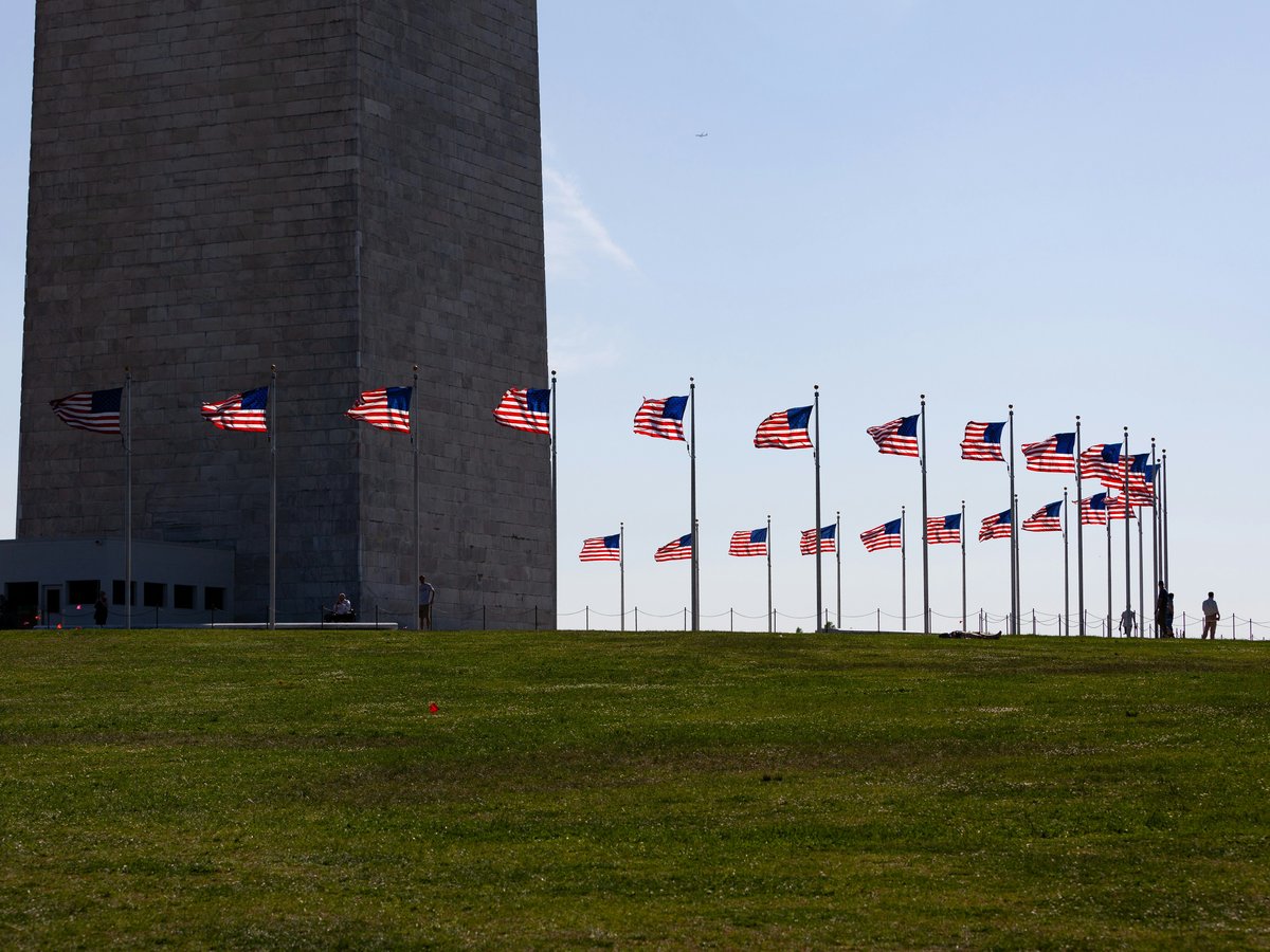
Washington DC sits on a diamond-shaped grid that Pierre Charles L'Enfant designed in 1791, the same year the National Mall was established as the civic spine of the new capital. The city fans out from the Capitol dome in four quadrants (NW, NE, SW, SE), with numbered streets running north-south and lettered streets running east-west. Diagonal avenues named after states cut through the grid, creating the circles and triangles that give each neighborhood its own geometry and feel. Northwest holds the bulk of what visitors come for, from the monuments along the Mall to the row-house neighborhoods stretching north toward Rock Creek Park. The eastern quadrants have changed faster in the last 15 years than in the previous 50, with whole corridors of formerly boarded-up commercial strips now lined with restaurants and condos. The Metrorail system connects most of these areas on 6 color-coded lines, though the city is surprisingly walkable if you stick to a cluster of 2 or 3 adjacent neighborhoods. One thing to know before picking a base. The distance from Georgetown to Capitol Hill is roughly 5 miles, and cabs or rideshares between the two can take 30 minutes in weekday traffic. Staying near a Metro station saves real time.
Neighborhoods
-
National Mall and Penn Quarter
The 2-mile grass corridor from the Capitol to the Lincoln Memorial (dedicated in 1922) is the part of DC that belongs to the whole country. It smells like hot pavement and food trucks in summer and damp stone in winter. Penn Quarter, the commercial district along 7th Street NW between the Mall and Chinatown, has the restaurants and hotels that make staying here practical. The architecture shifts from Beaux-Arts museum facades to glass-front mixed-use buildings within a few blocks.
- Best for
- First-time visitors who want walking-distance access to the Smithsonian museums (founded 1846, 21 free museums across the Institution), the Washington Monument (begun 1848), and the memorials without relying on transit.
- Key streets
- The 7th Street NW corridor from the National Archives down to the Mall. F Street NW between 7th and 12th for dining. Indiana Avenue for the quieter approach to the Navy Memorial plaza.
-
Georgetown
Georgetown predates DC itself. It was a tobacco port town established in 1751, four decades before the federal city existed. The streets are brick, literally, and they're uneven enough that you'll hear every rolling suitcase for a block. M Street and Wisconsin Avenue form the commercial cross, packed with chain stores now but still anchored by older spots like Martin's Tavern (open since 1933) on Wisconsin. North of M Street the residential blocks climb steeply toward Georgetown University (founded 1789), and the Federal-style townhouses get quieter and more expensive with each block of elevation. The waterfront along the Potomac has been redeveloped with a park and a few restaurants, but it still feels half-finished.
- Best for
- Couples and travelers who prefer a walkable, self-contained neighborhood with good restaurants and don't mind being off the Metro grid. The nearest stations (Foggy Bottom and Rosslyn) are each a 15-to-20-minute walk.
- Key streets
- M Street NW for shopping and restaurants. Wisconsin Avenue NW from the waterfront up to the cathedral neighborhood. The C&O Canal towpath for a flat, shaded walk west along the river. Dumbarton Street for the best residential architecture.
-
Dupont Circle
The circle itself is a gathering point, a concrete-and-grass roundabout where chess players set up folding tables and bike messengers cut through traffic on the inner ring. The neighborhood radiating outward is dense with row houses converted into small businesses, embassy residences, and bookstores like Kramerbooks on Connecticut Avenue (open since 1976, one of the first bookstore-cafes in the country). The pace here tends to be slightly slower than Penn Quarter. People sit on restaurant patios for longer. The side streets off Connecticut and Massachusetts avenues are residential and tree-lined, with the smell of magnolias heavy in June.
- Best for
- Solo travelers and couples who want a central, walkable base with good food and nightlife options. DC scores 9.5 out of 10 for LGBTQ+ friendliness (sourced from TTDI's editorial rubric), and Dupont Circle has been the center of that community since at least the 1970s, with 17th Street NW serving as the primary corridor.
- Key streets
- Connecticut Avenue NW from the circle north to the Hilton. 17th Street NW between P and R streets for bars and restaurants. Massachusetts Avenue NW (Embassy Row) for the architecture of diplomatic compounds. P Street NW heading west toward Rock Creek for a quieter residential walk.
-
Adams Morgan
Adams Morgan has the feel of a neighborhood that peaked as a nightlife strip in the early 2000s and has since settled into something more interesting. 18th Street NW, the main drag, still has a few loud bars, but it also has some of the best Ethiopian food in a city that claims the largest Ethiopian diaspora population in the US (estimated at over 40,000 in the metro area). The buildings are mostly 3-and-4-story brick apartment blocks with ground-floor retail, and the side streets are steep enough that you'll notice them in your calves. Weekend mornings are quiet here. You'll hear birds and the occasional screen door.
- Best for
- Budget-conscious travelers and younger visitors. Hotel options are limited, but Airbnb-style rentals in the residential blocks tend to run 20-30% cheaper than Dupont Circle or Penn Quarter equivalents.
- Key streets
- 18th Street NW from Columbia Road south to the Dupont Circle border for restaurants and bars. Columbia Road NW heading east for the Latin American grocery stores and weekend street vendors. Calvert Street NW for the Duke Ellington Bridge and the walk into Woodley Park.
-
Capitol Hill
Capitol Hill is where the federal government's workday happens, and the neighborhood's rhythm follows the congressional calendar. When Congress is in session, the restaurants along Pennsylvania Avenue SE fill up by noon with staffers in lanyards. When it recesses, the same blocks go noticeably quiet. The residential streets east of the Capitol are lined with narrow row houses, many dating to the 1870s and 1880s, with tiny front gardens and iron fences. Eastern Market (operating since 1873 on 7th Street SE) anchors the commercial life on weekends with a flea market and produce vendors. The area is flat, the blocks are short, and you can walk from Union Station to the Barracks Row restaurant strip on 8th Street SE in about 20 minutes.
- Best for
- Families and history-focused visitors. The family-friendliness score for DC sits at 8.5 out of 10 (see the TTDI Family-Friendliness Index), and Capitol Hill's low traffic, walkable streets, and proximity to the free Smithsonian museums make it a strong base for that profile.
- Key streets
- Pennsylvania Avenue SE from the Capitol to Eastern Market. 8th Street SE (Barracks Row) for independent restaurants and coffee shops. East Capitol Street for the grand row-house facades. Massachusetts Avenue NE near Union Station for hotel options.
-
U Street and Shaw
U Street was called 'Black Broadway' in the 1920s and 1930s, when Duke Ellington played the clubs here and the corridor was the commercial heart of Black Washington. The 1968 riots burned a lot of it, and it took decades to rebuild. The current version has a live-music tradition still anchored by venues like the 9:30 Club (technically on V Street since its 1996 relocation, capacity around 1,200). Shaw, the blocks south and east of U Street, has changed faster. New condo buildings sit next to Victorian row houses, and the restaurant scene has grown dense along 9th Street NW and 14th Street NW. The noise level on a weekend night on U Street between 13th and 15th can compete with any strip in the city.
- Best for
- Nightlife-oriented visitors and music fans. The density of bars and live venues per block between 9th and 14th on U Street is likely the highest in DC.
- Key streets
- U Street NW between 9th and 14th for bars, clubs, and late-night food. 14th Street NW from U Street south to Logan Circle for restaurants and boutiques. 9th Street NW through Shaw for the newer dining corridor. Florida Avenue NW for the boundary walk between Shaw and LeDroit Park.
-
Foggy Bottom
Foggy Bottom sits between Georgetown and the Mall, named for the fog that used to rise from the old industrial waterfront along the Potomac. Today it is one of the quieter central neighborhoods, dominated by George Washington University (founded 1821), the State Department's Harry S Truman Building, and the Kennedy Center for the Performing Arts on the river. The streets are wide and often feel underpopulated compared to Dupont or Penn Quarter. The hotel cluster near the Foggy Bottom Metro station makes it a practical base, if not a particularly atmospheric one. You'll hear tour buses idling on Virginia Avenue.
- Best for
- Visitors attending performances at the Kennedy Center or wanting a quiet, Metro-connected base between Georgetown and the Mall. Digital-nomad suitability in DC scores 6.2 out of 10 (sourced from TTDI's editorial rubric), and Foggy Bottom's GWU-adjacent coffee shops tend to have reliable wifi and open seating during non-class hours.
- Key streets
- Pennsylvania Avenue NW between Washington Circle and the White House (occupied since 1800, the oldest public building in DC). Virginia Avenue NW toward the waterfront. 25th Street NW between I Street and Pennsylvania for the GWU campus cluster. The Rock Creek Trail entrance near the Thompson Boat Center for running or cycling.
-
Navy Yard and Capitol Riverfront
This is DC's newest neighborhood in any meaningful sense. Ten years ago the area south of the Southeast Freeway was parking lots and a naval weapons facility. Now it is glass-and-steel apartment buildings, a baseball stadium (Nationals Park, opened 2008, capacity 41,339), and a boardwalk along the Anacostia River. The buildings are so new they still look like renderings. It lacks the texture of row-house DC, but the riverfront park is genuinely pleasant on a warm evening, and the restaurant options along Half Street SE keep growing. The area is still quiet on non-game days.
- Best for
- Baseball fans during Nationals season (April through September) and travelers who prefer new-construction hotels at slightly lower rates than Penn Quarter, roughly a 10-minute Metro ride north.
- Key streets
- Half Street SE for the stadium-adjacent restaurants and bars. Tingey Street SE and Water Street SE along the Yards Park boardwalk. 1st Street SE heading north toward Capitol Hill for a 20-minute walk to Eastern Market.
-
Woodley Park and Cleveland Park
These are residential neighborhoods strung along Connecticut Avenue NW between the National Zoo and the upper reaches of Rock Creek Park. Woodley Park has a small commercial strip near its Metro station with a handful of mid-range restaurants and two large hotels (the Marriott Wardman Park and the Omni Shoreham, both convention-scale). Cleveland Park, one Metro stop farther north, is quieter still. The houses here are larger, set back from the street, and the neighborhood feels like a leafy college town transplanted into the city. You'll smell wet earth and oak leaves on a morning walk. The Washington National Cathedral (construction begun in 1907, completed 1990) sits on the ridge between these neighborhoods and the campus of American University.
- Best for
- Families with younger children who want zoo access (the Smithsonian's National Zoo is free and a 5-minute walk from the Woodley Park Metro) and a calmer base with green space. Solo-traveler safety in DC scores 6.5 out of 10 (see the TTDI Solo-Safety Index), and these upper Connecticut Avenue neighborhoods tend toward the safer end of that range.
- Key streets
- Connecticut Avenue NW between Woodley Park and Cleveland Park stations for restaurants and neighborhood shops. Cathedral Avenue NW to reach the cathedral grounds. The paths through Rock Creek Park from the Woodley Park side for trail running or a long walk south toward the zoo.
-
H Street NE (Atlas District)
H Street NE, also called the Atlas District after the Atlas Performing Arts Center at 1333 H Street, is the main corridor of a neighborhood that has been rebuilding since the streetcar line was removed in the 1960s. A new streetcar returned in 2016 and runs the 2.4-mile stretch from Union Station to the eastern end at Benning Road. The buildings along H Street are mostly 2-story brick commercial structures with apartments above, and the block-by-block mix shifts from Ethiopian restaurants to dive bars to Korean fried chicken spots. It has a rougher-edged, less polished feel than 14th Street or U Street. That is part of the appeal.
- Best for
- Visitors looking for nightlife and dining variety outside the conventional tourist core. The walk from Union Station takes about 15 minutes east along H Street, and rideshares from Capitol Hill run under $10.
- Key streets
- H Street NE from 2nd Street to 14th Street for the full commercial strip. 12th Street NE heading south for the residential blocks with painted row houses. Bladensburg Road NE at the eastern edge for the Hechinger Mall shopping area.
FAQ
What is the best neighborhood to stay in for a first visit to Washington DC?
Penn Quarter puts you within walking distance of the National Mall, the National Gallery of Art (opened 1937), and most of the major memorials. The 7th Street NW corridor has enough restaurants that you won't need a cab for dinner. Metro Center station is a 5-minute walk, connecting you to every line in the system. The tradeoff is price. Hotel rates here run 15-25% above the city average.
Is the Washington DC Metro reliable for getting around neighborhoods?
The Metro covers most tourist-relevant neighborhoods on 6 lines, with trains running every 8 to 12 minutes on weekdays and every 15 to 20 minutes on weekends. It closes earlier than transit systems in New York or London, typically around 11:30 PM on weeknights and 1 AM on Fridays and Saturdays. Georgetown is the notable gap. No Metro station serves it, so you'll rely on the DC Circulator bus, a rideshare, or a 15-minute walk from Foggy Bottom.
Which DC neighborhoods are best for food and dining?
The 14th Street NW corridor between U Street and Logan Circle currently has the highest concentration of newer restaurants, with spots opening and closing fast enough that last year's recommendation might already be gone. Capitol Hill's Barracks Row on 8th Street SE is more stable, with places like Rose's Luxury (no reservations, line forms by 4:30 PM) drawing diners from across the city. Adams Morgan's 18th Street has the deepest Ethiopian dining scene, with Dukem and Zenebech among the long-running anchors.
How walkable is Washington DC between neighborhoods?
The central core from Georgetown east to Capitol Hill is roughly 5 miles, so walking the entire span in a day is possible but tiring. Within a single neighborhood or between two adjacent ones (say, Dupont Circle to Adams Morgan, about a 12-minute walk up 18th Street), you'll be fine on foot. The grid is mostly flat except for Georgetown's hills and the climb from Foggy Bottom toward the cathedral. Comfortable shoes matter more than transit planning for most visitors.
Where should families with children stay in Washington DC?
Capitol Hill and Woodley Park are the two strongest options. Capitol Hill keeps you close to the free Smithsonian museums and has low-traffic residential streets for stroller walks. Woodley Park puts the National Zoo on your doorstep and offers a calmer pace than the downtown core. Both neighborhoods have Metro stations, so you can reach the Mall in under 15 minutes by train.
Is Washington DC safe for solo travelers?
DC is generally safe in the tourist-heavy areas (the Mall, Penn Quarter, Georgetown, Dupont Circle, Capitol Hill west of 11th Street SE). The usual city-awareness rules apply. Avoid walking alone through unfamiliar neighborhoods east of the Anacostia River late at night, and stay aware of your surroundings near transit stations after dark. The Metro itself feels safe during operating hours, with visible transit police at the busier stations.
Last verified by automated review (v1.7.2) on . What is automated review?