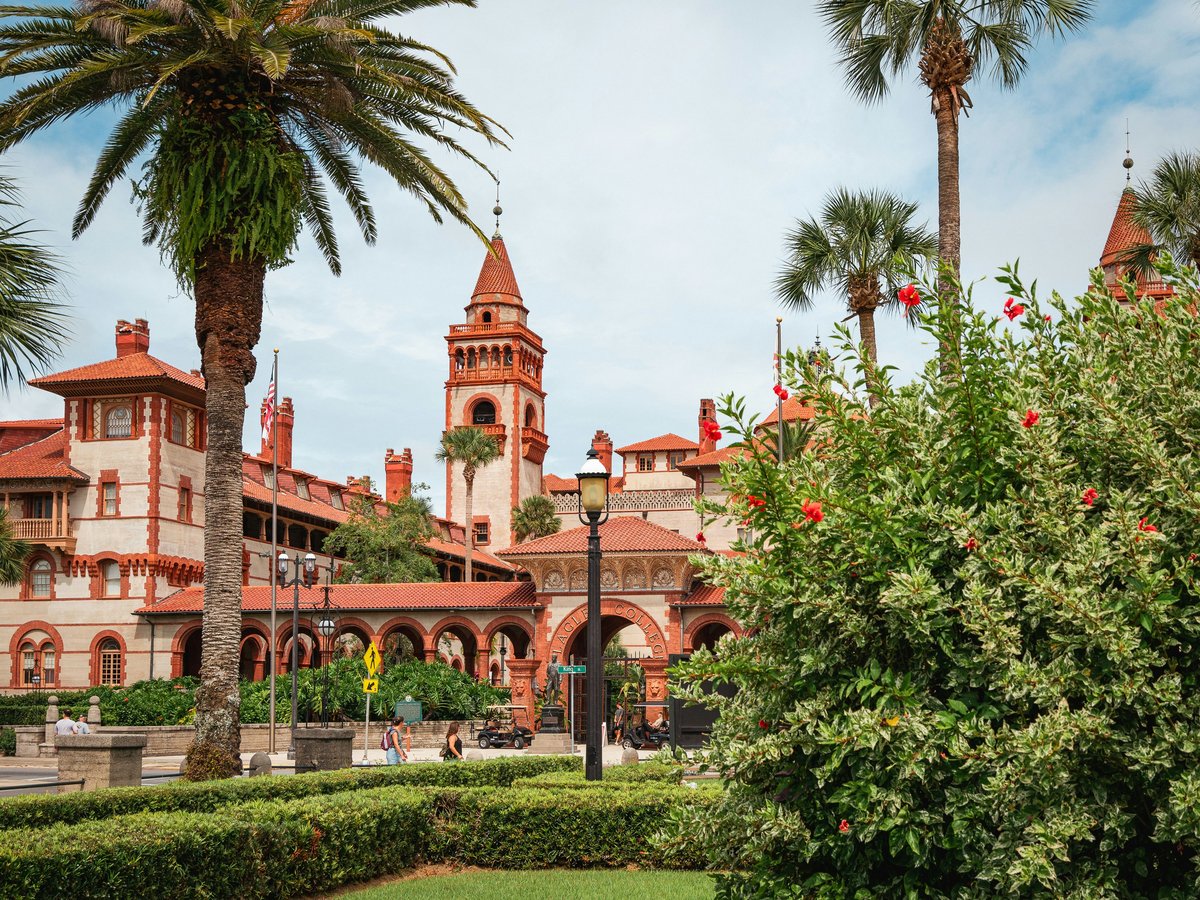
St. Augustine sits on a narrow strip of mainland between the San Sebastian River to the west and the Matanzas River (technically an intracoastal lagoon) to the east. Founded in 1565, the city still follows a colonial-era street grid downtown, with most of the historic core fitting inside a roughly 12-block rectangle. Cross the Bridge of Lions heading east and you're on Anastasia Island, where things spread out quickly into beach neighborhoods. Head north over the Vilano Bridge and the density drops further. The whole city proper holds around 15,000 residents, so distances between neighborhoods are short. You can walk from the Castillo de San Marcos to Lincolnville in 10 minutes. But the feel shifts block by block, and where you stay shapes the trip more than you might expect.
Neighborhoods
-
Historic Downtown
This is the 1565-and-forward core of the city, anchored by the Plaza de la Constitución at its south end and the Castillo de San Marcos at its north. Coquina stone walls and Spanish-colonial facades line the narrow streets, though a lot of what you see dates to Henry Flagler's 1880s building spree rather than the 1600s. St. George Street runs pedestrian-only for about 10 blocks and draws the heaviest foot traffic. Off the main drag, side streets like Aviles Street (likely the oldest European-platted street in the U.S.) and Spanish Street are quieter and lined with galleries and smaller restaurants. Mornings before 10 a.m. tend to be calm. By noon on weekends, St. George Street feels like a theme park queue.
- Best for
- First-time visitors, history enthusiasts, and couples who want to walk everywhere without a car
- Key streets
- St. George Street for the pedestrian corridor, Aviles Street for galleries and the oldest streetscape, Charlotte Street for restaurants with less tourist markup, Cathedral Place for the 1797 Cathedral Basilica
-
Lincolnville
South of King Street and west of the historic core, Lincolnville is a residential neighborhood with deep roots. Settled by formerly enslaved people after 1866, it became the center of Black civic life in St. Augustine and played a direct role in the 1964 Civil Rights movement. Dr. Martin Luther King Jr. stayed at a house on Central Avenue during the protests. The architecture runs toward late-Victorian frame houses, many painted in bold colors, with live oaks arching over the streets. It is quieter than downtown, still primarily residential, with a growing number of B&Bs in restored homes. The Lincolnville Museum on MLK Avenue covers the neighborhood's civil rights history in a converted 1907 house.
- Best for
- Travelers interested in American history beyond the colonial era, visitors who prefer a residential feel within walking distance (5 to 8 minutes) of the historic core
- Key streets
- Martin Luther King Jr. Avenue for the museum and neighborhood spine, Central Avenue for historic homes, Washington Street heading toward the St. Johns County Pier
-
Uptown San Marco
North of the Castillo de San Marcos, San Marco Avenue runs as a 4-lane road lined with independent motels from the 1950s and 60s, many still operating with their original neon signs. This stretch has a mid-century Florida roadside feel that the downtown core has polished away. The Fountain of Youth Archaeological Park sits at the north end, on the site where Menéndez likely landed in 1565. The neighborhood tends to be quieter after dark, with less restaurant and bar activity than downtown. Rooms at the older motels along San Marco typically run $80 to $150 per night, compared to $200 to $400 in the downtown B&Bs.
- Best for
- Budget-conscious visitors with a car, fans of mid-century Americana, families looking for motel pool access without resort prices
- Key streets
- San Marco Avenue is the main commercial strip, May Street connects east to the waterfront, Magnolia Avenue has some of the older residential homes
-
Davis Shores
On the north end of Anastasia Island, Davis Shores is a planned residential subdivision from the 1920s Florida land boom. D.P. Davis (the same developer behind Davis Islands in Tampa) dredged and filled the marshland here in 1925. The lots are modest by modern standards, and the neighborhood has a suburban-residential feel with ranch-style homes from the 1950s through 70s. The main draw is proximity to both downtown (a 5-minute drive over the Bridge of Lions) and St. Augustine Beach (10 minutes south on A1A). The Anastasia Island waterfront along Comanche Avenue has a row of docks and a small public boat ramp. No commercial strip to speak of, which is the point.
- Best for
- Families renting a vacation house who want space, a yard, and easy access to both the beach and downtown without staying in either
- Key streets
- Comanche Avenue along the waterfront, Arredondo Avenue as the main residential connector, Oglethorpe Boulevard for the commercial bits
-
Anastasia Island / St. Augustine Beach
Head south on A1A from Davis Shores and the island narrows before opening up at St. Augustine Beach, about 4 miles east of downtown. The beach itself is wide, hard-packed enough for cars in some stretches (a permit from the St. Johns County office costs $10 for residents, $50 for visitors), and rarely as crowded as Daytona or Jacksonville Beach. The commercial area clusters around A1A Beach Boulevard between A Street and F Street. Restaurants here lean casual. The Saltwater Cowboys on Anastasia Island (technically on the intracoastal side, not the beach) does fried shrimp baskets for around $16 and has a dock where dolphins surface at dusk. The pace is slow even by Florida standards.
- Best for
- Beach-first visitors, surfers (the pier area picks up swells in fall and winter), families with young kids who need sand time every day
- Key streets
- A1A Beach Boulevard for restaurants and shops between A Street and F Street, 2nd Avenue for the pier and public beach access, Pope Road on the way south toward Anastasia State Park
-
Vilano Beach
North of downtown, across the Vilano Bridge, Vilano Beach has the feel of a place that almost got developed and then didn't. The old Vilano Beach fishing pier collapsed during Hurricane Matthew in 2016 and the remaining pilings still stick out of the surf. The neighborhood is a mix of 1970s beach cottages, newer construction, and empty lots. There is one main intersection (Vilano Road and A1A) with a few restaurants and a surf shop. The beach here faces northeast and tends to be windier than St. Augustine Beach, which some surfers prefer. Vacation rentals are common and often run 20 to 30 percent less than comparable places on Anastasia Island.
- Best for
- Surfers, remote workers who want quiet and a beach, visitors who find downtown's tourist density tiring
- Key streets
- Vilano Road from A1A to the beach, Coastal Highway (A1A) heading north toward Ponte Vedra, the short residential grid east of A1A
-
West Augustine
Cross the San Sebastian River heading west on King Street and the city changes fast. West Augustine is a working neighborhood with auto shops, small churches, strip-center groceries, and some of the most affordable housing in the St. Augustine zip code. The area lacks the tourist polish of the east side entirely. That said, a handful of Latin American and Caribbean restaurants have opened along West King Street in recent years, and locals cross over for cheaper, less self-conscious food than what the downtown blocks offer. The West Augustine Community Redevelopment Area has been slowly investing in streetscape improvements since 2013, but progress is gradual.
- Best for
- Visitors on a tight budget looking for short-term rentals, anyone who wants to eat well without paying downtown markup
- Key streets
- West King Street as the main commercial corridor, Holmes Boulevard heading south toward the county fairgrounds, Masters Drive near the commercial cluster
FAQ
Is it possible to visit St. Augustine without a car?
Within the historic downtown core, yes. The area from the Castillo de San Marcos south to Lincolnville is flat and walkable in 15 minutes. But reaching St. Augustine Beach (4 miles east), Vilano Beach, or West Augustine on foot is impractical. The Sunshine Bus Company runs local routes, though service is infrequent, especially on weekends. If you plan to stay exclusively in the historic district, you can manage without a car. For anything else, you'll want one, or at least access to rideshare, which has decent coverage within city limits.
Which neighborhood is best for families with young children?
Anastasia Island, either Davis Shores for a vacation rental or St. Augustine Beach for direct sand access. Davis Shores puts you 5 minutes from downtown by car and 10 from the beach. St. Augustine Beach has the widest sidewalks, the most casual restaurants (most under $15 for kids' meals), and Anastasia State Park nearby for kayaking and calmer water. Downtown itself has uneven sidewalks, heavy foot traffic, and limited stroller-friendly dining, so it's better as a day trip from the island.
When is the best time to visit St. Augustine?
October and November tend to hit the sweet spot. Summer highs sit around 90°F with near-daily afternoon thunderstorms, and the humidity makes walking downtown feel heavy. Winter, roughly December through February, brings cooler temperatures (highs around 60 to 65°F) and Nights of Lights, a holiday light display that runs from mid-November to January 31 and draws significant crowds to the historic district. March and April bring spring breakers. October offers warm beach water (still around 78°F), thinner crowds, and shoulder-season pricing at most hotels and vacation rentals.
How far is St. Augustine Beach from the historic downtown?
About 4 miles by car, roughly a 12-minute drive east across the Bridge of Lions and down A1A. During peak season (summer weekends, holiday weekends), the Bridge of Lions opens for boat traffic and can add 10 to 15 minutes of delay. The bridge tends to open on the hour and half-hour. If you're heading to the beach on a Saturday in July, leave a few minutes early or take the 312 bridge to the south, which is a fixed span and avoids the wait.
Is downtown St. Augustine walkable for people with mobility issues?
Partially. St. George Street is flat and pedestrian-only, which helps. But many of the side streets in the historic core still have original brick or coquina surfaces that are uneven and difficult for wheelchairs or walkers. The bayfront along Avenida Menendez is smoother and has a continuous sidewalk. The Castillo de San Marcos is mostly accessible at ground level, though the upper deck requires stairs. Flagler College offers exterior viewing only (tours involve stairs). Parking in the historic district is limited, but there are designated accessible spaces along the bayfront and in the parking garage on Cordova Street.
Last verified by automated review (v1.7.2) on . What is automated review?