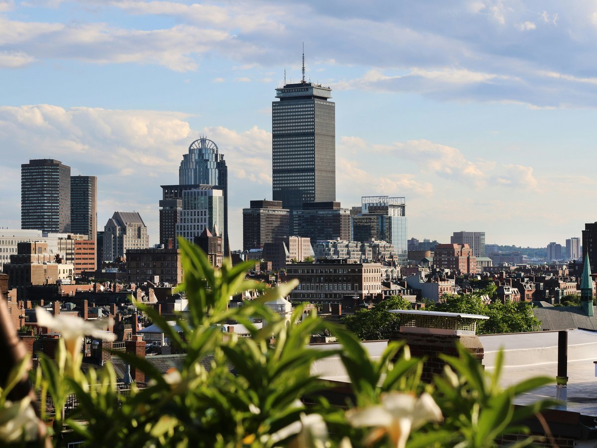
Boston sits on a compact peninsula where the Charles River meets Massachusetts Bay, and that geography shapes everything about outdoor life here. The city itself covers about 90 square miles, but within 30 minutes you can reach granite ridgelines, tidal marshes, barrier beaches, and old-growth forest remnants. Frederick Law Olmsted's Emerald Necklace still threads 1,100 acres of connected parkland from Boston Common to Franklin Park, more than 130 years after he designed it. The harbor, once famously polluted, has been swimmable since the early 2000s. You'll find runners on the Esplanade at 6 AM in January, sea kayakers threading the Harbor Islands by June, and cross-country skiers in the Fells after a good nor'easter. Mind you, New England weather keeps you honest. A 55-degree April morning can turn into sleet by lunch. That variability tends to breed a certain stubbornness in the people who get outside here, and the city rewards it.
Outdoor activities
-
Road cycling the Minuteman Bikeway
This 10-mile paved rail trail runs from Alewife station in Cambridge out to Bedford, passing through Arlington and Lexington. The surface is smooth asphalt, mostly flat with gentle grades. You'll roll past Spy Pond, cross Massachusetts Avenue in Lexington Center near the Battle Green, and finish at the Bedford depot. The path gets crowded on weekend mornings from April through October, so weekday rides tend to feel more relaxed. Bikes are available from BlueBikes stations at Alewife.
- Difficulty
- Easy
- Duration
- 1-2 hours one way
- Best season
- April through October
-
Trail running in the Middlesex Fells
The Fells covers 2,575 acres across Medford, Malden, Stoneham, Melrose, and Winchester, about 7 miles north of downtown Boston. The Skyline Trail here runs roughly 7 miles over rocky terrain with short, steep pitches. The footing is uneven granite and root-laced singletrack. You'll smell pine needles and damp earth after rain, and the canopy filters the light in a way that keeps summer runs cooler than the road. The reservoir loop offers a flatter 3.5-mile alternative. Orange Line to Wellington, then a 15-minute bus ride on the 100.
- Difficulty
- Moderate to strenuous
- Duration
- 1.5-3 hours depending on route
- Best season
- Year-round, though icy sections in winter require microspikes
-
Rock climbing at Quincy Quarries
These flooded granite quarries in Quincy, about 8 miles south of downtown, have been a local climbing spot for decades. The Quincy Quarries Reservation offers top-rope and sport routes on cut granite walls ranging from 20 to 60 feet. The rock is sharp-edged and abrasive on hands. Worth noting, this is an unsupervised site with no formal route grading, so you need to bring your own gear and judgment. Red Line to Quincy Center, then a 10-minute walk.
- Difficulty
- Moderate to advanced
- Duration
- Half day
- Best season
- April through November
-
Cross-country skiing on the Esplanade
After a solid snowfall of 6 inches or more, the Esplanade along the Charles River becomes skiable for about 3 miles between the Longfellow Bridge and the BU Bridge. The snow tends to pack down fast from foot traffic, so early morning on the day after a storm is the window. You'll hear the crunch of fresh snow and see the frozen river reflecting the Back Bay skyline. Classic technique works better than skate on the narrower paths. Boston averages around 49 inches of snow per season, though that number varies wildly year to year.
- Difficulty
- Easy to moderate
- Duration
- 1-2 hours
- Best season
- December through February, snow-dependent
-
Cycling the Emerald Necklace
Olmsted's 7-mile chain of parks from Boston Common through the Back Bay Fens, Olmsted Park, Jamaica Pond, Arnold Arboretum, and into Franklin Park makes for a slow, winding urban ride. The paths are mixed, some paved, some packed gravel, and narrow in places. You'll pass through dramatically different neighborhoods and landscapes within a single ride. Jamaica Pond appears about halfway, and stopping for a lap around its 1.5-mile shore path is almost compulsory. Parts of the route share space with pedestrians, so speed stays moderate.
- Difficulty
- Easy
- Duration
- 2-3 hours with stops
- Best season
- May through October
Day hikes
-
Blue Hills Reservation, Skyline Trail
The Skyline Trail runs about 9 miles through the Blue Hills Reservation in Milton and Canton, 10 miles south of downtown. The trail traverses Great Blue Hill at 635 feet, the highest point on the Atlantic coast south of Maine. The footing is rocky throughout, with exposed granite ledges that get slippery when wet. You'll climb through mixed hardwood forest, over open ledges with views south toward the Blue Hills Observatory, and down into hemlock ravines that stay cool even in August. The observatory at the summit has recorded weather data continuously since 1885. Parking at the Houghton's Pond lot fills early on fall weekends. Red Line to Ashmont, then bus 240 to the reservation entrance.
- Difficulty
- Moderate to strenuous
- Duration
- 4-6 hours for the full traverse
- Best season
- September through November for foliage, though hikeable year-round
-
World's End, Hingham
This 251-acre peninsula in Hingham Harbor, about 15 miles southeast of Boston, was landscaped by Olmsted in the 1890s for a housing development that was never built. The result is a series of tree-lined carriage paths winding over drumlins with harbor views in nearly every direction. The terrain is gentle, mostly mowed grass and gravel paths. The tip of the peninsula looks out toward the Boston Harbor Islands and the Hull shoreline. Managed by the Trustees of Reservations, admission is $8 per adult for nonmembers. A 4.5-mile loop covers both drumlins and the rocky shoreline.
- Difficulty
- Easy
- Duration
- 2-3 hours
- Best season
- April through November
-
Breakheart Reservation, Saugus
This 640-acre reservation in Saugus, 10 miles north of downtown, packs surprisingly rugged terrain into a compact space. The main ridge trail loops about 3 miles over rocky hills with views of the Boston skyline to the south and the North Shore to the east. Pearce Lake offers a supervised swimming area from late June through Labor Day. The forest is mostly oak and pine, and in October the colors are vivid. The trails are well-marked with colored blazes, though some sections involve scrambling over granite boulders. The silence up on the ridge, with only wind and jays, feels unlikely given how close you are to Route 1.
- Difficulty
- Moderate
- Duration
- 2-3 hours
- Best season
- May through October, fall foliage peaks mid-October
-
Mount Wachusett, Princeton
About 60 miles west of Boston on Route 2, Wachusett's 2,006-foot summit is the highest point in eastern Massachusetts. The Mountain House Trail, roughly 2 miles to the summit, climbs through sugar maple and birch forest that turns gold and crimson by early October. The summit has a fire tower and views north to Mount Monadnock in New Hampshire on clear days. Total elevation gain is around 1,000 feet. The ski area operates on the east face, so the western trails stay quieter. A Wachusett/Fitchburg commuter rail from North Station reaches the base area in about 90 minutes.
- Difficulty
- Moderate
- Duration
- 3-4 hours round trip
- Best season
- Late September through mid-October for foliage, June for wildflowers
-
Middlesex Fells, Skyline Trail loop
Closer to the city than the Blue Hills, the Fells Skyline Trail covers about 7 miles of rocky terrain through Medford, Stoneham, and Malden. The white-blazed loop crosses several hilltops, none higher than 300 feet, but the constant ups and downs over granite make it feel harder than the elevation suggests. Pine Knoll and Bear Hill have open ledges. The eastern section near Spot Pond is more forested and quieter. This is not a groomed path. Expect root tangles, loose rock, and unmarked side trails. Bring a map or download the DCR trail map beforehand.
- Difficulty
- Moderate to strenuous
- Duration
- 3-5 hours
- Best season
- Year-round, microspikes needed December through March
Water activities
-
Kayaking the Charles River
Paddling the Charles between the Esplanade and Watertown is one of the better urban kayak experiences on the East Coast. Charles River Canoe and Kayak operates rental locations at Kendall Square in Cambridge and at Soldier's Field Road in Brighton, with single kayak rentals starting around $20 per hour. The river is flat and slow-moving through this stretch, with blue herons standing in the shallows near the Watertown Dam. You'll paddle under stone arch bridges and past rowing crews from Harvard and BU. The water quality has improved dramatically since the 1990s, though swimming in the Charles is still limited to organized events. Wind can pick up in the afternoon basin near the Esplanade, so morning paddles tend to be calmer.
- Difficulty
- Easy
- Duration
- 1.5-3 hours
- Best season
- May through October
-
Harbor Islands ferry and swimming at Spectacle Island
Boston Harbor Islands National and State Park covers 34 islands accessible by ferry from Long Wharf. The ferry runs from late June through Labor Day, with tickets around $22 round trip for adults via Boston Harbor City Cruises. Spectacle Island, about 20 minutes out, has a supervised swimming beach on the north shore, 5 miles of walking trails, and a visitor center. The beach faces the inner harbor, so the water is calmer than open ocean but still cold. Georges Island, the other main ferry stop, has Fort Warren, a Civil War-era granite fort you can walk through. The salt air and the engine-quiet once you're on the islands make downtown feel far away.
- Difficulty
- Easy
- Duration
- Half day to full day
- Best season
- Late June through early September
-
Swimming at Walden Pond, Concord
Walden Pond in Concord, 20 miles west of Boston, is a 61-acre glacial kettle pond that reaches 102 feet deep. The water is clear and cold, typically 65-72 degrees Fahrenheit in July and August. The state reservation caps visitor capacity, and the parking lot fills by 10 AM on summer weekends, so arriving early matters. A 1.7-mile trail circles the pond through pine and oak forest. The site of Thoreau's cabin on the north shore is marked by a cairn and stone pillars. Fitchburg Line commuter rail to Concord station, then a 1.5-mile walk to the entrance. Day-use parking is $30 for Massachusetts plates, $50 for out-of-state.
- Difficulty
- Easy
- Duration
- Half day
- Best season
- June through August
-
Sailing on the Charles River Basin
Community Boating on the Esplanade, the oldest public sailing program in the country (founded 1936), offers adult seasonal memberships starting around $349. That covers unlimited use of 420s, Mercury keelboats, and Lasers on the Charles River Basin between the Longfellow and BU bridges. The basin is about 2 miles long and protected from ocean swells, though the wind funnels between the Back Bay and Cambridge buildings in unpredictable ways. Beginners take a skills test before sailing solo. Wednesday evening racing draws experienced sailors. The light on the water at sunset here, with the Hancock Tower going gold in the background, might be the best free show in the city.
- Difficulty
- Easy to moderate, depending on wind
- Duration
- 2-4 hours per session
- Best season
- April through November
-
Ocean swimming at Carson Beach, South Boston
Carson Beach, along Day Boulevard in South Boston, stretches about half a mile with lifeguard coverage from late June through Labor Day. The water temperature in Boston Harbor reaches the low 70s by mid-July, though some summers it stays in the upper 60s. The beach faces east toward the harbor, and on calm days the water is surprisingly clear for an urban beach. Red Line to JFK/UMass, then a 10-minute walk east. M Street Beach, a few hundred yards south, tends to attract a younger, louder crowd. L Street Beach, north of the bathhouse, is home to the L Street Brownies, a cold-water swimming club that takes its New Year's Day plunge here since 1904.
- Difficulty
- Easy
- Duration
- 1-3 hours
- Best season
- Late June through August
Parks & gardens
-
Arnold Arboretum
FreeHarvard University's 281-acre living museum in Jamaica Plain holds over 15,000 plants from temperate regions worldwide. The grounds were designed by Olmsted in 1872 and still follow his original circulation plan. In mid-May, Lilac Sunday draws thousands of visitors to the lilac collection near the Bradley Rosaceous Collection. The bonsai and dwarf conifer collection near the Hunnewell Building is easy to miss but worth the detour. Peters Hill, the highest point at 240 feet, gives you a clear sightline to the downtown skyline. The air smells different in every season here, from the heavy sweetness of magnolias in April to the dry rustle of oak leaves in November.
Highlights: Lilac Sunday in May, the Linden Collection along Meadow Road, Peters Hill summit views, Explorers Garden near the main gate
-
Boston Public Garden
FreeEstablished in 1837, the Public Garden was the first public botanical garden in the United States. The 24-acre space sits directly west of Boston Common, separated by Charles Street. The Swan Boats have operated on the lagoon since 1877, running from mid-April through mid-September at $4.50 per adult ride. The weeping willows along the water's edge are the most photographed trees in the city. In spring, the garden plants over 80 species of tulips, and the beds rotate through summer annuals into fall chrysanthemums.
Highlights: Swan Boats on the lagoon, the bronze Make Way for Ducklings sculptures, 80+ tulip varieties in April, the suspension bridge over the pond
-
Franklin Park
FreeThe largest park in Boston at 527 acres, Franklin Park anchors the southern end of the Emerald Necklace in Dorchester and Roxbury. Olmsted considered this his masterpiece, though it has been through periods of neglect and renewal. The 18-hole William J. Devine Golf Course occupies the western section, greens fees around $28-44 depending on season. The Playstead and Ellicott Dale offer wide open meadows for pickup soccer and cricket. The Wilderness, Olmsted's name for the wooded interior, has miles of unpaved trails where you might spot red-tailed hawks overhead and hear woodpeckers working the old oaks.
Highlights: Hagborne Hill overlook, the Wilderness trails through mature hardwood forest, Scarboro Pond, the Playstead fields, the Overlook Ruins shelter
-
Castle Island and Pleasure Bay
FreeThis South Boston peninsula connects to the mainland by a causeway and wraps around a protected swimming lagoon. Fort Independence, a granite pentagonal fort built in 1851, sits at the tip and is open for free tours on summer weekends. The 2.2-mile loop path around Pleasure Bay and the Head Island Causeway draws walkers, joggers, and fishing regulars. The water in Pleasure Bay stays calmer than the open harbor, and families swim off the L Street Beach side through July and August. Sullivan's, the seasonal concession stand near the parking lot, has been selling hot dogs and clam chowder since 1951.
Highlights: Fort Independence tours, the 2.2-mile loop walk, Sullivan's for fried clams, views of the harbor and planes descending into Logan
-
Charles River Esplanade
FreeThis 3-mile stretch of parkland along the Charles River from the Museum of Science to the BU Bridge is Boston's primary riverside green space. The Hatch Memorial Shell hosts free concerts from June through September, including the Boston Pops July 4th performance that draws around 500,000 people. Community Sailing operates from the Harry McDonough Sailing Center near the Longfellow Bridge, offering adult memberships starting around $349 per season. The path is the city's busiest multi-use trail, shared by runners, cyclists, and strollers. Spring evenings here smell like river water and cut grass.
Highlights: Hatch Shell summer concerts, Community Sailing center, the lagoons near Fiedler Footbridge, Storrow Lagoon for birdwatching, views of the Cambridge skyline
-
Boston Common
FreeThe oldest public park in the United States, established in 1634, covers 50 acres in the center of the city. The Frog Pond operates as a splash pad and wading pool from late June through early September, then converts to an ice skating rink from November through mid-March with a $6 admission for adults. The Central Burying Ground along Boylston Street dates to 1756. The park tends to feel like a transit hub during weekday commutes, but early weekend mornings are quieter, with dog walkers and tai chi groups on the Great Lawn.
Highlights: Frog Pond skating and wading, the Soldiers and Sailors Monument on the hilltop, Central Burying Ground, Brewer Fountain Plaza, the Great Elm site marker
Practical tips
- Layering for New England weather
- Boston's weather can shift 20 degrees within a single day, especially in spring and fall. A moisture-wicking base layer, a fleece mid-layer, and a wind-resistant shell covers most conditions from March through November. Winter hiking in the Blue Hills or the Fells requires insulated layers and microspikes for icy granite. Check weather.gov forecasts for the specific town you're heading to, not the Boston metro forecast, since inland temps often run 5-10 degrees cooler.
- Tick prevention on trails
- Deer ticks carrying Lyme disease are established throughout eastern Massachusetts, with the Fells, Blue Hills, and any trail with tall grass or leaf litter posing risk from April through November. Treat pants and socks with permethrin before the season. Do a full tick check after every hike, paying attention to hairlines and waistbands. The nymph-stage ticks active in May and June are the size of a poppy seed and easy to miss.
- Hydration and water access
- Most Boston parks have water fountains that run from May through October, but trailheads at the Blue Hills and the Fells often do not. Carry at least 1.5 liters for any hike over 2 hours. Summer humidity in July and August pushes heat index values above 100 degrees on some days, which accelerates dehydration faster than you might expect from the air temperature alone.
- Trail conditions and footwear
- The granite bedrock on Blue Hills and Middlesex Fells trails stays slippery for hours after rain. Trail runners with aggressive lugs work for dry conditions, but proper hiking boots with ankle support are worth it on the Skyline Trail. After snowmelt in March and April, many trails turn to mud that can swallow a shoe to the ankle. The DCR posts occasional trail advisories at mass.gov/dcr for closures and conditions.
- Sun protection on the water
- Sunburn on the Charles River and harbor comes faster than on land because of water reflection. SPF 50 reapplied every 90 minutes is the baseline. Polarized sunglasses cut the glare enough to spot submerged obstacles when kayaking. A brimmed hat stays on better than a cap when wind picks up on the Charles basin in the afternoon.
- Parking and access without a car
- Most Boston outdoor destinations are reachable by MBTA. Blue Hills via the 240 bus from Ashmont, the Fells via the 100 from Wellington, Walden Pond via the Fitchburg commuter rail to Concord. Weekend parking at popular trailheads fills by 9 AM from May through October. The commuter rail bike car, available on most trains, lets you combine a rail ride with a cycling route. A Charlie Card for the T costs $2.40 per subway ride.
FAQ
Is it safe to swim in Boston Harbor and the Charles River?
Boston Harbor beaches like Carson Beach, M Street Beach, and the Pleasure Bay lagoon are monitored by lifeguards and tested for water quality throughout the summer. The harbor water has been clean enough for swimming since the late 1990s, following a $3.8 billion cleanup of the sewage system. The Charles River is a different story. While water quality has improved, swimming is still restricted to organized events like the Charles River Swim, typically held in July, which requires registration and is monitored by the Charles River Conservancy.
When is the best time of year to hike near Boston?
Late September through mid-October tends to be the sweet spot. The foliage peaks, the humidity drops, and the summer crowds thin out. Temperatures run in the 50s and 60s, comfortable for sustained effort on the trail. Spring hiking from mid-April through May is also good, but trails can be muddy from snowmelt well into April, and black flies appear in May near wetlands. Summer hiking works if you start early to avoid the afternoon heat and thunderstorms that build from mid-June through August.
Do I need permits for kayaking or paddleboarding on the Charles River?
No individual permit is needed if you rent from a licensed outfitter like Charles River Canoe and Kayak. If you bring your own boat, you can launch from designated DCR access points along the Charles without a permit. The river between Watertown Dam and the Museum of Science is the recreational section. Downstream of the locks near the Museum of Science enters the harbor, which has commercial vessel traffic and different regulations. Stand-up paddleboards follow the same access rules as kayaks.
Are Boston's outdoor trails dog-friendly?
Most DCR trails in the Blue Hills and Middlesex Fells allow dogs on leash, with a 10-foot maximum leash length. Arnold Arboretum requires dogs on leash at all times, no exceptions. Franklin Park has an unofficial off-leash culture in some meadow areas, though the posted rule is leash-required. The Harbor Islands do not allow dogs. Walden Pond does not allow dogs from Memorial Day through Labor Day. Bring water for your dog on any hike over an hour, since most trailheads lack pet fountains.
What gear should I rent versus bring for outdoor activities in Boston?
Kayaks, paddleboards, and sailboats are easy to rent at Charles River Canoe and Kayak or Community Boating, so bringing your own watercraft is unnecessary for a visit. Bikes rent through BlueBikes at $2.95 per 30-minute ride or $11 for a day pass. Hiking boots and layered clothing you should bring, since outdoor gear retail in Boston (REI in Fenway, Eastern Mountain Sports in Cambridge) is priced at full retail. Microspikes for winter hiking are worth owning if you plan to hike between December and March.
How crowded are the trails on weekends?
The Blue Hills Skyline Trail and Walden Pond reach capacity on weekend mornings from May through October. Arriving before 9 AM helps. The Middlesex Fells stays somewhat quieter because it's less well-known to tourists, though the Spot Pond area draws families. Weekday mornings, even in peak season, are noticeably less crowded everywhere. The Harbor Islands ferries sell out on summer Saturdays, so buying tickets online a day ahead avoids the Long Wharf line.
Outdoor experiences in Boston
 Free cancellation
 Boston Harbor Sightseeing Cruise
Outdoor experience — 1.5 hours, free cancellation.
via Viator Free cancellation
 Boston to Newport: Breakers, Marble House Small Group Max 12 Tour
Outdoor experience — free cancellation.
via Viator
1 Hour Boston Segway Tour
Outdoor experience — 1.5 hours.
via ViatorLast verified by automated review (v1.7.2) on June 13, 2026. What is automated review?