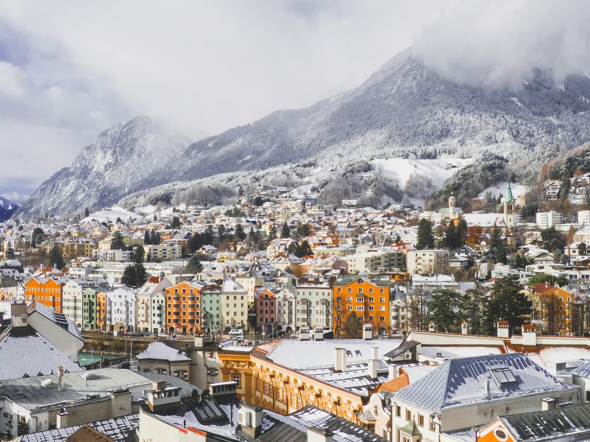
Innsbruck sits in a narrow east-west valley where the Inn River cuts between the Nordkette range to the north and the Patscherkofel massif to the south. The city center is compact, maybe 2 kilometers across, and the river splits it into a distinct north bank and south bank. Most visitors stick to the south-bank Altstadt and the Maria-Theresien-Straße corridor, but the north-bank neighborhoods like St. Nikolaus and Mariahilf have a slower, more residential feel that tends to reward an afternoon of wandering. Tram lines 1, 3, and 6 connect most of the inner districts in under 10 minutes. The Stubaitalbahn (STB) heads south toward Igls and the ski areas. Worth noting, the city still feels small enough that you can walk from the westernmost neighborhood of Hötting to the eastern edge of Pradl in about 45 minutes along the Inn promenade. Elevation matters here more than in most European cities. The valley floor sits at roughly 574 meters, but neighborhoods like Hungerburg climb to 860 meters, and the temperature can drop 5 to 8 degrees between your hotel lobby and the Seegrube station at 1,905 meters.
Neighborhoods
-
Altstadt (Old Town)
Narrow medieval lanes with 15th and 16th-century facades, painted in faded pinks and yellows, opening onto small squares where the sound of church bells from the Dom zu St. Jakob bounces off stone walls. The Goldenes Dachl on Herzog-Friedrich-Straße draws crowds by mid-morning, but by 8 p.m. the tour groups have gone and the Old Town gets quiet enough to hear the river. The buildings are tall and close together, which keeps the streets cool even in July. You'll catch the smell of fresh Apfelstrudel from Stiftskeller and roasted coffee from any of 3 or 4 small cafes tucked under the arcades.
- Best for
- First-time visitors, history-focused travelers, and anyone who wants to walk to everything without needing transit
- Key streets
- Herzog-Friedrich-Straße is the spine, running south from the Goldenes Dachl to the Triumphpforte arch on Maria-Theresien-Straße. Pfarrgasse leads to the Dom. Hofgasse connects to the Hofburg and the Hofkirche with Maximilian I's cenotaph. Kiebachgasse has some of the oldest shopfronts in the city.
-
Saggen
This is the Gründerzeit quarter northeast of the Altstadt, built in the late 1800s when Innsbruck expanded as a garrison and university town. The streets are wide and lined with 4-story apartment buildings in that solid Austro-Hungarian style, heavy cornices, tall windows with wooden shutters. Rennweg is the main artery and it's quieter than Maria-Theresien-Straße despite being only 2 blocks away. The Hofgarten park sits at the western edge, and on warm afternoons the benches fill with university students and parents with small children. The pace is noticeably slower here than the Old Town. You might hear piano practice drifting from upper-floor windows.
- Best for
- Couples and repeat visitors who want a residential base within a 5-minute walk of the center, and anyone who values calm over proximity to bars
- Key streets
- Rennweg runs east-west and has a handful of good restaurants and wine bars. Claudiastraße connects south to the Inn bridges. Kaiser-Josef-Straße has the daily farmers market (Bauernmarkt) at its eastern end, open mornings Monday through Saturday. The Hofgarten park at the corner of Rennweg and Burggraben is worth a slow loop.
-
St. Nikolaus
Cross the Innbrücke or the Universitätsbrücke to the north bank and you'll find yourself on Innstraße, the main road through St. Nikolaus. The buildings here are lower, 2 to 3 stories, many with wooden balconies and painted facades in that Tyrolean style. It feels like a separate small town. The neighborhood has a handful of artist studios and a few independent shops that turn over slowly. The sound of the Inn River is a constant background, louder in spring when snowmelt raises the water level. There's a slight dampness in the air near the river that you stop noticing after a day.
- Best for
- Budget-conscious travelers, solo visitors who want a local neighborhood feel, and anyone interested in craft workshops or independent galleries
- Key streets
- Innstraße is the commercial spine with bakeries, a pharmacy, and a couple of Gasthäuser. Höttinger Gasse branches northwest and climbs toward Hötting proper. The Waltherpark along the river has a small playground and benches facing the Altstadt skyline across the water.
-
Wilten
South of the train tracks and the Hauptbahnhof, Wilten is anchored by the Wiltener Basilika, a Rococo church from 1756 with a pale yellow exterior that looks almost out of place against the dark mountain backdrop. The neighborhood is a mix of old Tyrolean houses and postwar apartment blocks, more residential than touristic. Leopoldstraße has a row of small restaurants and cafes that cater to locals rather than visitors. The Bergisel ski jump (site of the 2 Olympic events in 1964 and 1976) sits at the southern edge, designed by Zaha Hadid and reopened in 2003. The streets smell like woodsmoke in winter.
- Best for
- Families and sports-minded visitors who want easy access to the Bergisel area, the Tirol Panorama museum, and southern hiking trails without paying Old Town hotel prices
- Key streets
- Leopoldstraße has the best cafe-to-tourist ratio in the city. Müllerstraße leads to the Stift Wilten monastery. Bergiselweg climbs to the ski jump and the Tirol Panorama museum, about a 20-minute walk from the basilica.
-
Pradl
East of the Altstadt across the Sill River, Pradl is the working neighborhood that most visitors never see. The streets are a grid of 1950s and 1960s apartment blocks interspersed with older Tyrolean houses that survived the 1943 and 1944 bombing raids. The Pradler Markt on Pradler Straße is a small daily market that sells Turkish bread, Balkan pastries, and Austrian Wurst side by side. You'll hear more Turkish and Bosnian spoken here than in any other Innsbruck neighborhood. The food is cheaper, with a Döner running 5 to 6 euros compared to 8 or 9 in the Old Town. It's noisier than Saggen or Hötting, and the architecture won't win awards, but it has the best everyday eating in the city.
- Best for
- Budget travelers, food-focused visitors who care more about a good meal than a pretty street, and anyone staying longer than a few days who wants to feel like a temporary resident
- Key streets
- Pradler Straße is the main commercial road with grocers, bakeries, and takeaway spots. Amraser Straße heads east toward Schloss Ambras (about 2.5 kilometers). Pembaurstraße has a few quiet residential blocks that feel surprisingly green.
-
Hötting
North of St. Nikolaus, the terrain starts to climb. Hötting is spread across the lower slopes of the Nordkette, with winding residential streets, garden walls covered in ivy, and views over the city rooftops that improve with every 50 meters of elevation gain. The houses are a mix of 19th-century villas and interwar Tyrolean chalets, many with carved wooden balconies. The air is noticeably cleaner and cooler up here, and the birdsong is louder than the traffic. The Alpenzoo (one of Europe's highest-altitude zoos at 727 meters) sits on the eastern edge. It's a 15-minute walk downhill to the Altstadt, but the return climb takes closer to 25 minutes.
- Best for
- Nature lovers, families visiting the Alpenzoo, and hikers who want to start their day already partway up the mountain
- Key streets
- Höttinger Gasse winds up from the Inn bridges. Schneeburggasse passes some of the finest old villas. Weiherburggasse leads to the Alpenzoo entrance and the Hungerburgbahn valley station (the Zaha Hadid-designed funicular that opened in 2007).
-
Hungerburg
Hungerburg sits at 860 meters above sea level, reachable by the Hungerburgbahn funicular from the Congress station in about 8 minutes, or by a steep road that switchbacks up from Hötting. The air temperature drops noticeably as you ascend. The neighborhood is a handful of hotels, a few residential streets, and the midway station of the Nordkettenbahn cable car system. The views from the Hungerburg plateau are the kind that make you stop mid-sentence. You can see the full length of the Inn Valley in both directions, the Altstadt rooftops directly below, and the Stubai Alps to the south. In winter, a thin layer of fog sometimes fills the valley while Hungerburg sits in bright sunshine above it.
- Best for
- Hikers, skiers heading to the Nordkette freeride runs, and anyone willing to trade convenience for a mountain setting 10 minutes from the city center
- Key streets
- There's really one main road, Höhenstraße, that loops through the settlement. The Nordkettenbahn station is the anchor point. The Gramartboden trail heads west along the slope at a gentle gradient, good for families.
FAQ
Where should I stay in Innsbruck if I only have 2 days?
The Altstadt or Saggen will keep your walking distances short. From either neighborhood you can reach the Goldenes Dachl, the Hofburg, the Dom, and the Nordkettenbahn valley station on foot in under 15 minutes. Hotels in the Altstadt tend to run 130 to 200 euros per night for a double room in summer. Saggen is slightly cheaper, often 100 to 160 euros, and quieter after dark.
Is Innsbruck walkable or do I need public transit?
The core city is roughly 2 kilometers across and flat along the valley floor. You can walk between the Altstadt, Saggen, St. Nikolaus, and Wilten without needing a bus or tram. Pradl is about a 20-minute walk east from the center. For Hötting and Hungerburg, the uphill walk is steep enough that most people take the Hungerburgbahn funicular (runs every 15 minutes) or tram line 1 to the lower slopes. A 24-hour transit pass costs 5.50 euros and covers all city buses and trams.
Which Innsbruck neighborhood has the best food scene?
That depends on what you want. Pradl has the cheapest and most diverse everyday eating, with Turkish, Balkan, and Austrian options on Pradler Straße for under 10 euros a meal. Wilten along Leopoldstraße has quieter sit-down restaurants with Tyrolean menus and local wine. The Altstadt has the most options overall but prices are 30 to 50 percent higher than the outer neighborhoods. For a specific recommendation, Gasthof Engl on Innstraße in St. Nikolaus has been open since 1312 and does a proper Tiroler Gröstl for about 14 euros.
What is the best neighborhood in Innsbruck for families with children?
Wilten and Hötting both work well. Wilten is flat, has the Bergisel ski jump and Tirol Panorama museum within walking distance, and sits close to the Hauptbahnhof for day trips. Hötting has the Alpenzoo (roughly 10 euros for kids, 14 euros for adults) and more green space, though the hilly streets mean a stroller can be a workout. Saggen's Hofgarten park has a large playground and is the most central family-friendly green space.
Is it worth staying in Hungerburg instead of the city center?
Only if mountains are your primary reason for visiting. Hungerburg puts you 8 minutes by funicular above the city at 860 meters, with direct access to Nordkette hiking trails and the freeride ski terrain in winter. But the last Hungerburgbahn down runs at about 11:15 p.m., and there are no restaurants or shops up top beyond hotel dining. You'll descend for every meal, every errand, and every evening out. For most visitors, staying in the Altstadt or Saggen and riding up for the day makes more practical sense.
Last verified by automated review (v1.7.2) on . What is automated review?