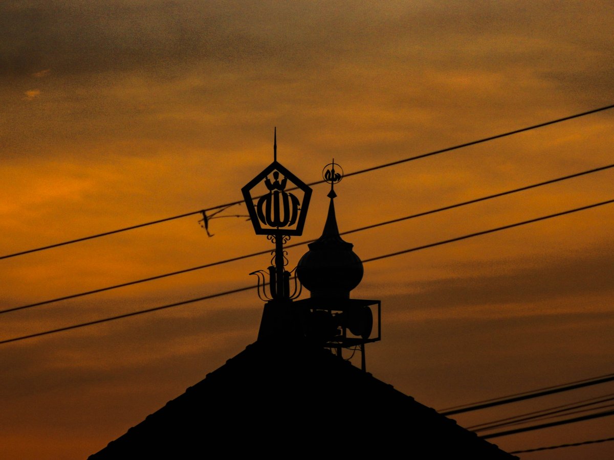
Yogyakarta sits on a gentle slope between two very different landscapes. Mount Merapi, roughly 2,900 m and one of Indonesia's most active volcanoes, rises about 30 km to the north. The Indian Ocean breaks on black sand around 27 km to the south. To the east, the Gunungkidul karst plateau holds limestone caves, underground rivers, and small white-sand coves. To the west, the Menoreh Hills of Kulon Progo roll toward Borobudur. On a clear morning from the Kraton area you can see the Merapi cone at the top of the city's north-south axis, which runs from the palace past Tugu Yogyakarta toward the volcano. Most outdoor days here start before 5 am. By noon in late September the city can reach 35.8°C, so locals ride, hike, and paddle at dawn and head for shade after lunch. The dry season, roughly May to October, is when trails in Gunungkidul and the Merapi foothills are firm and the cave rivers run clear. From November to March, afternoon storms turn karst tracks into orange mud and can close Goa Jomblang and the river-tubing sites at short notice.
Outdoor activities
-
Merapi Lava Tour by 4x4 Jeep
Open-top jeeps leave from Kaliurang and the Kinahrejo area on Merapi's southern flank and follow the 2010 eruption's pyroclastic flow paths. Standard loops stop at Bunker Kaliadem, the Museum Sisa Hartaku (a house kept as the ash left it, with melted clocks and cutlery) and the site of Mbah Maridjan's former home. Drivers also cross the Kali Kuning riverbed, where the jeeps splash through shallow water. Prices are set per jeep for up to four people and run 350,000 to 550,000 IDR depending on the route length, about 20 to 31 USD at the current rate. Book the 4:30 am sunrise departure if you want Merapi's summit before the clouds cover it, usually by about 9 am.
- Difficulty
- Easy (seated, but bumpy and dusty)
- Duration
- 1.5 to 3 hours depending on route
- Best season
- May to October; sunrise slots give the clearest summit views
-
Vertical Descent into Goa Jomblang
Goa Jomblang is a collapsed sinkhole in Semanu, Gunungkidul, about 60 km southeast of the city. Operators lower visitors on ropes and harnesses about 60 m into a forested pit. From the floor, a muddy 300 m walk leads to Goa Grubug, where sunlight falls through an opening in the roof between roughly 10 am and noon. Daily visitor numbers are capped, so book at least a few days ahead in July and August. The climb out is by rope winch, with the operator's crew doing the heavy pulling.
- Difficulty
- Moderate (no caving skill needed, but mud and humidity make it tiring)
- Duration
- Half day, including roughly 2 hours of driving each way
- Best season
- April to October; descents are often cancelled after heavy rain in the wet season
-
Temple Cycling Loop around Prambanan
Hire a bike in the Prambanan area and ride the flat village roads linking Prambanan Temple with the smaller Buddhist sites at Sewu, Plaosan and Banyunibo. The 9th-century stones at Plaosan sit among rice paddies where farmers still plant by hand in the early morning. A longer version climbs to Ratu Boko on its hilltop plateau, a short but steep push of about 200 m in altitude. Start by 6 am. After 10 am the asphalt heats up and the tour-bus traffic grows on Jalan Raya Solo-Yogya.
- Difficulty
- Easy to Moderate (flat except the Ratu Boko climb)
- Duration
- 3 to 5 hours
- Best season
- May to October, starting at dawn
-
Sandboarding at Gumuk Pasir Parangkusumo
Gumuk Pasir Parangkusumo, beside Parangtritis in Bantul, is one of the few coastal dune fields in Southeast Asia. Rental stalls at the dunes hire out sandboards by the hour. The slopes are short, 15–20 m, so expect a lot of walking back uphill through soft, hot sand. The black volcanic grains get too hot to touch barefoot by midday in September; late afternoon is the better window before the sunset crowd arrives.
- Difficulty
- Easy
- Duration
- 1 to 2 hours
- Best season
- Dry season, May to October, in the late afternoon
-
Rock Climbing at Pantai Siung
Pantai Siung in Tepus, Gunungkidul, is the main sport-climbing crag in the Yogyakarta region, with dozens of bolted routes on the limestone above the beach. Local climbing clubs from the city's universities have climbed here since the 1990s and still organise weekend trips. Bring your own rack, rope and helmet, because rental gear on site is limited. Morning shade on the cliff face tends to last until about 11 am.
- Difficulty
- Moderate to Hard (experienced climbers only)
- Duration
- Full day, including about 2.5 hours of driving each way
- Best season
- May to September, when the rock is dry
-
Downhill Cycling from Kaliurang
Several operators in Yogyakarta drive riders up to Kaliurang, about 25 km north of the city, and let them coast downhill through salak (snake fruit) plantations and rice terraces in Sleman. The descent loses around 800 m of elevation. Most routes finish at a village warung for a breakfast of gudeg or nasi pecel. Merapi's cool morning air at the top can drop below 20°C, so bring a light layer for the first 15 minutes.
- Difficulty
- Easy (mostly downhill)
- Duration
- 3 to 4 hours
- Best season
- May to October
Day hikes
-
Gunung Api Purba Nglanggeran
Nglanggeran is an ancient extinct volcano in Patuk, Gunungkidul, about 25 km east of the city. The marked trail climbs through andesite boulders, narrow rock chimneys and bamboo ladders to a summit at roughly 700 m. The village-run ecotourism group manages the entrance and trail upkeep. Below the peak, Embung Nglanggeran is a hilltop reservoir that draws sunset photographers in the dry season. Sunrise hikers typically leave the basecamp around 4:30 am with headlamps.
- Difficulty
- Moderate (short, steep scrambles and ladders).
- Duration
- 1 to 1.5 hours up, about 3 hours round trip.
- Best season
- May to October; the rock is slick in the wet season.
-
Mount Andong Sunrise Hike
Mount Andong rises to about 1,726 m in Ngablak, Magelang, around a 2-hour drive north of Yogyakarta. The standard route starts from the Sawit basecamp and climbs through farmland and pine forest to a narrow ridge. On clear mornings you can see Merbabu, Merapi, Sumbing and Sindoro from the top. Trail volume rises sharply on Saturday nights, so a weekday start gives you the ridge mostly to yourself.
- Difficulty
- Easy to Moderate
- Duration
- 1.5 to 2 hours up, 3 to 4 hours round trip
- Best season
- June to September for the clearest volcano views
-
Punthuk Setumbu Sunrise Viewpoint
Punthuk Setumbu is a hill in Karangrejo village, about 3 km west of Borobudur and roughly 45 km northwest of Yogyakarta. A paved, stepped path climbs from the car park to a viewing deck. At dawn in the dry season, the Borobudur stupa often shows through the mist with Merapi and Merbabu behind it. A short walk down the other side leads to Bukit Rhema, the chicken-shaped prayer house locals call Gereja Ayam.
- Difficulty
- Easy
- Duration
- 15 to 20 minutes up; plan for 2 hours with sunrise
- Best season
- July to September, when morning mist is most reliable
-
Mount Prau via Patak Banteng
Mount Prau reaches about 2,565 m on the Dieng Plateau in Wonosobo, a 3.5- to 4-hour drive from Yogyakarta, so this is a very long day or an overnight trip. The Patak Banteng route climbs steadily through potato and cabbage terraces to rolling grassy summit hills. Temperatures near the top can fall to single digits Celsius before sunrise in July and August, and frost has been recorded on the plateau.
- Difficulty
- Moderate
- Duration
- 2 to 3 hours up, 5 hours round trip
- Best season
- June to September; the trail often closes for recovery during parts of the wet season
Water activities
-
Cave Tubing at Goa Pindul
Goa Pindul in Bejiharjo, Gunungkidul, is a limestone cave with a slow underground river. Guides tow visitors on inner tubes through about 350 m of cave, past stalactites and a colony of bats near the roof opening. The water is calm and waist-to-chest deep in most sections, and life jackets are included. Weekends in July bring long queues, so arrive by 8 am.
- Difficulty
- Easy (suitable for children with life jackets)
- Duration
- 45 minutes to 1 hour on the water
- Best season
- May to October, when the water is clear rather than brown
-
Rafting the Elo River
The Elo River in Magelang is the standard first rafting trip from Yogyakarta, about an hour's drive north. Commercial runs cover roughly 12 km of Grade II to III rapids through rice fields and small villages, with a snack stop midway. For more demanding water, the upper Progo River nearby runs Grade III to IV. Operators include transport, helmets and a meal of nasi and fried chicken at the finish.
- Difficulty
- Easy to Moderate (Elo); Moderate to Hard (upper Progo)
- Duration
- 2 to 3 hours on the water
- Best season
- Year-round, though November through April brings higher, faster water; by September the level drops low enough to scrape over rocks.
-
Sri Gethuk Waterfall and the Oya River
Air Terjun Sri Gethuk drops into the Oya River in Playen, Gunungkidul, about 45 km southeast of the city. Most visitors arrive by bamboo raft ferry pulled along the river between limestone walls. The pool below the falls is swimmable when the flow is gentle; the same stretch of the Oya also runs river tubing trips through local outfitters.
- Difficulty
- Easy
- Duration
- 2 to 3 hours on site
- Best season
- Late wet season into early dry, roughly March to June: full falls, safe water.
-
Snorkelling and Swimming at Pantai Sadranan
Pantai Sadranan sits beside Pantai Indrayanti on the Gunungkidul coast. At low tide the shallow reef lagoon offers the calmest snorkelling on this stretch, and beach stalls rent masks and fins by the hour. Beyond the reef edge it is open Indian Ocean with strong currents: stay inside the lagoon. Parangtritis, by contrast, is dangerous for swimming; rip currents there are severe enough that lifeguards pull people out regularly.
- Difficulty
- Easy inside the lagoon
- Duration
- 2 to 3 hours
- Best season
- April to May and September to October, when southern swells run smaller than the June-to-August peaks.
Parks & gardens
-
Alun-Alun Kidul
FreeAlun-Alun Kidul is the southern square behind the Kraton Ngayogyakarta Hadiningrat, a wide grass field that has been part of the palace layout since the court was founded in the 18th century. In the evening families rent pedal cars strung with LED lights and circle the square while wedang ronde (hot ginger drink) vendors set up along the edge. The ground is mostly packed earth and patchy grass, so it serves better as a local gathering place than as a manicured park.
Highlights: The twin banyan trees at the centre, where people attempt the masangin tradition of walking blindfolded between them; evening street food lines the edges.
-
Taman Sari Water Castle
Taman Sari was built in the 1750s as a royal garden and bathing complex for Sultan Hamengkubuwono I, about 500 m southwest of the Kraton. The pools now occupy the lanes of the Kampung Taman neighbourhood, where locals run batik workshops and small cafes. The site charges an entrance fee, and the stone courtyards hold the heat hard after 10 am.
Highlights: The Umbul Binangun bathing pools, the underground mosque Sumur Gumuling with its central staircases, and the tunnels linking the kampung alleys.
-
Tebing Breksi
Tebing Breksi is a former limestone quarry in Sambirejo, Sleman, a few kilometres south of the Prambanan temple compound. After quarrying stopped, residents carved the cliff faces into terraces, reliefs and an amphitheatre. The top terrace looks north across the plain toward Merapi, and sunset draws heavy crowds on weekends. It is a short ride from Ratu Boko, and the two pair well in a single afternoon.
Highlights: Carved dragon and wayang reliefs in the white stone; the summit terrace at sunset; the open-air amphitheatre.
-
Hutan Pinus Mangunan
The Mangunan pine forest in Dlingo, Bantul, lies about 25 km south-southeast of the city on the edge of the Gunungkidul hills. The stands are managed plantation forest, and the needle floor stays soft and quiet on weekday mornings. Wooden platforms and hammock spots are scattered through the trees. Nearby, Kebun Buah Mangunan has a viewpoint over the Oya River valley where morning fog pools until around 7 am.
Highlights: Early-morning light through the pines, the fog-filled Oya valley from Kebun Buah Mangunan, and several nearby viewpoints including Bukit Panguk Kediwung.
Practical tips
- Timing and heat
- Start every hike, ride, or beach trip by 5 or 6 am. Afternoon temperatures in late September can top 35°C in the city with a feels-like above 36°C, and bare Gunungkidul limestone amplifies the heat further. Plan shade stops and a long lunch between 11 am and 3 pm.
- Water and hydration
- Carry at least 2 litres per person on Nglanggeran, Andong, or Prau. Warungs on the trails sell bottled water and sweet iced tea, but expect them closed at 4 am. Refill stations are scarce outside the city: pick up a 1.5-litre bottle at an Indomaret or Alfamart before leaving Yogyakarta.
- Footwear and gear
- Trail shoes with good grip outperform sandals on the volcanic scree of Andong and the limestone of Nglanggeran. Goa Jomblang and Goa Pindul operators supply helmets, boots, and life jackets, but bring a dry bag for your phone. Prau's summit calls for a fleece and a windproof layer; dawn on the Dieng Plateau is far colder than the city.
- Merapi volcanic status
- The Merapi summit route from Selo has been closed to climbers for several years because of the volcano's elevated alert level. Check current status with BPPTKG, the Yogyakarta volcano observatory, before any trip on the flanks: lava tours included, which operators reroute or suspend during high activity.
- Getting to trailheads
- Public transport to Gunungkidul, Magelang or Dieng trailheads thins out sharply before dawn: hire a car and driver for the day or rent a scooter if you want to hit morning slots. Ride-hailing apps work reliably inside the city, but drivers routinely decline long rural runs. Wikivoyage's Get around section covers local options.
- Wet season conditions
- From November to March, heavy afternoon rain turns karst dirt roads slippery and can raise cave rivers within an hour. Operators at Goa Jomblang, Goa Pindul and Sri Gethuk close with little notice after storms. Book morning slots and confirm by phone or WhatsApp the day before.
FAQ
Can I climb Mount Merapi from Yogyakarta?
Not to the summit. The volcano has been at an elevated alert level since late 2020 and the summit trails remain closed. Jeep lava tours from Kaliurang get you close to the flows; Andong and Punthuk Setumbu both offer clear views of the cone.
Is it safe to swim at Parangtritis beach?
No. Parangtritis has strong rip currents and heavy surf: drownings happen there most years. For swimming, drive roughly 2 hours to the reef-protected lagoons of Gunungkidul, such as Sadranan, and stay inside the reef at low tide.
When is the best time of year for outdoor activities around Yogyakarta?
The dry season (roughly May to October) is the most reliable window for hiking, caving and beach visits. July to September delivers the clearest mountain views but also the hottest afternoons. Rafting on the Elo and Progo rivers runs year-round, and the wet months from November to April make for the most exciting water.
Are outdoor activities around Yogyakarta suitable for families?
Most are. Yogyakarta scores 7.2 out of 10 for family friendliness (see the TTDI Family-Friendliness Index), and Goa Pindul tubing, the Prambanan-area bike rides and the Punthuk Setumbu sunrise walk all work well with children. Goa Jomblang's rope descent and the Siung climbing crag are better suited to older teens and adults.
Is it safe to hike alone near Yogyakarta?
On popular routes like Nglanggeran and Andong, solo hikers are common on weekends. Yogyakarta rates 5.8 out of 10 for solo-traveler safety (see the TTDI Solo-Safety Index), so log your route with your guesthouse, avoid remote coastal cliffs alone and consider a local guide for Prau or any pre-dawn start. Wikivoyage's Stay safe section covers scams and road safety in detail.
Outdoor experiences in Yogyakarta
 Free cancellation
 From Surabaya / Malang : Mt Bromo Sunrise - Ijen Blue Fire 2D1N
Outdoor experience: 2 days, free cancellation.
via Viator Free cancellation
 Jogja Hidden Gems - Cycling Tour
Outdoor experience: 3 hours, free cancellation.
via Viator Free cancellation
 Selogriyo Temple and Trekking Java Rice Terraces, hidden waterfall -Nature Java
Outdoor experience: 10 hours, free cancellation.
via Viator Free cancellation
 Jakarta Bogor Botanical Garden, Waterfall and Rice terrace, Lunch
Outdoor experience: free cancellation.
via Viator Free cancellation
 Private 3-Day Java Tour: Bromo & Ijen from Bali
Outdoor experience: 3 days, free cancellation.
via Viator Free cancellation
 A day Private Tour Jomblang cave and Pindul Cave Tubing
Outdoor experience: free cancellation.
via Viator Free cancellation
 Jomblang Cave With cave Pindul River Tubing one day tour
Outdoor experience: 10 hours, free cancellation.
via Viator Free cancellation
 Private Merapi Volcano 4WD Jeep Tour from Yogyakarta
Outdoor experience: 4 hours, free cancellation.
via ViatorLast verified by automated review (v1.7.2) on . What is automated review?