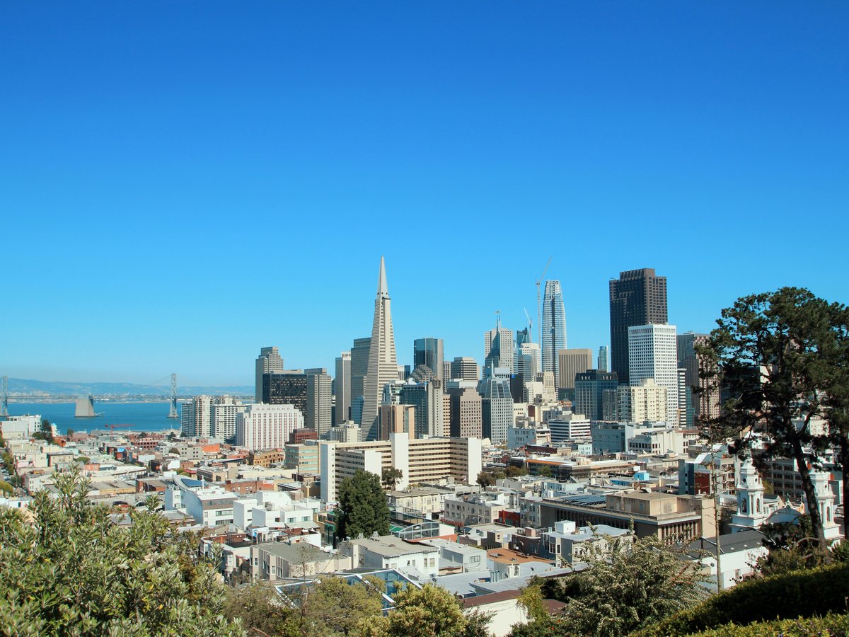
San Francisco sits on the tip of a 7-mile-wide peninsula, hemmed in by the Pacific Ocean to the west and San Francisco Bay to the east. The city covers about 47 square miles, and roughly 20% of that is parkland. Fog rolls through the Golden Gate most summer mornings, burning off by noon in the eastern neighborhoods while the Sunset District stays socked in until 2 or 3 PM. That marine layer keeps temperatures between 50 and 65°F for much of June through August, which means September and October are the warmest, clearest months for outdoor activity. You'll want layers no matter the season. The terrain is famously hilly, with over 50 named hills, and the highest point, Mount Davidson, tops out at 928 feet. Wind is a constant companion, particularly along the coast and up on Twin Peaks. To be fair, the city's compact size works in your favor. You can be on a coastal trail in the morning, paddle the bay at lunch, and hike through old-growth redwoods by mid-afternoon with a 30-minute drive south.
Outdoor activities
-
Road cycling across the Golden Gate Bridge to Marin
The classic San Francisco ride starts near Fisherman's Wharf, crosses the 1.7-mile Golden Gate Bridge on the west sidewalk (weekdays) or east sidewalk (weekends), and descends into Sausalito. From there, most riders continue north along Bridgeway to Mill Valley, or loop back via the Sausalito ferry ($14.50 one-way for bike and rider on Golden Gate Ferry as of 2025). The bridge sidewalk tends to get crowded on weekends by 11 AM, so an early start helps. Wind gusts on the bridge can reach 25 mph, and the fog makes the deck slippery. Worth noting, the return climb on the Marin side has a 5% grade that catches people off guard.
- Difficulty
- Moderate
- Duration
- 2-4 hours round trip depending on route
- Best season
- September through November, when fog is less frequent and winds tend to be calmer
-
Rock climbing at Glen Canyon Park
Glen Canyon sits in the geographic center of San Francisco, between Glen Park and Diamond Heights. The crags along Islais Creek offer about a dozen bouldering problems in the V0 to V4 range on chert and sandstone. The rock can be crumbly in places, so you'll want to test holds before committing. The canyon floor smells of eucalyptus and damp earth, and you might hear red-tailed hawks overhead. It's a low-key spot, mostly used by locals warming up for weekend trips to Castle Rock or Mickey's Beach. The park is free and open daily.
- Difficulty
- Easy to moderate bouldering (V0-V4)
- Duration
- 1-3 hours
- Best season
- Year-round, though the rock is best when dry, typically April through October
-
Mountain biking in the Marin Headlands
The Marin Headlands, part of the Golden Gate National Recreation Area, sit directly across the bridge and offer over 60 miles of fire roads and singletrack. The Coastal Trail from Tennessee Valley to Muir Beach covers about 3.5 miles of rolling terrain with ocean views down to the left. Marincello Trail climbs 800 feet over 3 miles from Tennessee Valley up to the ridge. The dirt gets slick after rain, and the descents on Old Springs Trail are rutted enough to rattle your teeth. You can smell the sage and coyote brush on the warm south-facing slopes. Mountain bikes are restricted to fire roads in many areas, so check the GGNRA map before heading out.
- Difficulty
- Moderate to strenuous depending on route
- Duration
- 2-5 hours
- Best season
- Late spring through early fall, May to October, when trails are dry
-
Surfing at Ocean Beach
Ocean Beach runs 3.5 miles along San Francisco's western edge, from the Cliff House south to Fort Funston. The waves here are powerful and inconsistent, with strong rip currents and cold water that hovers around 50-55°F year-round. You'll need a 4/3mm wetsuit minimum, and many locals wear 5/4mm with booties. The beach break shifts constantly, and the paddle-out can be punishing on bigger days. The south end near Sloat Boulevard tends to be more manageable for intermediate surfers. This is not a beginner wave. Stinson Beach, 30 minutes north, offers gentler conditions for learning. Ocean Beach picks up the biggest swells from October through March, when overhead days are common.
- Difficulty
- Advanced (strong currents, cold water, powerful shore break)
- Duration
- 2-3 hour sessions typical
- Best season
- October through March for consistent swell, though rideable waves appear year-round
-
Trail running in the Presidio
The Presidio covers 1,491 acres on the city's northern tip, with over 24 miles of trails through eucalyptus groves, coastal bluffs, and former military installations. The Batteries to Bluffs Trail drops steeply from the coastal road down to Marshall's Beach, where the sand is coarse and the Golden Gate Bridge towers directly above. A popular 5-mile loop connects Lovers' Lane (the oldest footpath in San Francisco, dating to 1862), the Ecology Trail, and the Bay Area Ridge Trail segment along the ridge. The footing is mostly packed dirt and decomposed granite, though the Lobos Creek section gets muddy after storms. You'll hear foghorns on overcast mornings.
- Difficulty
- Easy to moderate, with some steep sections on the bluff trails
- Duration
- 45 minutes to 2 hours depending on distance
- Best season
- Year-round, with September and October offering the clearest skies
-
Hang gliding at Fort Funston
Fort Funston, perched on 200-foot bluffs at the city's southwest corner, is one of the most reliable hang gliding and paragliding sites on the West Coast. The prevailing northwest winds hit the cliff face and create consistent ridge lift. The Fort Funston Hang Gliding Club has been active here since the 1970s. Tandem flights with certified instructors run around $200-250 for a 15-20 minute flight. The launch area sits above a sandy beach where leashed dogs run and the wind carries the smell of salt and ice plant. Spectators gather on the observation deck near the parking lot off Skyline Boulevard.
- Difficulty
- Tandem flights require no experience; solo flying requires USHPA certification
- Duration
- 15-20 minutes per flight; allow 2 hours total with setup and briefing
- Best season
- March through October, when northwest winds are most consistent
Day hikes
-
Tennessee Valley Trail to Tennessee Beach
This 3.4-mile out-and-back trail in the Marin Headlands starts from the Tennessee Valley parking lot, about 20 minutes north of the Golden Gate Bridge. The path follows a wide, flat fire road through a valley framed by coastal hills, then drops to a dark-sand cove flanked by 100-foot cliffs. The beach itself is small and the water is cold, around 52°F. Sneaker waves are a real hazard here, so stay well back from the waterline. The hike is flat enough for small children, though the last quarter mile to the beach has a mild descent. You'll hear red-winged blackbirds in the willows along the creek. The parking lot fills by 10 AM on weekends from April through October.
- Difficulty
- Easy (minimal elevation gain, about 100 feet total)
- Duration
- 1.5-2 hours round trip
- Best season
- Year-round, though trails can be muddy December through March
-
Dipsea Trail from Stinson Beach to Mill Valley
The Dipsea is the oldest trail race in the United States, first run in 1905. The full trail covers 7.4 miles from downtown Mill Valley to Stinson Beach, dropping and climbing through Muir Woods and over rolling grassland ridges. Most hikers start from the Stinson Beach end and arrange a car shuttle or take the West Marin Stagecoach bus back. The climb out of Stinson gains about 1,400 feet over 2.5 miles, with sections of exposed switchbacks on the Steep Ravine side. The trail passes through dense redwood forest where the air cools 10 degrees and the light goes dim. You'll smell bay laurel leaves if you brush past them. The famous Dipsea Steps in Mill Valley, 688 stairs total, are the steepest section.
- Difficulty
- Strenuous (1,400+ feet elevation gain, uneven terrain, exposed sections)
- Duration
- 4-5 hours one way
- Best season
- April through November, with September and October being the warmest and driest
-
Lands End Coastal Trail
This 3.4-mile trail stays entirely within San Francisco city limits, following the rocky northwest shoreline from the Sutro Baths to Eagle's Point near the Golden Gate Bridge. The path is mostly flat with a few short, rooty sections. You'll pass through stands of Monterey cypress that frame views of the Marin Headlands across the water. At low tide, the rusted ribs of old shipwrecks poke out of the rocks below. The trail can be slippery when fog drips off the trees, and a few sections have eroded cliff edges with drop-offs. Mile Rock Beach, accessible via a steep side trail, is a pocket cove where harbor seals haul out in winter.
- Difficulty
- Easy to moderate (mostly flat, some uneven terrain and short steep sections)
- Duration
- 1.5-2.5 hours
- Best season
- Year-round, with the best visibility September through November
-
Mount Tamalpais via Steep Ravine to East Peak
Mount Tamalpais stands 2,571 feet above the bay, about 45 minutes north of San Francisco by car. The Steep Ravine Trail starts at the Pantoll Ranger Station and descends through a redwood canyon with a wooden ladder bolted to a rock face. Most hikers combine it with the Matt Davis Trail for a 7.2-mile loop that traverses open grassland ridges with views of the Pacific, Stinson Beach, and Point Reyes. The East Peak summit, accessible by a separate 0.4-mile paved path from the parking lot, has a fire lookout and a view that extends to the Sierra Nevada on exceptionally clear days. The temperature on the ridgeline can be 15 degrees warmer than the canyon floor. Parking at Pantoll costs $8 per vehicle.
- Difficulty
- Strenuous (1,500+ feet elevation gain on the full loop, wooden ladder section, uneven footing)
- Duration
- 4-6 hours for the full Steep Ravine/Matt Davis loop
- Best season
- Late April through October, with wildflowers peaking in May
-
Muir Woods to Muir Beach via the Coastal Trail
This 5.5-mile point-to-point hike starts at the Muir Woods National Monument entrance and climbs out of the redwood canyon via the Ben Johnson Trail, gaining about 900 feet to the Coastal Trail junction. From there, you descend through chaparral and grassland to Muir Beach, a quiet cove with coarse sand and a creek outlet. The redwood section at the start is dark and cool, with ferns thick along the creek. The coastal section opens up to Pacific views and dry grass that turns golden by July. Muir Woods requires a parking reservation ($9 per vehicle, book at recreation.gov), though you can avoid this by taking the Marin Transit Route 66 shuttle on weekends from the Sausalito ferry terminal.
- Difficulty
- Moderate (900 feet of climbing, mostly on well-maintained trail)
- Duration
- 3-4 hours one way
- Best season
- Year-round for the redwoods; April through October for the coastal section
-
Point Reyes, Tomales Point Trail
Tomales Point sits at the northernmost tip of the Point Reyes peninsula, about 1.5 hours north of San Francisco. The trail runs 9.4 miles round trip through open grassland along a narrow ridge between Tomales Bay and the Pacific. Tule elk herds graze along the route. At one point the peninsula narrows to maybe 200 yards wide, with water visible on both sides. The trail is mostly flat to gently rolling, but there is no shade and no water, and the wind can be fierce. On a clear afternoon the views stretch north to Bodega Bay. The trailhead is at the Pierce Point Ranch, a preserved 1850s dairy ranch with whitewashed buildings still standing.
- Difficulty
- Moderate (flat but long, no shade, exposed to wind)
- Duration
- 4-5 hours round trip
- Best season
- September through November for warmth and elk rutting season; wildflowers peak in April and May
Water activities
-
Kayaking in Richardson Bay and Sausalito
Richardson Bay, on the sheltered side of the Marin Headlands, offers the calmest paddling water near San Francisco. Sea Trek in Sausalito rents single kayaks starting around $30/hour and runs guided full-moon paddles for about $85 per person. The bay is shallow, rarely more than 10 feet deep at high tide, and harbor seals lounge on the houseboats near Gate 5 Road. Morning paddles before 10 AM tend to have the flattest water, before the afternoon westerly fills in. You'll see egrets in the mudflats at low tide and the Sausalito waterfront looks like a Mediterranean hillside from the water.
- Difficulty
- Easy (sheltered water, minimal current in the bay proper)
- Duration
- 1.5-3 hours
- Best season
- April through October, mornings before the wind builds
-
SUP and kayaking at McCovey Cove and Mission Creek
Mission Creek Channel, running behind Oracle Park in the Mission Bay neighborhood, is a flat-water canal sheltered from the bay's wind and current. City Kayak, based at South Beach Harbor near Pier 40, rents kayaks and stand-up paddleboards starting around $35/hour. On game days, kayakers and SUP riders gather in McCovey Cove beyond the right-field wall hoping for home run balls. That said, the cove gets choppy when ferries pass. The creek itself is calm and narrow, lined with houseboats and new apartment buildings. Water quality has improved since the 2012 restoration, but you still probably want to avoid a full submersion.
- Difficulty
- Easy (flat water, sheltered from open bay conditions)
- Duration
- 1-2 hours
- Best season
- Year-round, though summer and early fall have the warmest air temperatures
-
Open-water swimming at Aquatic Park
Aquatic Park, at the foot of Van Ness Avenue near Ghirardelli Square, is the hub of San Francisco's open-water swimming community. The curved municipal pier creates a small, semi-protected cove about 400 yards across. Water temperature ranges from 50°F in winter to maybe 62°F in September. The Dolphin Club and South End Rowing Club, both founded in the 1870s, share a building on the beach and welcome day-use swimmers. Most swimmers wear neoprene, though the club old-timers go without. The bottom is sandy and visibility is poor, maybe 3-4 feet on a good day. You'll taste salt and feel the tidal pull near the opening between the piers. Lifeguards are not on duty, so swimming is at your own risk.
- Difficulty
- Moderate to advanced (cold water, no lifeguards, tidal currents near the pier opening)
- Duration
- 30 minutes to 1.5 hours depending on cold tolerance
- Best season
- September and October for the warmest water; year-round for club swimmers
-
Sailing on San Francisco Bay
San Francisco Bay is one of the windiest urban sailing venues in the world. The slot effect through the Golden Gate accelerates westerly winds to 20-30 knots on summer afternoons. OCSC Sailing in Berkeley offers introductory lessons starting at about $99, and skippered charter boats out of San Francisco Yacht Club or South Beach Harbor run $400-800 for a 3-hour outing. The flood tide pushes northeast and the ebb pulls toward the Golden Gate, with currents reaching 4-5 knots near Alcatraz. You'll feel the temperature drop as you pass under the bridge. Even in August, spray over the bow is cold enough to make you flinch.
- Difficulty
- Varies. Crewed charters require no experience. Independent sailing demands strong skills due to current, wind, and commercial traffic.
- Duration
- 2-4 hours for a typical outing
- Best season
- May through September for the strongest and most reliable afternoon winds; October for lighter winds and warmer air
-
Swimming and wading at Stinson Beach
Stinson Beach, 30 minutes north over Mount Tamalpais, is the closest thing to a warm-water swim beach in the San Francisco area. The water still only reaches about 58-62°F in late summer, but the beach faces south and the sand warms up nicely on clear days. The beach stretches about 3.5 miles, with the national park section near the village being the most popular. Lifeguards are on duty from late May through mid-September, weekends and holidays. Great white sharks have been spotted in the Red Triangle offshore, though attacks at Stinson are rare. The Parkside Cafe, a 2-minute walk from the sand, serves fish tacos for around $18 and local Lagunitas IPA on draft.
- Difficulty
- Easy for wading and calm-day swimming; moderate if swimming past the breakers
- Duration
- Half-day trip including the 45-minute drive each way
- Best season
- July through October, when fog is least likely to obscure the sun
Parks & gardens
-
Golden Gate Park
FreeGolden Gate Park stretches 3 miles from the Haight-Ashbury neighborhood to Ocean Beach, covering 1,017 acres. That makes it about 20% larger than Central Park in New York. The western half feels wilder, with sand dunes stabilized by Monterey cypress and a chain of small lakes. The eastern end is more manicured, with formal gardens, museums, and the 7.5-acre Stow Lake. On Sundays, JFK Drive is still closed to cars, and you'll find roller skaters near 6th Avenue and pickup soccer games on the polo fields. The park smells different depending on where you are. Near the Conservatory of Flowers it's humid and floral. Out by the bison paddock, about a mile west, it's grass and eucalyptus.
Highlights: The Conservatory of Flowers (1879, the oldest wood-and-glass conservatory in North America), the 55-acre Strybing Arboretum with over 8,000 plant species, Stow Lake with pedal boat rentals for $28-34/hour, and the herd of bison that has lived in the park since 1891
-
The Presidio
FreeA former U.S. Army post turned national park site, the Presidio sits on 1,491 acres at the base of the Golden Gate Bridge. The forest here was planted by the Army beginning in the 1880s, mostly eucalyptus, Monterey pine, and Monterey cypress, now totaling roughly 300,000 trees. Andy Goldsworthy's four permanent art installations are scattered through the woods, including Spire, a 90-foot tower of Monterey cypress trunks near the Arguello Gate entrance. The Officers' Club, built over adobe walls from the original 1776 Spanish presidio, currently houses exhibits on the site's history. Crissy Field, the restored tidal marsh along the bay, draws shorebirds and kite-flyers, and the wind there is relentless.
Highlights: Crissy Field's restored marsh and beach, Batteries to Bluffs Trail, Andy Goldsworthy's Spire and Wood Line sculptures, and the Walt Disney Family Museum ($25 adult admission)
-
San Francisco Botanical Garden
Located inside Golden Gate Park at 9th Avenue and Lincoln Way, this 55-acre garden holds over 8,000 plant varieties from around the world. The Redwood Grove, planted in the 1930s, feels like a different climate zone. The air is cool and damp, the light filters green through the canopy, and the ground is soft with duff. The Mesoamerican Cloud Forest section uses misters to simulate highland tropical conditions, and on warm days you can feel the humidity shift as you walk from one garden to the next. San Francisco residents get in free with proof of address. Non-residents pay $13.
Highlights: The Ancient Plant Garden with species dating to the Jurassic era, the Succulent Garden, the California Native Plants section with 30+ local wildflower species, and the Moon Viewing Garden designed in the Japanese stroll-garden tradition
-
Lands End
FreeLands End occupies the northwest corner of San Francisco, a rocky, wind-scoured stretch of coastline between the Cliff House and the Golden Gate Bridge. The 3.4-mile Coastal Trail runs along eroded bluffs above the remnants of three shipwrecks visible at low tide (the Ohioan, the Lyman Stewart, and the Frank Buck). The Sutro Baths ruins sit at the western end, concrete pools built in 1896 that could hold 10,000 swimmers at once. Now they're a roofless shell that fills with seawater at high tide. You might spot harbor seals on Mile Rock Beach, a scramble down a steep unofficial trail. Cypress trees lean sideways from decades of coastal wind.
Highlights: The Sutro Baths ruins, the Lands End Labyrinth (a rock spiral on a bluff near the 32nd Avenue trailhead), views of the Marin Headlands and Golden Gate Bridge, and the shipwreck remnants visible at minus tides
-
Twin Peaks
FreeTwin Peaks, at 922 feet elevation, provides a 360-degree view of the entire San Francisco Bay Area. The two summits (Eureka Peak and Noe Peak) sit about 200 yards apart, connected by a paved loop road and a few dirt paths. The 64-acre natural area is one of the last remaining patches of native coastal grassland in the city. On clear days, you can pick out Mount Diablo 30 miles to the east, Mount Tamalpais to the north, and the Farallon Islands 27 miles offshore. Mind you, those clear days are somewhat rare in summer. The best visibility tends to come September through November. The parking lot fills up fast on weekends, but the 44-O'Shaughnessy bus stops within walking distance.
Highlights: Unobstructed 360-degree panorama, remnant native grassland with mission blue butterfly habitat, the Christmas Tree Point overlook, and night views of the city grid below
-
Buena Vista Park
FreeSan Francisco's oldest park, established in 1867, covers 36 acres on a steep hill between Haight-Ashbury and the Castro. The summit sits at 569 feet, and the paths to the top are genuinely steep, with crumbling stone steps and tree roots crossing the trail. Old Monterey cypress trees, some over 100 years old, create a dark canopy that blocks most of the light in the upper sections. The bark smells resinous in the afternoon heat. From the top, you can see downtown, the Bay Bridge, and across to Oakland. It's a quieter alternative to Dolores Park, which gets packed on sunny weekends.
Highlights: Historic WPA-era stone gutters and stairways from the 1930s, century-old Monterey cypress grove, views of downtown and the Bay Bridge from the summit, and relatively uncrowded trails even on weekends
Practical tips
- Layering system
- San Francisco's microclimates can shift 15°F within a few miles. Carry a wind-resistant outer layer even on sunny mornings. The Richmond and Sunset districts run 8-10°F cooler than the Mission on any given day. A merino wool base layer and a packable shell handle most conditions. Cotton gets cold fast in fog.
- Sun protection
- The fog tricks people. UV penetrates the marine layer, and you can burn on an overcast day at Ocean Beach or on a ridge in the Marin Headlands. Apply SPF 30+ before heading out, particularly from April through October. The reflection off water and sand on bay kayak trips doubles your exposure. Sunglasses with polarized lenses cut the glare on the water significantly.
- Water and hydration
- Tap water in San Francisco comes from the Hetch Hetchy reservoir in Yosemite and tastes clean. Fill bottles before you go. Most Marin County trailheads (Tennessee Valley, Pantoll, Stinson Beach) have water fountains near the parking lots. Point Reyes trails and the Tomales Point Trail have no water sources at all, so carry at least 2 liters per person for any hike over 5 miles.
- Trail conditions and footwear
- Trails in the Marin Headlands and on Mount Tamalpais get muddy from November through March. Waterproof hiking shoes with good tread make a real difference on the Steep Ravine Trail and the Dipsea stairs. City trails like Lands End and the Presidio are manageable in trail runners year-round. Watch for poison oak on any trail below 1,500 feet in Marin County. It grows thick along Tennessee Valley and the Coastal Trail.
- Parking and transit
- Muir Woods requires advance parking reservations ($9/vehicle) at recreation.gov, especially on weekends from May through October when slots fill weeks ahead. The Route 66 weekend shuttle from Sausalito eliminates the problem entirely. Tennessee Valley's lot holds about 75 cars and fills by 10 AM on sunny weekends. Muni bus lines reach Lands End (line 38 to the Legion of Honor), the Presidio (line 28), and Ocean Beach (N-Judah to the end of the line).
- Ocean safety
- Ocean Beach has some of the strongest rip currents on the California coast. The San Francisco Fire Department responds to dozens of water rescues there each year. Never turn your back on the waves, and stay well above the high-tide line. Swimming at Ocean Beach is for experienced open-water swimmers only. For safer ocean swimming, Aquatic Park or Stinson Beach with lifeguards on duty are far better choices.
FAQ
What is the best time of year for outdoor activities in San Francisco?
September and October are consistently the warmest and clearest months. Summer fog blankets the coast from June through August, keeping temperatures in the low 60s on the western side of the city. The locals call September through mid-November 'Indian summer' or simply the real summer. Water temperatures in the bay peak in September at around 60-62°F. Wildflower season on the Marin trails runs from late March through May.
Do I need a wetsuit for water activities in San Francisco Bay?
For anything beyond a quick dip, yes. Bay water stays between 50 and 62°F year-round. A 3/2mm wetsuit works for summer kayaking and SUP if you plan to get wet. For surfing at Ocean Beach, most people wear a 4/3mm or 5/4mm with booties. The Dolphin Club swimmers at Aquatic Park go without wetsuits, but they train for cold exposure over months. If you're visiting and want to swim, a wetsuit rental from a shop like Wise Surfboards on Irving Street runs about $15-25 per day.
Are there any permits needed for hiking near San Francisco?
Most trails in the Marin Headlands, Presidio, and Lands End are free and require no permits. Muir Woods National Monument requires a parking reservation ($9 per vehicle) booked in advance through recreation.gov. Point Reyes camping requires a backcountry permit from the Bear Valley Visitor Center. No permits are needed for day hiking at Point Reyes, Stinson Beach, or Mount Tamalpais, though parking at Pantoll Ranger Station costs $8.
Is it safe to swim at Ocean Beach?
Ocean Beach is not safe for casual swimming. Strong rip currents, sneaker waves, and water temperatures around 52-55°F make it one of the more dangerous urban beaches in California. There are no lifeguards. The San Francisco Fire Department advises against swimming there. If you want an ocean swim near the city, Stinson Beach has lifeguards from late May through mid-September, and Aquatic Park offers a semi-protected cove for experienced open-water swimmers.
Can I rent outdoor gear in San Francisco without bringing my own?
San Francisco has solid gear rental options. Sports Basement on Bryant Street and at the Presidio rents camping gear, bikes, and ski equipment at reasonable rates. Sea Trek in Sausalito and City Kayak at South Beach Harbor rent kayaks and SUP boards. Blazing Saddles near Fisherman's Wharf rents road and hybrid bikes starting around $32/day for the Golden Gate Bridge ride. Wise Surfboards on Irving Street near Ocean Beach rents surfboards and wetsuits.
How do I get to trailheads without a car from San Francisco?
The Golden Gate Transit bus system runs from downtown San Francisco to Marin County. Route 130 stops at the Sausalito ferry terminal, and from there the Marin Transit Route 66 weekend shuttle reaches Muir Woods. The Golden Gate Ferry from the Ferry Building to Sausalito ($14.50 with a bike) connects to cycling routes in Marin. Within the city, Muni bus 38 reaches the Lands End trailhead, the N-Judah streetcar ends at Ocean Beach, and line 28 serves the Presidio. For Stinson Beach and Point Reyes, West Marin Stagecoach Route 61 runs on weekends from the Sausalito terminal.
Outdoor experiences in San Francisco
 Free cancellation
 Yosemite and Giant Sequoias Day Tour from San Francisco w Pickup
Outdoor experience: 15 hours, free cancellation.
via Viator Free cancellation
 Painted Ladies San Francisco City Tour
Outdoor experience: 2 hours, free cancellation.
via Viator Free cancellation
 GoCar San Francisco Tour
Outdoor experience: 5 hours, free cancellation.
via Viator Free cancellation
 Golden Gate Bridge Guided E-Bike Tour to Sausalito
Outdoor experience: 3 hours, free cancellation.
via Viator Free cancellation
 Yosemite Day Tour from San Francisco
Outdoor experience: 15 hours, free cancellation.
via Viator
Yosemite National Park 2-Day Tour from San Francisco with Lodging
Outdoor experience: 2 days.
via Viator Free cancellation
 Painted Ladies Wine Country Tour
Outdoor experience: free cancellation.
via Viator
Alcatraz Inside tour with Round trip ferry & Audio App Packages
Outdoor experience.
via Viator Free cancellation
 San Francisco Golden Gate Bridge & Presidio E-Bike Tour — Max 9
Outdoor experience: 3.5 hours, free cancellation.
via Viator Free cancellation
 San Francisco Golden Gate Seaplane Tour
Outdoor experience: 30 minutes, free cancellation.
via Viator Free cancellation
 3HR Golden Gate Bridge and Golden Gate Park GoCar Tour
Outdoor experience: 3 hours, free cancellation.
via Viator Free cancellation
 Private San Francisco City Tour by Open-Air Jeep (Max 6)
Outdoor experience: 2 hours, free cancellation.
via ViatorLast verified by automated review (v1.7.2) on . What is automated review?