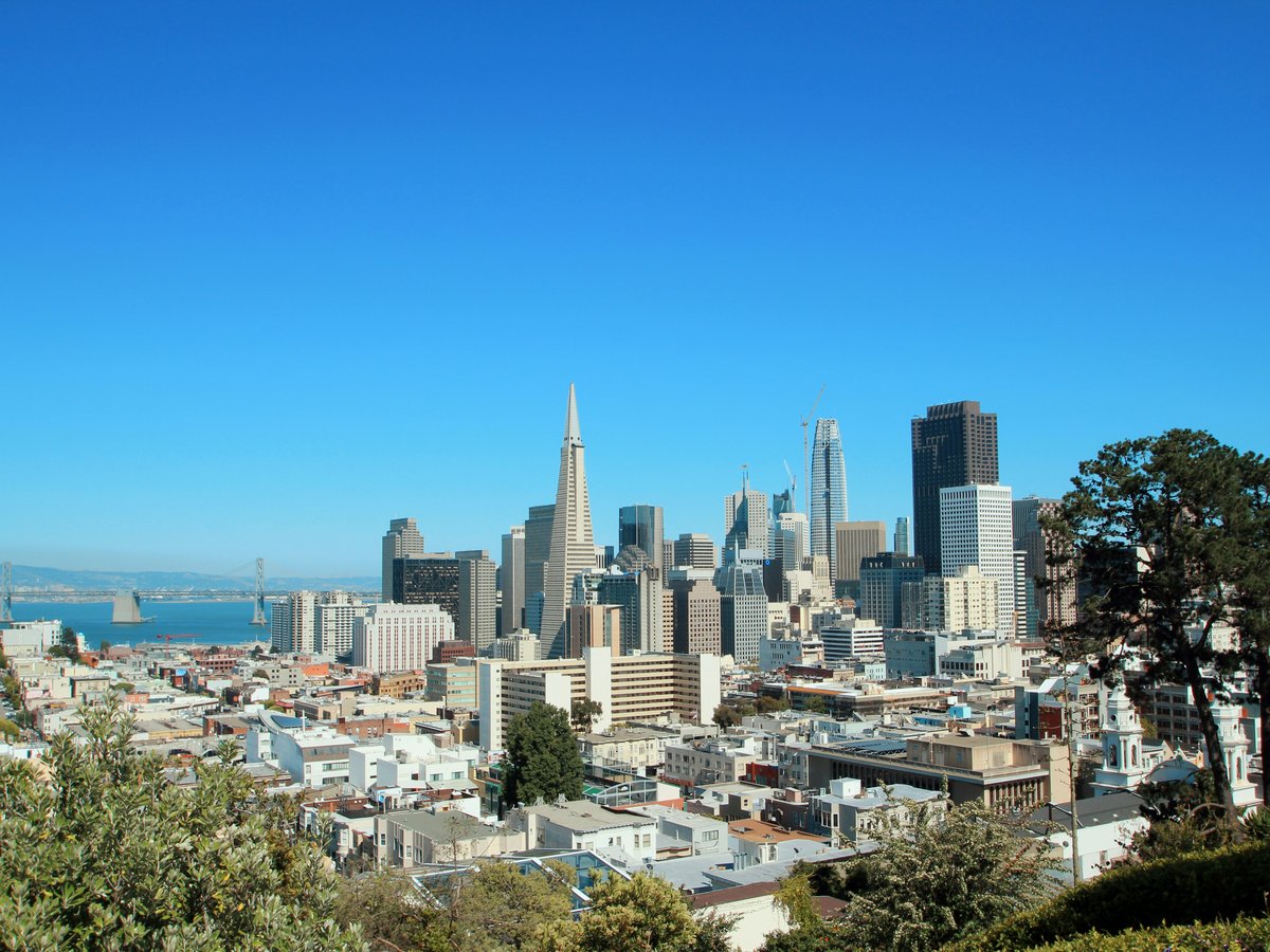
San Francisco fits 49 square miles into the tip of a peninsula, and the whole city is maybe 7 miles across at its widest. That compressed geography means neighborhoods stack against each other with little transition. You can walk from the financial towers of the FiDi into the narrow alleys of Chinatown in about 4 minutes. The city runs on a loose east-west logic. The eastern waterfront neighborhoods tend to be flatter and more commercial. Head west and the terrain gets hillier, more residential, foggier. The famous fog usually rolls in from the Pacific through the Sunset and Richmond districts and stops somewhere around Twin Peaks, which sits at roughly 922 feet and acts as a weather wall. South of Market (SoMa) and the Mission occupy the city's sunniest corridor, a microclimate phenomenon that still surprises newcomers. Public transit via BART and Muni covers most of the city, though the hills make walking between certain neighborhoods a genuine cardio event. One thing worth knowing from the start. San Francisco neighborhoods have hard identities. People here will correct you if you call the Inner Richmond the Outer Richmond. That specificity matters, and it shapes where you should stay.
Neighborhoods
-
The Mission
The Mission District runs along Mission Street and Valencia Street from roughly 14th Street down to Cesar Chavez. It has the warmest weather in the city thanks to its position in the fog shadow east of Twin Peaks. The architecture is mostly Victorians and Edwardians with flat commercial storefronts, many of them painted in bright colors. The pace here stays busy from morning until well past midnight. You'll hear Spanish and English in equal measure at the taquerias along 24th Street, and bass from someone's car stereo seems to be a permanent feature of the soundscape. The smell of roasting chiles and fresh tortillas drifts from La Palma Mexicatessen on 24th near Florida Street, where they've been making masa by hand since 1953. Murals cover full building facades in Balmy Alley and along Clarion Alley, some dating back to the 1970s Chicano art movement.
- Best for
- Younger travelers, food-obsessed visitors, anyone who wants walkable nightlife and does not mind a bit of noise after 10pm
- Key streets
- Valencia Street between 16th and 24th for restaurants and bars. 24th Street between Mission and Potrero for the older Latino commercial corridor. Balmy Alley near 24th and Treat for the mural walk. 18th and Mission is the main BART station intersection.
-
North Beach
North Beach sits between Telegraph Hill and Russian Hill, centered on Columbus Avenue and its old-school Italian-American commercial strip. The neighborhood still smells like garlic and espresso in the mornings, especially near the intersection of Columbus and Vallejo where Caffe Trieste has been pulling shots since 1956. The architecture leans toward 3-story apartment buildings with ground-floor storefronts, many with Italian-language signs that have hung for decades even as the demographics have shifted. It is louder than you might expect. Columbus and Broadway traffic runs constantly, and the Broadway strip between Columbus and Montgomery still has a few legacy strip clubs alongside newer restaurants. The pace feels distinctly mid-20th century. Old men read newspapers at cafe tables. The sounds of someone practicing piano drift from an upstairs window. Then you turn a corner onto Broadway and it is neon and bar noise.
- Best for
- Couples, literary types, anyone who likes walkable restaurants and cafe culture with proximity to Fisherman's Wharf without staying in Fisherman's Wharf
- Key streets
- Columbus Avenue from Broadway north to Filbert for the main Italian corridor. Grant Avenue between Columbus and Filbert feels more local and less performative. Vallejo Street steps heading up toward Telegraph Hill for one of the best walks in the city. Broadway between Columbus and Montgomery for the old nightlife strip.
-
Chinatown
San Francisco's Chinatown is the oldest in North America, established in the 1840s, and it is still one of the most densely populated neighborhoods in the city. Grant Avenue is the tourist-facing corridor with the pagoda-style lampposts and souvenir shops. Stockton Street, one block west, is where residents shop. On a Saturday morning, Stockton between Clay and Broadway is shoulder-to-shoulder with people buying live fish, bok choy, and roast ducks hanging in shop windows. The air is thick with the smell of soy-braised meats and incense from the temples. Buildings are packed tight, mostly 3 to 5 stories, many with the ornamental balconies added during the 1906 post-earthquake rebuild. Noise-wise, it is constant. Deliveries in narrow alleys, Cantonese being spoken at volume, the clatter of dim sum carts.
- Best for
- Food travelers willing to explore beyond Grant Avenue, history-focused visitors, anyone comfortable with density and sensory overload who wants a central location near Union Square and North Beach
- Key streets
- Stockton Street between California and Broadway for the real commercial heart. Waverly Place, a narrow alley off Washington Street, for the temple balconies. Ross Alley for the old barbershops. Grant Avenue from Bush to Broadway if you want the tourist version first.
-
Hayes Valley
Hayes Valley sits in a compact rectangle roughly bounded by Market Street to the south, Gough to the east, Fulton to the north, and Webster to the west. It was transformed in the 1990s after the 1989 earthquake damaged the Central Freeway overpass that used to cut through the area. The freeway came down, Patricia's Green went up (a small park on Octavia between Hayes and Fell), and the neighborhood shifted from overlooked to design-conscious. The buildings are mostly Victorians, but the storefronts house independent boutiques, wine bars, and small-batch everything. The pace is weekend-brunch slow even on weekdays. Foot traffic clusters between Laguna and Gough on Hayes Street, maybe a 4-block stretch. It smells like coffee and fresh bread most mornings, with Smitten Ice Cream's liquid nitrogen process sometimes creating a visible plume near Octavia.
- Best for
- Design-minded travelers, boutique shoppers, people who want a walkable base near both Civic Center BART and the Lower Haight without the volume of Union Square
- Key streets
- Hayes Street between Laguna and Gough is the main commercial strip. Octavia Boulevard (the street that replaced the freeway) for Patricia's Green. Linden Street, a narrow alley parallel to Hayes, has a few quieter bars and the entrance to some popular spots like Biergarten.
-
The Haight (Haight-Ashbury and Lower Haight)
Haight-Ashbury, the Upper Haight, runs along Haight Street from Masonic to Stanyan, right at the eastern entrance to Golden Gate Park. The Summer of Love happened here in 1967, and the neighborhood still trades on that history. Vintage clothing stores, record shops, and the smell of incense from storefronts are constant. The architecture is some of the city's best-preserved Victorian, with painted ladies and Queen Annes lining the side streets. The Lower Haight, from Divisadero to Webster, has a different feel entirely. It is grittier, less curated, with more bars and a younger, more local crowd. The Toronado on 547 Haight Street in the Lower Haight has been a serious beer bar since 1987, with around 50 taps and zero pretense. The whole corridor tends to be noisy from foot traffic and street musicians, especially on weekends.
- Best for
- Music fans, vintage shoppers, visitors who want to be close to Golden Gate Park on foot, younger travelers who prefer neighborhood bars over cocktail lounges
- Key streets
- Haight Street from Masonic to Stanyan for the Upper Haight commercial strip. Haight Street from Divisadero to Webster for the Lower Haight. Ashbury Street at Haight for the iconic intersection. Cole Street between Carl and Parnassus for a quieter block of restaurants a few minutes south in Cole Valley.
-
Pacific Heights and Japantown
Pacific Heights runs along the ridge between Van Ness and the Presidio, with some of the city's most expensive real estate and widest views of the Bay. The architecture is grand. Mansions from the early 1900s line Broadway and Pacific Avenue between Divisadero and Lyon. The streets are quiet, almost suburban in their stillness, which is disorienting when you are technically 15 minutes from downtown. Fillmore Street from Jackson to Bush is the main commercial corridor, with upscale restaurants and boutiques. Japantown, centered on the Japan Center mall at Post and Buchanan, sits at the southern edge of this area. It is one of only 3 remaining Japantowns in the US. The Peace Pagoda, designed by Yoshiro Taniguchi and dedicated in 1968, anchors the plaza. Inside the mall, the acoustics shift entirely. It is hushed, with the sound of a waterfall feature and Japanese pop playing from the shops.
- Best for
- Families who want quiet streets and space, visitors interested in Japanese culture and food, anyone willing to trade nightlife proximity for architecture and views
- Key streets
- Fillmore Street from Jackson to Bush for dining and shopping. Buchanan Street at Post for the Japan Center. Broadway between Divisadero and Lyon for mansion architecture. Lyon Street Steps between Broadway and Green for a staircase workout with panoramic Bay views.
-
SoMa (South of Market)
SoMa is the city's largest neighborhood by area, stretching from Market Street south to roughly Mariposa and from the Embarcadero west to Division Street. It is also the hardest to generalize about. The blocks around the Moscone Center and Yerba Buena Gardens feel corporate and convention-oriented. The stretch near 6th and Mission has historically been one of the city's rougher corridors. East of 2nd Street toward the waterfront, tech company offices and newer condo towers dominate. SFMOMA at 151 3rd Street reopened its expansion in 2016 with 170,000 square feet of gallery space. The Oracle Park area near 3rd and King is lively on Giants game days and quiet otherwise. The textures vary block by block. One street is glass and steel, the next is a loading dock with a hand-painted mural. It smells like exhaust on the main avenues and coffee roasting near Blue Bottle's old SoMa roastery.
- Best for
- Museum visitors, conference attendees, sports fans staying near Oracle Park, travelers who prioritize transit access (Caltrain, BART, Muni all converge here)
- Key streets
- 3rd Street between Market and King for the SFMOMA and Yerba Buena corridor. The Embarcadero from the Ferry Building south to AT&T (now Oracle) Park. Howard Street between 2nd and 6th for a cross-section of the neighborhood's range. Folsom Street between 7th and 12th for galleries and nightlife.
-
The Richmond (Inner and Outer)
The Richmond District stretches from Arguello Boulevard west to the ocean, with Golden Gate Park as its southern boundary and the Presidio to the north. It is flat, foggy, and residential. The Inner Richmond, roughly from Arguello to Park Presidio Boulevard, has a dense restaurant scene along Clement Street that rivals the Mission for quality but gets a fraction of the press. Cantonese, Burmese, Russian, and Korean restaurants sit next to each other within a few blocks. The Outer Richmond pushes toward Ocean Beach, where the temperature drops noticeably and the Pacific wind is a constant presence. The houses are post-1906 stucco rows, many in pastel colors, stretched in long identical blocks. It is quiet at night. The fog here is not a metaphor. Summer evenings at Ocean Beach can sit at 52 degrees Fahrenheit while the Mission hits 75.
- Best for
- Food explorers who want to eat well without the Mission's crowds, families looking for a quieter residential feel, surfers and beach walkers heading to Ocean Beach, visitors who do not mind fog
- Key streets
- Clement Street from 2nd to 12th Avenue for restaurants and shops. Geary Boulevard runs parallel and has larger-format businesses and more Asian supermarkets. Balboa Street is even quieter. Point Lobos Avenue at the western edge leads to the Sutro Baths ruins and Lands End trails.
-
The Castro
The Castro, centered on Castro Street between Market and 19th, has been the heart of San Francisco's LGBTQ+ community since the 1970s. Harvey Milk's old camera shop at 575 Castro is now the Human Rights Campaign store. The Castro Theatre, a 1922 Spanish Colonial Revival movie palace at 429 Castro, is the neighborhood's architectural landmark, with an organ that still plays before screenings. The residential streets above the commercial core are steep and lined with meticulously maintained Victorians. The neighborhood feels settled and neighborhood-proud. Rainbow flags fly from lampposts and storefronts, and the crosswalks at Castro and 18th are painted in rainbow colors. The pace on weekends is slow and social, with brunch lines and dog walkers on the sidewalks.
- Best for
- LGBTQ+ travelers, history-minded visitors, anyone who wants a walkable neighborhood with strong community identity and good transit (the Castro Muni station connects to downtown in about 10 minutes)
- Key streets
- Castro Street between Market and 19th for the commercial heart. 18th Street between Castro and Sanchez for more restaurants. Market Street at Castro for the transit hub. Noe Street, one block west, for a quieter parallel street with its own cafes.
-
Nob Hill
Nob Hill sits at one of the city's highest points, centered on the intersection of California and Powell streets. This is where the cable cars climb, and the grip operators' shouts of 'hold on' are part of the ambient noise. The neighborhood is defined by its grand hotels and the Grace Cathedral at 1100 California Street, an Episcopal cathedral completed in 1964 with doors cast from Lorenzo Ghiberti's Gates of Paradise. The Fairmont, the Mark Hopkins, and the Huntington Hotel ring Huntington Park, a small manicured green space where residents walk small dogs and children play on the concrete structures. The architecture is a mix of old money apartment buildings, some dating to the 1910s, and more recent high-rises. The streets are steep enough that parked cars are legally required to curb their wheels. It is quiet after dark, especially compared to the neighborhoods immediately downhill.
- Best for
- Visitors who want a classic San Francisco hotel experience, architecture enthusiasts, anyone who does not mind hills and wants a central location within walking distance of Chinatown, Union Square, and the Financial District
- Key streets
- California Street from Powell to Jones for the cable car line and the big hotels. Powell Street for the cable car turnaround at Market. Jones Street heading north toward Russian Hill for steep residential beauty. Sacramento Street between Jones and Leavenworth for a quiet block of old apartment facades.
-
The Sunset (Inner and Outer)
The Sunset District mirrors the Richmond on the south side of Golden Gate Park, stretching from Stanyan west to Ocean Beach. It is the city's most residential neighborhood, with rows of nearly identical stucco houses from the 1930s and 1940s extending in long, fog-covered avenues. Irving Street in the Inner Sunset, particularly between 7th and 19th Avenues, has a strong food corridor with Thai, Chinese, Japanese, and Mexican spots packed tightly. The Outer Sunset is surfer territory, quieter, sandier, with the occasional wetsuit hanging over a porch railing. The temperature near Ocean Beach runs 8 to 12 degrees cooler than downtown on summer afternoons. The pace is slow. This is a neighborhood where people live, not where they go out. You might hear the foghorn from the Golden Gate at night, depending on the wind.
- Best for
- Budget-conscious visitors who prefer Airbnbs over hotels, surfers, anyone who wants proximity to Golden Gate Park without tourist density, families who like quiet evenings
- Key streets
- Irving Street between 7th and 19th Avenues for restaurants and cafes. Judah Street runs the N-Judah Muni line to downtown. Noriega Street in the mid-Sunset has a growing cluster of restaurants. The Great Highway (now partially closed to cars) at Ocean Beach for walking and cycling.
-
Fisherman's Wharf and the Embarcadero
Fisherman's Wharf runs along the northern waterfront from Pier 39 west to Ghirardelli Square. It smells like sourdough bread and crab, particularly near Boudin Bakery at 160 Jefferson Street, where they have been baking since 1849. Pier 39's sea lions, which arrived in 1990, bark constantly and the sound carries for blocks. To be fair, the Wharf is mostly a tourist district and locals will tell you they never go. That said, the Embarcadero running south from Fisherman's Wharf toward the Ferry Building is a different story. The Ferry Building Marketplace, reopened in 2003, hosts about 50 vendors selling everything from oysters to craft olive oil. Saturday mornings, the farmers market outside draws several thousand people, and the quality of the produce is genuinely high-end. The Embarcadero itself is a flat, palm-tree-lined waterfront walk with views of the Bay Bridge and Treasure Island.
- Best for
- First-time visitors who want proximity to Alcatraz ferries and Pier 39, families with young children who will enjoy the sea lions and the Musee Mecanique arcade, runners and walkers who want the Embarcadero waterfront path
- Key streets
- Jefferson Street between Taylor and Powell for Fisherman's Wharf proper. The Embarcadero from Pier 39 south to the Ferry Building, about a 25-minute walk. Leavenworth between Jefferson and Beach for the cable car turnaround. Ferry Building area, 1 Ferry Building, for the Saturday market.
FAQ
Which San Francisco neighborhood should I stay in for a first visit?
For a first visit, North Beach or Hayes Valley tends to work well. North Beach puts you within walking distance of Chinatown, the Embarcadero, and Fisherman's Wharf without staying in the tourist zone. Hayes Valley is more central, close to Civic Center BART, and walkable to the Mission in about 20 minutes. Both have enough restaurants and bars within a few blocks that you will not need to take a cab for dinner. Fisherman's Wharf is convenient for Pier 39 and Alcatraz but feels disconnected from the rest of the city after dark.
Is it true that San Francisco summers are cold and foggy?
Mark Twain likely never said the quote about the coldest winter being a summer in San Francisco, but the sentiment holds. July and August are the foggiest months, especially in the Sunset, Richmond, and along the western waterfront, where afternoon temperatures might sit at 55 degrees Fahrenheit. The Mission and SoMa are noticeably warmer, often reaching the mid-70s on the same day. September and October are the city's true summer, with warmer temperatures and clearer skies across most neighborhoods. Pack layers regardless of when you visit. A 20-degree temperature swing between neighborhoods on the same afternoon is normal.
How easy is it to get around San Francisco without a car?
Quite manageable for most visitors. BART connects SFO to downtown in about 30 minutes for $9.65 one way. Muni buses and the historic streetcars cover most neighborhoods, though service frequency varies. The F-Market streetcar runs vintage cars from the Castro to Fisherman's Wharf along Market Street and the Embarcadero, and it doubles as a sightseeing ride. Cable cars are $8 per ride and worth doing once for the experience, though they move slowly and the lines at the Powell and Market turnaround can be 30 to 45 minutes on weekends. Rideshare apps work well. The city is about 7 miles end to end, so most rides run $12 to $25. Parking a car is expensive, often $40 to $60 per day at hotel garages, and street parking in popular neighborhoods requires patience and a strong understanding of the color-coded curb system.
What neighborhoods are best for food in San Francisco?
The Mission is the default answer and it is earned. The stretch of Valencia between 16th and 24th has maybe 80 restaurants across every price point. The Richmond's Clement Street corridor tends to be underrated, particularly for Chinese, Burmese, and Russian food at lower prices. The Inner Sunset's Irving Street has strong Asian restaurants with less competition for tables. North Beach still does Italian-American cooking well, though it has gotten pricier. Chinatown on Stockton Street (not Grant Avenue) remains one of the best-value food neighborhoods in any American city. Hayes Valley and the Ferry Building skew higher-end but the quality is consistent.
Are there neighborhoods in San Francisco I should avoid?
San Francisco's safety situation varies block by block rather than neighborhood by neighborhood. The Tenderloin, roughly bounded by Geary, Market, Mason, and Van Ness, has visible homelessness and open drug use that can be confronting, especially along the blocks near Turk and Jones. Parts of 6th Street in SoMa between Market and Howard have similar issues. Mid-Market between 5th and 7th Streets has been slow to improve despite tech company investment. These areas are not typically dangerous to walk through during daylight, but they can feel uncomfortable, particularly for families. Most tourist-relevant neighborhoods, including North Beach, Chinatown, the Mission's main corridors, and the waterfront, feel safe during normal hours. Standard city awareness applies after dark everywhere.
How many days do I need to see San Francisco's neighborhoods properly?
Four full days lets you cover the core neighborhoods at a reasonable pace without rushing. Day 1 might be Chinatown, North Beach, and a walk up Telegraph Hill to Coit Tower. Day 2 could cover the Mission, including Dolores Park and the mural alleys, then Hayes Valley. Day 3 works for Golden Gate Park (the de Young Museum, Botanical Garden, and Japanese Tea Garden fill a morning), followed by the Inner Sunset or Inner Richmond for lunch. Day 4 might be the waterfront, from the Ferry Building north to Fisherman's Wharf, with a cable car ride and a detour to Nob Hill or Russian Hill. A 5th day opens up the Presidio, Lands End, or a trip across the Golden Gate Bridge to Sausalito on the ferry. Trying to do it all in 2 days means you will spend more time in transit than in any single place.
Last verified by automated review (v1.7.2) on . What is automated review?