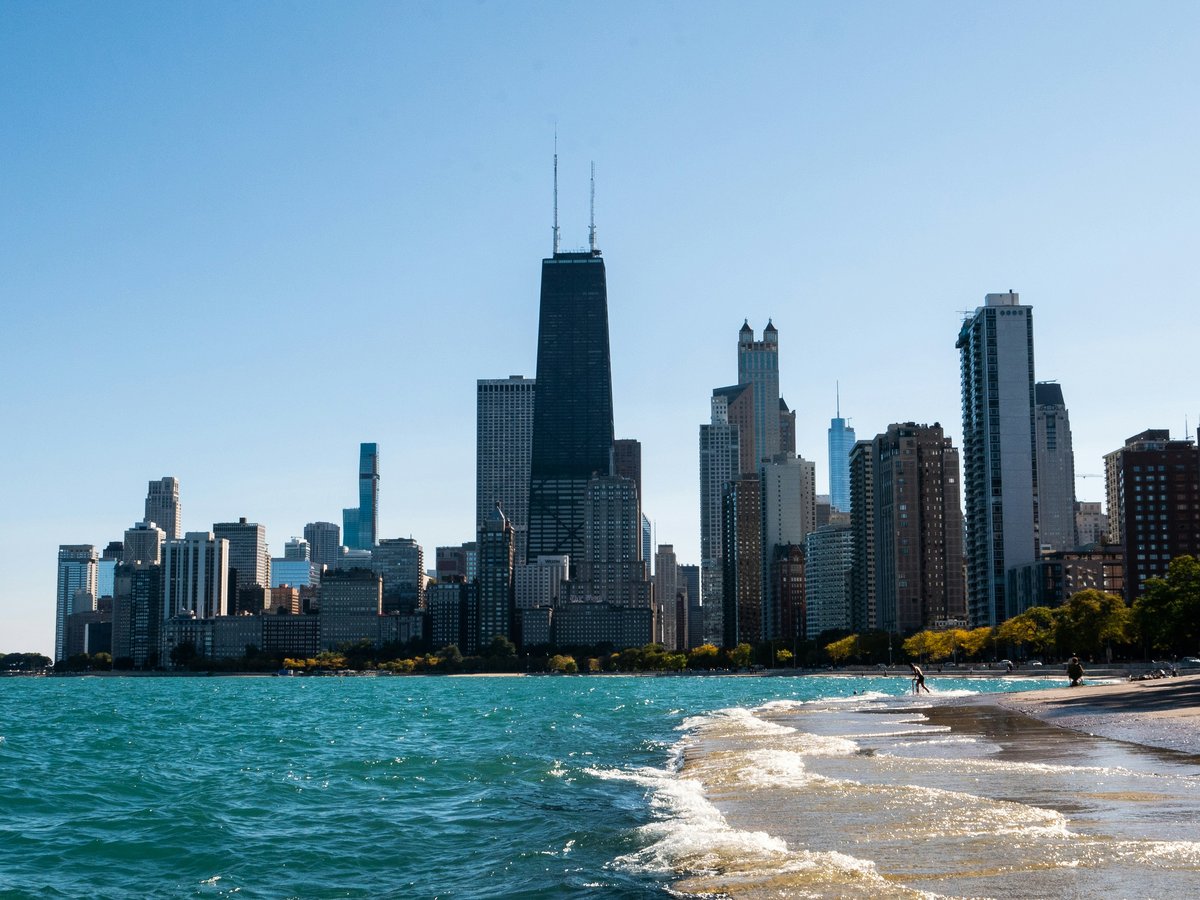
Chicago sits on the southwestern shore of Lake Michigan, a freshwater sea that stretches to the horizon and generates its own weather patterns. The city occupies what was once tallgrass prairie and marshy river flats, and that flat topography still defines the outdoor experience here. You won't find elevation gain. What you will find is 26 miles of open lakefront, a river system that cuts through the downtown core, and a forest preserve network that rings the metropolitan area with over 70,000 acres of protected land. The wind off the lake is real, not a marketing slogan. It drops the effective temperature by 10 to 15 degrees on spring mornings and pushes 3-foot swells onto the beaches by afternoon in summer. Chicago's outdoor season runs roughly from late April through October, though winter has its own appeal if you're willing to layer up. The shoulder months, May and September, tend to be the sweet spot. Fewer crowds, mild temperatures in the 60s and 70s, and the lake is calm enough for paddling.
Outdoor activities
-
Lakefront Trail Cycling
The Lakefront Trail runs 18.5 miles from Ardmore Street on the north end down to 71st Street on the South Side. It's paved and separated into bike and pedestrian lanes for most of its length, though the separation breaks down near Navy Pier and the Museum Campus where foot traffic spills over. The stretch between Fullerton and North Avenue is consistently the most congested, especially on weekend mornings from June through August. South of McCormick Place, the trail opens up considerably. You'll pass Promontory Point in Hyde Park, where the limestone ledges jut into the lake and the skyline view back toward downtown is worth a stop. Divvy bike-share stations sit every half-mile or so along the northern sections.
- Difficulty
- Easy to moderate
- Duration
- 2 to 4 hours for the full out-and-back
- Best season
- May through October, with September offering the best combination of weather and fewer riders
-
Rock Climbing at Devil's Lake State Park
Devil's Lake sits about 3 hours northwest of Chicago near Baraboo, Wisconsin, and it's the closest real rock climbing to the city. The quartzite bluffs rise 500 feet above the lake and offer hundreds of established routes on the East Bluff and West Bluff. Most trad routes on the East Bluff range from 5.4 to 5.10, and the rock is grippy but abrasive on your hands. The West Bluff tends to be quieter with longer approaches. Worth noting, there's no bolted sport climbing here. It's all trad and top-rope. The park charges a vehicle admission fee, currently $13 for out-of-state vehicles with an annual Wisconsin state park sticker as the alternative.
- Difficulty
- Moderate to difficult depending on route selection
- Duration
- Full day trip, 3-hour drive each way
- Best season
- Late April through mid-October, with fall offering the best friction on dry quartzite
-
Fat Tire Mountain Biking at Palos Trail System
The Palos trail network in the southwestern suburbs, managed by the Forest Preserves of Cook County, has roughly 30 miles of singletrack spread across several interconnected loops. The terrain is glacial moraine, so you get rolling hills, surprisingly tight switchbacks, and sections that turn to thick mud after rain. The most popular loops run through Bullfrog Lake, Maple Lake, and Country Lane Woods. Trail conditions get posted on the Concerned Off-Road Bicyclists Association (CORBA) website, and they'll close trails when it's too wet to ride without causing ruts. The Palos system sits about 20 miles southwest of the Loop, reachable in 40 minutes outside rush hour.
- Difficulty
- Easy to moderate, with some technical root sections
- Duration
- 2 to 4 hours
- Best season
- Late spring through fall, avoiding the 2-3 days after heavy rain when trails stay closed
-
Cross-Country Skiing in the Forest Preserves
When Chicago gets a solid 4 or more inches of snow, several forest preserve sites groom cross-country ski trails. Deer Grove in Palatine, Swallow Cliff in Palos Park, and Bemis Woods near Western Springs are the most reliable. Swallow Cliff has a sledding hill that pulls families, so the ski trails there tend to be the busiest. Deer Grove is quieter and has about 5 miles of groomed loops through oak-hickory forest. Rental equipment is sometimes available at Swallow Cliff, though calling ahead is wise since availability varies year to year. Chicago winters have become less reliably snowy, so the season might be 3 good weekends or it might be 8. You check the forecast and go when conditions line up.
- Difficulty
- Easy to moderate
- Duration
- 1.5 to 3 hours
- Best season
- December through February, conditions dependent on snowfall
-
Birding at Montrose Point Bird Sanctuary
Montrose Point, at the east end of Montrose Avenue on the lakefront, is likely the best birding spot inside Chicago city limits. The Magic Hedge, a crescent of dense shrubbery planted by the Army in the 1950s to screen a Nike missile installation, funnels migrating warblers, thrushes, and sparrows into a concentrated area during spring and fall migration. On a good mid-May morning, experienced birders have logged 80-plus species before 10 AM. The dune habitat east of the hedge attracts shorebirds, and Snowy Owls show up on the beach in some winters. The adjacent Montrose Beach has a fenced-off piping plover nesting area, as Chicago is currently one of the few Great Lakes sites with nesting pairs of this federally endangered species.
- Difficulty
- Easy, flat walking on paved and gravel paths
- Duration
- 1 to 3 hours
- Best season
- May for spring warbler migration, September through October for fall migrants and raptors
-
Sailing on Lake Michigan
Chicago has one of the largest concentrations of recreational sailboats on the Great Lakes, with several harbors strung along the lakefront. Monroe Harbor, Burnham Harbor, and Belmont Harbor all have sailing schools and charter outfits. Chicago Sailing, based out of Belmont Harbor, offers introductory lessons starting around $50 per person for a 2-hour group session. The lake can be deceptively rough. Afternoon thermal winds in summer regularly hit 15 to 20 knots, and the fetch across open water builds short, choppy waves that are harder to manage than ocean swells of similar height. Morning sails tend to be calmer. If you have an ASA certification, several clubs rent keelboats in the 22- to 30-foot range.
- Difficulty
- Moderate, dependent on wind conditions and experience
- Duration
- 2 to 4 hours for a lesson or charter
- Best season
- June through September, with July and August offering the most consistent thermal winds
Day hikes
-
Starved Rock State Park Canyon Trails
Starved Rock sits about 100 miles southwest of Chicago near the town of Utica, reachable in under 2 hours on I-80. The park has 13 miles of marked trails that wind through 18 sandstone canyons carved by glacial meltwater. The canyons are the draw. French Canyon and St. Louis Canyon both have seasonal waterfalls that run strongest after spring rain or snowmelt, typically March through early May. The main trail along the bluff top follows the Illinois River and connects to most canyon spur trails. That said, the park draws over 2 million visitors per year, so weekend parking fills by 10 AM in peak season. Weekday visits or early arrivals on Saturday are the move. The canyon floors can be muddy and the wooden stairways slick. Wear shoes with grip.
- Difficulty
- Easy to moderate, some steep stairways into canyons with uneven footing
- Duration
- 3 to 6 hours depending on how many canyons you explore
- Best season
- March through May for waterfall flow, October for fall color in the canyon hardwoods
-
Indiana Dunes National Park, West Beach to Dune Succession Trail
Indiana Dunes became a national park in 2019 and sits about 50 miles southeast of Chicago along the southern Lake Michigan shoreline. The West Beach area has a loop trail that climbs through a progression of dune ecosystems, from bare sand to established forest, in under 3 miles. The sand sections are steep and soft underfoot, which makes the effort feel harder than the distance suggests. You'll gain roughly 200 feet climbing the dune ridges. The 3 Dune Challenge is a separate self-guided route connecting Mount Tom, Mount Holden, and Mount Jackson across about 1.5 miles with significant sand climbing. The park charges a $25 per-vehicle entrance fee, valid for 7 days. The beach at West Beach is swimmable in summer, so bringing a towel and making an afternoon of it is common.
- Difficulty
- Moderate, due to soft sand and steep dune climbs
- Duration
- 2 to 4 hours for the trails, longer if you add beach time
- Best season
- May through October, with late September offering warm sand, cooler air, and smaller crowds
-
Waterfall Glen Forest Preserve Loop Trail
Waterfall Glen surrounds Argonne National Laboratory in DuPage County, about 25 miles southwest of downtown. The main loop trail is roughly 9.5 miles on crushed limestone and runs through oak-maple forest, prairie restoration, and a stretch along the Des Plaines River. The terrain is rolling, not flat, with enough gentle grade changes to keep it from feeling monotonous. The trail's namesake waterfall is a man-made rocky cascade near the south end that runs year-round, though it's modest. The real appeal is the distance. This is one of the few trail loops near Chicago where you can get a genuine half-day hike without driving 2 hours. Trail runners and mountain bikers share the path, so step to the side when you hear wheels. Parking at the Bluff Road entrance tends to have space even on weekends.
- Difficulty
- Moderate, flat to rolling terrain but sustained distance
- Duration
- 3 to 5 hours for the full 9.5-mile loop
- Best season
- April through November, with fall color peaking in mid-to-late October
-
Matthiessen State Park Canyon Trail
Matthiessen sits 2 miles south of Starved Rock and tends to be quieter despite having similar sandstone canyon geology. The Upper Dells trail follows a creek through a narrow canyon with moss-covered walls and seasonal waterfalls. The Lower Dells are wider and end at a falls that drops into a pool. The trail network covers about 5 miles total, with the Upper and Lower Dells connected by a staircase. Some sections of the canyon floor require rock-hopping across the creek, and the footing is uneven enough that hiking poles help. The park has fewer facilities than Starved Rock, no lodge, no restaurant, but that's part of the appeal. Combine it with Starved Rock for a full-day outing if you're already driving 2 hours.
- Difficulty
- Moderate, with uneven rock surfaces and creek crossings
- Duration
- 2 to 3 hours
- Best season
- March through May for water flow, or October for fall color with less mud
-
North Branch Trail from Caldwell Woods to Chicago Botanic Garden
The North Branch Trail follows the North Branch of the Chicago River from the city's northwest side all the way up to the Botanic Garden in Glencoe, roughly 20 miles one way. You don't need to do the whole thing. The most scenic stretch runs about 8 miles from Caldwell Woods near Devon Avenue through the Skokie Lagoons to the garden's southern entrance. The trail is paved and mostly flat, passing through forest preserve land that feels surprisingly remote for a metropolitan area. The Skokie Lagoons section, a series of connected pools created by the CCC in the 1930s, is excellent for spotting herons, egrets, and the occasional mink. This is more of a long walk or easy bike ride than a hike, but the distance qualifies and the scenery delivers.
- Difficulty
- Easy, flat paved path
- Duration
- 3 to 4 hours walking one way, 1.5 hours by bike
- Best season
- April through October, with May offering peak bird activity in the Skokie Lagoons
Water activities
-
Kayaking the Chicago River Downtown
Paddling the Chicago River through the Loop is one of those experiences that feels like it shouldn't be possible in a major city. The river was reversed in 1900 to flow away from the lake, and in the last 15 years the water quality has improved enough that you'll see fish jumping. Several outfitters operate from the riverwalk near Michigan Avenue. Wateriders and Kayak Chicago both rent single and tandem kayaks, typically $25 to $40 per hour. You'll paddle under the DuSable Bridge and past Marina City's corncob towers at water level, with the canyon of buildings rising on both sides. Morning launches are calmer, both in terms of boat traffic and wind. The architectural tour boats start running by mid-morning, and their wakes can be disorienting in a kayak if you're not used to it.
- Difficulty
- Easy to moderate, depending on river traffic and wind
- Duration
- 1.5 to 3 hours
- Best season
- June through September, with weekday mornings offering the least congestion from tour boats
-
Swimming at North Avenue Beach
North Avenue Beach is probably the most popular swimming beach in Chicago, with its distinctive ocean-liner-shaped bathhouse and wide sand frontage. The water is Lake Michigan, which means it stays cold. Surface temperatures in June hover around 60 to 65 degrees Fahrenheit, reaching the mid-70s by late July in a warm year. That said, the cold keeps the water clear, and the beach has lifeguards on duty from Memorial Day weekend through Labor Day. The beach is free. The bottom drops off gradually, making it approachable for kids and waders, though the slope steepens further out. Wind from the northeast can build waves to 3 or 4 feet, which draws bodysurfers but triggers swim warnings. Check the Chicago Park District beach conditions page before heading out.
- Difficulty
- Easy, with conditions varying based on wind and waves
- Duration
- As long as you'd like
- Best season
- Late June through August for the warmest water temperatures, typically peaking in late July
-
Stand-Up Paddleboarding on Bubbly Creek and the South Branch
Bubbly Creek, the South Fork of the South Branch of the Chicago River near Bridgeport, earned its name from the methane bubbles that used to rise from decades of stockyard waste on the creek bottom. The water is cleaner now, and outfitters like Chicago SUP run paddleboard rentals and tours from a launch near Eleanor Street. The creek is narrow and sheltered from wind, which makes it one of the easier places in Chicago to learn to stand-up paddleboard. A 2-hour rental typically runs around $40 to $50. The surrounding neighborhood is industrial-turned-residential, and you'll paddle past old rail bridges and brick warehouses. It's not scenic in a nature-calendar way, but it's specific to Chicago in a way that few other paddle routes are.
- Difficulty
- Easy, calm sheltered water
- Duration
- 1.5 to 2.5 hours
- Best season
- June through September
-
Fishing at Montrose Harbor and the Rock Jetty
The rock jetty extending from Montrose Harbor into Lake Michigan is one of the city's most productive shore-fishing spots. Smallmouth bass, yellow perch, and Chinook salmon are the main targets, depending on season. Perch fishing peaks from late September through November as schools move shallow near the rocks. Salmon run in the fall as well, though landing one from shore requires heavier gear and patience. An Illinois fishing license is required for anyone 16 or older, currently $15 for residents and $31.50 for non-residents for an annual license. No bait shop sits right at the jetty, so pick up tackle and bait at one of the shops along Lincoln Avenue before heading over. The jetty rocks are uneven and can be slippery with algae, so watch your footing.
- Difficulty
- Easy, though jetty walking requires some balance
- Duration
- 2 to 5 hours
- Best season
- September through November for perch and salmon runs, May through June for smallmouth bass
-
Canoeing the Des Plaines River from Libertyville to River Trail Nature Center
The Des Plaines River north of Chicago offers a quieter paddling experience than the downtown river. The stretch from Libertyville south to the River Trail Nature Center near Northbrook covers about 8 miles and passes through forest preserve land with minimal development on the banks. The river is shallow in spots, with riffles and occasional fallen trees that require maneuvering. Chicagoland Canoe Base, which has operated from a location on the North Branch for decades, rents canoes and can arrange shuttle logistics. Spring high water in April and May gives the best flow, though the river is runnable through October in most years. You'll likely see great blue herons, turtles on logs, and possibly deer along the wooded banks.
- Difficulty
- Easy to moderate, some maneuvering around obstacles in low water
- Duration
- 3 to 5 hours for the 8-mile stretch
- Best season
- April through June for reliable water levels, with fall offering color along the banks
Parks & gardens
-
Lincoln Park
FreeLincoln Park stretches about 7 miles along the lakefront from North Avenue up to Ardmore, covering roughly 1,200 acres. It's the city's largest public park and it handles a staggering amount of use without feeling as cramped as you might expect. The southern end around the Zoo and the conservatory draws the densest crowds. North of Diversey Harbor, the park opens into wide meadows and the running paths thin out. The Alfred Caldwell Lily Pool near Fullerton is a quiet limestone-edged pond designed in the Prairie style, and it's often empty midweek. The park's mature tree canopy includes bur oaks that predate the city.
Highlights: Lincoln Park Zoo (free admission year-round), Alfred Caldwell Lily Pool, North Pond, the Lincoln Park Conservatory with its fern room and orchid house, and the lakefront running path from North Avenue to Montrose
-
Garfield Park Conservatory
FreeGarfield Park Conservatory on the West Side is one of the largest conservatories under glass in the United States, with roughly 2 acres of indoor growing space across several connected rooms. The Palm House feels tropical and humid even in February, with palms reaching 70 feet to the glass ceiling. Jens Jensen designed the original 1908 structure to echo the prairie landscape, with limestone outcrops and layered plantings meant to resemble Illinois bluffs. The outdoor demonstration garden is free and open in warmer months, and the Saturday farmers market from mid-June through October pulls a neighborhood crowd. The surrounding Garfield Park itself has a gold-domed fieldhouse and lagoons that freeze for informal ice skating some winters.
Highlights: The Palm House, the Fern Room with its stone waterfall, the Show House for seasonal displays, the outdoor sensory garden, and free children's programming on weekday mornings
-
Jackson Park and the Osaka Japanese Garden
FreeJackson Park on the South Side was the site of the 1893 World's Columbian Exposition, and you can still feel the Olmsted bones in the layout. The park's 500-plus acres include lagoons, wooded islands, and the restored Osaka Garden on Wooded Island, a gift from Chicago's sister city that dates to 1934. The garden has a moon bridge, stone lanterns, and carefully pruned plantings that make it feel removed from the surrounding city. Jackson Park is also where the Obama Presidential Center is under construction on the west side of the park, which has redrawn some paths and closed sections. The 63rd Street Beach at the park's eastern edge is wide and less crowded than the North Side beaches.
Highlights: Osaka Garden on Wooded Island, the Museum of Science and Industry at the park's north end, 63rd Street Beach, the perennial garden near the lakefront, and the Columbian Basin lagoon where you can still trace the Expo's Court of Honor footprint
-
Lurie Garden at Millennium Park
FreeLurie Garden occupies 5 acres at the southern end of Millennium Park, between the Pritzker Pavilion and the Art Institute. Designed by Kathryn Gustafson, Piet Oudolf, and Robert Israel, the garden uses a mix of native prairie grasses and perennials that shift dramatically through the seasons. The "Dark Plate" section under the shoulder hedge has shade-tolerant plants and a boardwalk over wet areas. In late June and July, the coneflowers and salvias peak, and the insect activity is constant. Free guided walks run on Fridays and Sundays from May through September. Mind you, this is downtown Chicago, so the backdrop is the skyline and the noise of Michigan Avenue, but the plantings are sophisticated enough that serious gardeners travel to see them.
Highlights: Piet Oudolf's perennial planting design, the 15-foot shoulder hedge that screens the garden from the street, the seasonal bulb displays in April, free volunteer-led garden walks, and the boardwalk through the wet meadow section
-
Northerly Island
FreeNortherly Island is a 91-acre peninsula south of the Adler Planetarium that was converted from Meigs Field airport in 2003. It's still maturing as a landscape, with prairie grasses, wetlands, and gravel paths that loop the perimeter. The east side faces open lake and catches serious wind, which makes it a prime spot for watching storms roll across the water. The fishing pier on the south end is popular with shore anglers casting for perch and smallmouth bass. In summer, the Huntington Bank Pavilion at the island's north end hosts outdoor concerts, and the sound carries across the water in a way that feels specific to this spot. The walking loop is roughly 2 miles.
Highlights: The prairie restoration with native wildflowers peaking in August, the fishing pier, lakefront views of the skyline from the southern tip, the outdoor concert venue, and the 12th Street Beach tucked between the island and the planetarium
-
Chicago Botanic Garden
FreeThe Chicago Botanic Garden in Glencoe sits about 25 miles north of the Loop, and while it's technically outside city limits, most Chicagoans claim it. The 385-acre site includes 27 gardens and 4 natural areas spread across a series of islands and shorelines on a chain of lakes. Admission is free, though parking currently runs $25 to $35 depending on the day. The Japanese Garden on one of the islands is among the finest in the country, with water, stone, and pruned pines composed by landscape architect Koichi Kawana. The Dixon Prairie section recreates every major Illinois prairie ecosystem, from wet to dry, and blooms from May through October. You could spend an entire day and still skip sections.
Highlights: The Evening Island with its carillon, the Japanese Garden designed by Koichi Kawana, the Sensory Garden, the Model Railroad Garden (seasonal, extra fee), the 100-acre McDonald Woods restoration with hiking trails, and the orchid and aquatic plant greenhouses
Practical tips
- Lake Wind and Layering
- The lake creates its own microclimate. A sunny 75-degree day in Wicker Park can feel like 60 degrees at the lakefront with a northeast wind. Bring a wind-resistant layer any time you're heading to the shore, even in summer. In spring and fall, the temperature swing between the lake and neighborhoods 2 miles inland can reach 15 degrees Fahrenheit.
- Sun Protection on the Water
- Reflected UV off Lake Michigan is intense from late May through August. The lake acts like a mirror, so you're getting exposure from below as well as above. Wear SPF 30 or higher sunscreen and reapply every 90 minutes when kayaking, paddleboarding, or on the beach. Polarized sunglasses cut the glare and let you see into the water. Sunburn can happen even on overcast days when the cloud layer is thin.
- Trail Conditions After Rain
- Many of the unpaved trails in the Cook County and DuPage County forest preserves close after heavy rain to prevent erosion damage. The Palos mountain bike trails close after roughly half an inch of rain and stay closed 24 to 48 hours. Check the CORBA trail status page or the Forest Preserves of Cook County website before driving out. The paved Lakefront Trail and North Branch Trail stay open in all weather.
- Hydration and Water Access
- Chicago's lakefront has drinking fountains roughly every mile along the Lakefront Trail, though some shut off in mid-October and don't reactivate until late April. The forest preserves have limited water access, so carry at least 1 liter per person for any trail over 5 miles. For summer paddling trips, bring water in a dry bag since most rental kayaks and canoes don't have built-in storage.
- Mosquitoes in the Forest Preserves
- From late May through August, mosquitoes in the Cook County forest preserves can be severe, especially near standing water and in the early morning or evening. The Skokie Lagoons and Palos wetland sections are the worst. DEET-based or picaridin-based repellent is worth bringing. The lakefront itself tends to be breezy enough that mosquitoes are less of an issue, but step 50 yards inland into tree cover and conditions change.
- Getting to Trailheads Without a Car
- Several solid outdoor spots are reachable by Metra commuter rail. The Union Pacific North line stops in Glencoe near the Chicago Botanic Garden. The BNSF line to Route 59 connects to Waterfall Glen via a short bike ride. Indiana Dunes is accessible on the South Shore Line from Millennium Station downtown to Dune Park station, a 75-minute ride. The Lakefront Trail and Montrose Point are on the CTA Red and Brown lines. Chicago is one of the few cities where you can legitimately car-free your way to quality outdoor time.
FAQ
Is Lake Michigan safe for swimming in Chicago?
Lake Michigan is generally safe for swimming at the 27 designated Chicago Park District beaches, which have lifeguards from Memorial Day through Labor Day. The main risks are cold water, which stays below 60 degrees Fahrenheit into mid-June, and sudden wind-driven waves that can reach 4 to 6 feet. Check the Chicago Park District's daily beach conditions report, which uses a green-yellow-red flag system. Rip currents do occur, particularly near piers and breakwaters. Never swim at unguarded beaches or during red flag conditions.
What is the best day hike within 2 hours of Chicago?
Starved Rock State Park near Utica, Illinois, about 95 miles southwest, is the most popular choice for good reason. The 18 sandstone canyons are genuinely interesting geology, and you can link several canyon trails for 6 to 8 miles of hiking. For something quieter with fewer crowds, try Matthiessen State Park 2 miles south of Starved Rock. Indiana Dunes National Park is closer at 50 miles and offers a different landscape with sand dunes and lake views, plus you can take the South Shore Line train directly to the Dune Park station.
Do I need any permits for kayaking the Chicago River?
You do not need a permit to paddle the Chicago River. The river is open to non-motorized watercraft. If you're renting from an outfitter like Wateriders or Kayak Chicago, they handle any launch access and provide PFDs as required by Illinois law. If you're bringing your own kayak, public launch points exist at Clark Park and several spots along the riverwalk, though parking near downtown launches can be expensive. Be aware that commercial boat traffic, including architecture tour boats, has right of way.
When does Chicago's outdoor season start and end?
The practical outdoor season runs from late April through October for most activities. Lake Michigan water temperatures don't reach comfortable swimming levels until late June, and they drop below 65 degrees by mid-September. Hiking at Starved Rock and the forest preserves is good from March through November. Cycling on the Lakefront Trail works year-round for the determined, though wind chill from December through February can make it brutal. The best overall months are May, June, September, and early October, when temperatures sit in the 60s to 70s and the worst of the summer humidity hasn't arrived or has already broken.
Are the forest preserve trails near Chicago dog-friendly?
Most Cook County and DuPage County forest preserve trails allow dogs on leashes of 6 feet or shorter. The Palos Trail System, Waterfall Glen, and the North Branch Trail all permit leashed dogs. Off-leash dog areas exist at several forest preserves, including Caldwell Woods and Dan Ryan Woods, in designated fenced areas. Dogs are not allowed on Chicago Park District beaches during the swimming season from Memorial Day through Labor Day, though Montrose Dog Beach at the north end of Montrose Beach is a dedicated off-leash dog beach that operates year-round and is one of the most popular in the city.
What gear should I bring for a first visit to Chicago's outdoor areas?
For lakefront activities, bring sunscreen, sunglasses, a wind layer, and water. A daypack with 1 to 2 liters of water covers any urban trail. For the forest preserves, add insect repellent from May through August and shoes with decent tread since crushed limestone paths can be loose. If you're heading to Starved Rock or Indiana Dunes, wear actual hiking shoes or trail runners, as the canyon stairs at Starved Rock are often wet and the dune sand is steep. For winter outings, windproof layers matter more than heavy insulation. The wind chill off the lake is the main variable year-round.
Last verified by automated review (v1.7.2) on June 16, 2026. What is automated review?