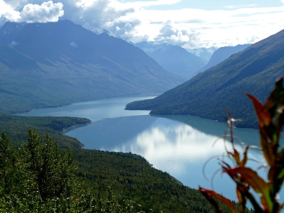
Anchorage sits on a roughly triangular slab of land between two arms of Cook Inlet, with Chugach State Park (established 1970) pressing against the city's entire eastern edge. The layout is simpler than it looks. Downtown occupies a compact grid near Ship Creek at the northern end. South of that, neighborhoods fan outward along a few major corridors. Northern Lights Boulevard and the Seward Highway act as the main east-west and north-south spines, and most of the city's life happens within 10 miles of the intersection of those two roads. The farther east you go, the closer you get to the mountains. The farther south, the more suburban and spread out things become. Mid-August temperatures currently sit around 16.5°C with overcast skies, which is fairly standard for late summer here. Worth noting, Anchorage scores 7.2/10 for family friendliness (see the TTDI Family-Friendliness Index), and the city's broad park system and trail network are a big part of that. You will need a car for anything outside the downtown core, full stop. The People Mover bus system runs limited routes, and ride-share availability drops off sharply after 10 PM.
Neighborhoods
-
Downtown
A small, walkable grid of 4- to 8-story buildings concentrated between A Street and Barrow Street, running from Ship Creek south to about 9th Avenue. The pace is slow compared to any Lower 48 downtown. Foot traffic picks up around the 4th Avenue strip in summer, where seasonal gift shops cater to cruise passengers bused up from Whittier. The rest of the year it gets quiet. Cathedral of the Holy Family, built in 1915, sits on 5th Avenue and still holds daily services. The older commercial buildings along 4th Avenue survived the 1964 earthquake, and some of them still lean slightly if you look carefully at the rooflines.
- Best for
- First-time visitors, cruise ship passengers with a day to fill, and anyone who wants to walk to restaurants without renting a car
- Key streets
- 4th Avenue between C Street and E Street for the tourist-facing strip. F Street between 3rd and 6th for the better restaurants and bars. The Tony Knowles Coastal Trail starts at 2nd Avenue near Elderberry Park and runs 11 miles to Kincaid Park.
-
South Addition
Anchorage's oldest residential neighborhood sits between L Street and the Coastal Trail, bordered by downtown to the north and Westchester Lagoon to the south. The houses here are a mix of 1940s bungalows and newer infill, many with corrugated metal roofs built to handle snow load. Streets are narrow by Anchorage standards, and the canopy of birch and spruce makes it feel more Pacific Northwest than Alaska. It stays noticeably quieter than downtown, even though you can walk to 4th Avenue in 15 minutes. Delaney Park Strip, the long green belt running along 9th and 10th Avenues, marks its southern edge.
- Best for
- Couples and solo travelers who want a residential feel within walking distance of downtown restaurants. The LGBTQ+ friendliness score for Anchorage sits at 6.2/10 (sourced from TTDI's editorial rubric), and South Addition tends to be one of the more welcoming pockets of the city.
- Key streets
- L Street south of 10th Avenue for the classic older homes. The Coastal Trail section between Westchester Lagoon and Earthquake Park offers the best views of the Chugach range across the inlet on clear days.
-
Spenard
Spenard Road runs southwest from Midtown toward the airport, and the neighborhood that grew up along it has a rougher, more interesting personality than most of Anchorage. You'll find tattoo parlors next to Thai restaurants, secondhand stores next to craft breweries. The buildings are mostly 1960s and 70s low-slung commercial, nothing taller than 2 stories, with gravel parking lots. Spenard was the city's red-light district decades ago, and some of that edge lingers in the dive bars and neon signs. The food scene here is legitimately the best in Anchorage. The smell of birria tacos at one end of the road and pho at the other end is a real thing on summer evenings when doors are propped open.
- Best for
- Budget travelers, food-focused visitors, and anyone who wants to see the side of Anchorage that the cruise-ship loop skips entirely
- Key streets
- Spenard Road between Northern Lights Boulevard and Minnesota Drive. The stretch near the intersection of Spenard and Benson has the densest cluster of independent restaurants. International Inn Drive for the hodgepodge of Korean and Filipino spots.
-
Midtown
The commercial heart of Anchorage sprawls around the intersections of Northern Lights Boulevard, Benson Boulevard, and the Seward Highway. Big box stores, strip malls, medical offices, and chain hotels fill most of the landscape. It looks like suburban America anywhere. That said, this is where Anchorage residents do their daily shopping, and the large Carrs-Safeway on Northern Lights is the grocery store most visitors end up at. The architecture is functional, the traffic is the heaviest in the city, and the area has little walking appeal. It does have the highest concentration of mid-range hotels, which keeps rates lower than downtown.
- Best for
- Road-trippers who need a practical base for day trips south toward Kenai or north on the Glenn Highway, and anyone prioritizing hotel value over walkability
- Key streets
- Northern Lights Boulevard between the Seward Highway and Arctic Boulevard for the main retail corridor. Old Seward Highway, the parallel service road, has a surprising number of Korean and Japanese restaurants tucked behind the strip malls.
-
Government Hill
This small bluff neighborhood sits north of Ship Creek, overlooking the Port of Anchorage and the railroad yards. It was one of the first residential areas in the city, and many of the houses date to the 1940s and 50s, built originally for military and government workers. The streets are steep and narrow, the lots are small, and the views of the Chugach range from the bluff edge are arguably the best in town. It has a slightly forgotten quality, since most visitors never cross Ship Creek. The population is small enough that you will see the same faces at the neighborhood coffee shop within a few days.
- Best for
- Travelers who want a quiet residential base and don't mind being a 10-minute drive from downtown restaurants
- Key streets
- Government Hill Drive along the bluff edge for the mountain views. The Ship Creek area directly below, accessed via the footbridge from downtown, has a seasonal salmon fishery where kings and silvers run from June into September.
-
Turnagain
A residential neighborhood on the western bluffs above Cook Inlet, Turnagain takes its name from Captain Cook's 1778 expedition. The 1964 Good Friday earthquake devastated this area, and Earthquake Park at its western end preserves the buckled ground as a reminder. The rebuilt homes are mostly 1970s and 80s ranch-style, set on wide lots with big spruce trees. The neighborhood is quiet to the point of feeling empty on weekday mornings. You can hear the wind off the inlet clearly. Turnagain Arm, visible from several vantage points, produces bore tides that draw photographers from around the state.
- Best for
- Families with kids who want space, quiet, and quick access to the Coastal Trail. Earthquake Park is a 5-minute walk from many Turnagain homes.
- Key streets
- Northern Lights Boulevard at its western terminus near Point Woronzof for sunset views over Cook Inlet. Wisconsin Street and Turnagain Parkway for the residential core. The Coastal Trail section through Turnagain passes through dense spruce forest before opening up at Point Woronzof.
-
Airport Heights
A working-class residential area east of Merrill Field, Anchorage's smaller general-aviation airport. The neighborhood is defined by modest 1950s and 60s houses, many with prior military connections. Mountain View, its neighbor to the north, has some of the highest crime rates in the city, and the solo-traveler safety score for Anchorage as a whole sits at 4.8/10 (see the TTDI Solo-Safety Index), so this area warrants awareness after dark. The Alaska Native Heritage Center (opened in 1999) sits on the neighborhood's eastern edge along the Glenn Highway, and it is the single best cultural institution in Anchorage for understanding the state's Indigenous peoples.
- Best for
- Budget-conscious visitors with a car who want proximity to the heritage center and the Glenn Highway corridor heading north toward Palmer and the Matanuska Glacier
- Key streets
- Muldoon Road for the main commercial strip. Boniface Parkway connects to the Glenn Highway interchange. The area around the heritage center has wide open views of the Chugach foothills.
-
Hillside
The foothills climbing east from O'Malley Road and Huffman Road toward Chugach State Park. This is where Anchorage's wealthier residents built large houses on multi-acre lots, and the area feels more like a mountain exurb than a city neighborhood. Moose sightings on front lawns are a daily occurrence from September through April. The trailheads for Flattop Mountain and Glen Alps sit at the top of the Hillside road system, making this the gateway for serious hikers. The Alaska Botanical Garden, which opened in 1993, sits at the neighborhood's lower edge along Campbell Creek.
- Best for
- Hikers and outdoors-focused visitors who plan to spend most of their time on trails. The digital-nomad suitability score for Anchorage is 4.2/10 (sourced from TTDI's editorial rubric), and Hillside's spotty cell coverage and distance from cafes makes that gap more pronounced up here.
- Key streets
- Upper Huffman Road and Toilsome Hill Drive lead to the Glen Alps trailhead. O'Malley Road is the main east-west connector to the Seward Highway and Midtown. Abbott Road provides a less congested alternate route.
-
Eagle River
Technically within the Municipality of Anchorage but 15 miles north on the Glenn Highway, Eagle River operates as its own small town. A strip of restaurants and shops lines the Old Glenn Highway through the town center. The surrounding valley is hemmed in by mountains, and the Eagle River itself runs milky blue-gray with glacial silt. The pace is noticeably slower than Anchorage proper, and the population skews toward military families from Joint Base Elmendorf-Richardson. Property crime is lower than the Anchorage average, and the area feels safer at night.
- Best for
- Families and road-trippers who want a quieter, more scenic base and don't mind the 20-minute drive into Anchorage for restaurants
- Key streets
- Old Glenn Highway through the town center for the small-town commercial strip. Eagle River Road leads 12 miles east to the Eagle River Nature Center at the end of the valley, where the Crow Pass Trail begins.
FAQ
Which Anchorage neighborhood is best for first-time visitors without a car?
Downtown is the only neighborhood where you can reasonably get by without renting a car. The grid between 3rd Avenue and 6th Avenue covers most of the restaurants, the museum district, and the Coastal Trail access point within a 15-minute walk. Hotel rates downtown run $180 to $280 per night in summer, roughly $50 more than comparable rooms in Midtown, but the savings on not renting a car ($70 to $90 per day in peak season) can offset the difference.
Is Anchorage safe for solo travelers exploring neighborhoods on foot?
The city scores 4.8/10 on TTDI's solo-traveler safety index (see the TTDI Solo-Safety Index). Downtown and South Addition feel safe during daylight, and the Coastal Trail is well-trafficked in summer. Mountain View and parts of Airport Heights warrant more caution after dark. Anchorage has a higher property-crime rate than most U.S. cities of comparable size, so locking car doors and not leaving valuables visible applies everywhere. Wildlife is also a real factor. Moose are unpredictable in winter, and bears appear on trails from May through October.
Where should families with kids base themselves in Anchorage?
Turnagain and Eagle River both offer the kind of space and quiet that works well with younger children. The Alaska Zoo (founded in 1969) sits on O'Malley Road between Hillside and Midtown, roughly a 15-minute drive from either area. South Addition puts you within walking distance of Westchester Lagoon, which has a playground and the ice-skating loop in winter.
When is the best time to visit Anchorage's neighborhoods?
Late June through mid-August gives you the longest daylight (nearly 20 hours in late June) and the warmest temperatures, typically 15°C to 20°C. September brings fall color, fewer tourists, and lower hotel rates, but daylight drops fast. Winter visitors should expect temperatures well below freezing from November through March and limited daylight, with December offering fewer than 6 hours. The Fur Rondy festival in late February and the Iditarod ceremonial start in early March bring energy back to downtown after the quiet midwinter months.
How do Anchorage's neighborhoods connect to day trips?
Midtown and Airport Heights offer the fastest access to the Glenn Highway, which leads north to the Matanuska Glacier (about 100 miles) and Palmer. Hillside and South Anchorage connect most directly to the Seward Highway heading south toward Girdwood (40 miles), the Kenai Peninsula, and Seward (125 miles). Eagle River is already on the Glenn Highway corridor and adds no backtracking for northbound trips.
What does the food scene look like across Anchorage's neighborhoods?
Spenard has the most interesting independent restaurant density, with Southeast Asian, Mexican, and Korean options concentrated along a 2-mile stretch. Downtown's F Street corridor offers higher-end dining, including local halibut and king crab preparations that lean upscale. Midtown hides surprisingly good Korean barbecue spots along Old Seward Highway. Eagle River's options are more limited, mostly pizza and burger spots along the Old Glenn Highway. For groceries, the New Sagaya market in Midtown stocks local seafood, imported Japanese ingredients, and prepared foods that beat most restaurant lunch options.
Last verified by automated review (v1.7.2) on . What is automated review?