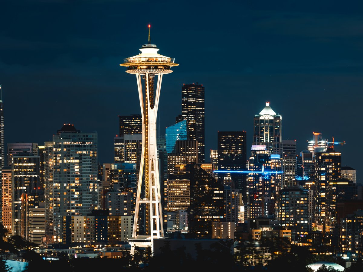
Seattle sits on a narrow isthmus between Puget Sound to the west and Lake Washington to the east, with the Olympic Mountains visible across the water on clear days and Mount Rainier looming 14,411 feet to the southeast. The city itself is hilly, green year-round thanks to mild Pacific moisture, and threaded with more than 485 parks covering over 6,200 acres. You might expect the rain to keep people indoors, but locals tend to treat drizzle as background noise. From late June through September, Seattle gets roughly 16 hours of daylight and surprisingly little precipitation, maybe 1 to 2 inches total in July. That dry stretch turns the whole region into an outdoor playground. The rest of the year, the forests stay lush, the trails stay quiet, and a decent rain shell is all you need. Within 90 minutes of downtown you can reach alpine lakes, old-growth forest, saltwater beaches, and volcanic terrain. The city's outdoor character feels less performative than, say, Denver's or Boulder's. People here paddle to work on Lake Union, run the Burke-Gilman Trail at lunch, and climb real rock on weekends at Exit 38 off I-90. It is a place where outdoor life is woven into the commute, not saved for vacation.
Outdoor activities
-
Road cycling on the Burke-Gilman Trail
The Burke-Gilman Trail runs about 27 miles from Golden Gardens Park in Ballard through the University of Washington campus, along the north shore of Lake Washington, and out to Bothell. The surface is paved almost entirely, with one notorious gap through Ballard's industrial zone that the city has been arguing about for years. On weekday mornings you'll share the path with bike commuters moving fast. Weekends get crowded near Gas Works Park and the university, so starting early helps. The Sammamish River Trail connects at the eastern end and adds another 11 miles to Marymoor Park in Redmond, giving you a 38-mile one-way route if you want the full stretch.
- Difficulty
- Easy to moderate, mostly flat with gentle grades
- Duration
- 2-4 hours for the full Burke-Gilman, depending on pace and stops
- Best season
- April through October, though rideable year-round with rain gear
-
Rock climbing at Exit 38 (Deception Crags)
About 35 minutes east of Seattle off I-90, Exit 38 leads to Deception Crags and the surrounding walls in the Mount Baker-Snoqualmie National Forest. The rock is solid andesite with good friction when dry. Routes range from 5.4 slabs to 5.12 sport climbs, with most of the popular lines in the 5.8 to 5.10 range. The Far Side Wall tends to stay drier in light rain because of its overhang, which makes it a go-to on typical Seattle spring days. The approach from the parking area is about 10 minutes on a well-worn trail. Bring your own gear. There is no rental available at the crag.
- Difficulty
- Moderate to advanced, depending on route selection
- Duration
- Half day to full day
- Best season
- May through October, though Far Side Wall stays climbable in light rain
-
Mountain biking at Duthie Hill
Duthie Hill Mountain Bike Park sits in Issaquah, about 25 minutes east of downtown Seattle. Evergreen Mountain Bike Alliance built and maintains the trail network, which includes roughly 7 miles of singletrack ranging from smooth beginner flow trails like Bootcamp to steep, technical lines like Semper Dirticus. There is a skills park with log rides, skinnies, and drops near the main parking area off Southeast Duthie Hill Road. The soil is loamy and drains well compared to many Northwest trails, so Duthie often rides well within a day of rain. You might notice that it gets muddy in sustained wet spells from November through February, though.
- Difficulty
- Beginner to expert, with clearly marked trail ratings
- Duration
- 2-4 hours
- Best season
- Year-round, best conditions May through October
-
Trail running in Forest Park at Discovery Park
Discovery Park covers 534 acres on the Magnolia bluff, making it Seattle's largest city park. The Loop Trail is about 2.8 miles and circles the park through mixed forest, open meadow, and bluff-top sections with views of Puget Sound and the Olympics. You can extend your run down to the West Point Lighthouse on the beach, which adds roughly a mile of steep switchbacks each way. The footing is mostly packed dirt with some root sections that get slick after rain. On foggy mornings the park feels surprisingly remote for a place 15 minutes from downtown. You'll hear crows, maybe a barred owl, and the low hum of container ships moving through the Sound.
- Difficulty
- Easy to moderate, with elevation change on the lighthouse spur
- Duration
- 45 minutes to 1.5 hours
- Best season
- Year-round
-
Skiing and snowboarding at Snoqualmie Pass
The Summit at Snoqualmie is about 50 miles east of Seattle on I-90, making it the closest ski area to the city. It operates four base areas: Summit West, Summit Central, Summit East, and Alpental. Alpental is the one locals gravitate toward for steeper terrain and genuine backcountry access. The base elevation is around 3,000 feet, which means rain instead of snow happens more than anyone would like, especially early and late season. That said, a good powder day at Alpental's Upper International is legitimate alpine skiing. Lift tickets currently run around $90 to $120 for a full day, depending on the date. Night skiing is available at Summit West and Summit Central, typically running until 10 PM on Fridays and Saturdays from December through March.
- Difficulty
- Beginner to expert across the four areas
- Duration
- Full day
- Best season
- December through April, with January and February being the most reliable for snow
-
Sailing on Puget Sound
The Center for Wooden Boats on South Lake Union and the Sail Sand Point program on Lake Washington both offer affordable sailing lessons and boat rentals. Puget Sound sailing out of Shilshole Bay Marina in Ballard gives you access to open saltwater with tidal currents that demand attention. The wind tends to fill in from the south around noon on summer afternoons, building to 10-15 knots by mid-afternoon. You can sail north toward the San Juan Islands or south toward Vashon Island on a long day. Water temperatures in the Sound hover around 50 to 55 degrees Fahrenheit even in August, so a PFD is non-negotiable. Several charter companies at Shilshole rent keelboats to sailors with ASA certification.
- Difficulty
- Moderate, requires basic sailing knowledge for Sound sailing
- Duration
- 3-8 hours depending on destination
- Best season
- June through September for the most consistent afternoon thermal winds
Day hikes
-
Rattlesnake Ledge
The most popular day hike near Seattle, and for good reason. The trailhead is about 30 miles east of the city off I-90 near North Bend. The trail climbs roughly 1,160 feet over 2 miles to a rocky ledge overlooking Rattlesnake Lake and the Cedar River watershed. The path is wide, well-maintained, and busy on weekends. Arrive before 9 AM on a Saturday in summer or you might not find parking. The ledge itself has a sheer drop with no railing, so keep an eye on kids and dogs. On a clear day you can see Mount Si across the valley.
- Difficulty
- Moderate, steady uphill with some rocky sections near the top
- Duration
- 2-3 hours round trip
- Best season
- Year-round, though the upper section can be icy from November through March. Microspikes help.
-
Mount Si (main trail to Haystack Basin)
Mount Si is the big one that locals use as a fitness benchmark. The trailhead sits at the edge of North Bend, about 35 miles from Seattle. The trail gains roughly 3,150 feet over 4 miles to the Haystack Basin viewpoint. The lower half moves through mossy forest, and the upper half opens up with switchbacks through boulder fields. The final scramble to the Haystack, the rocky summit knob, adds another 200 feet and requires hands-on-rock scrambling that some hikers skip. The parking lot fills by 8 AM on summer weekends. A Discover Pass is required for the trailhead parking.
- Difficulty
- Strenuous, relentless elevation gain
- Duration
- 4-6 hours round trip
- Best season
- May through November. Snow lingers on the upper trail into June some years.
-
Snow Lake
This is likely the most heavily used trail in the Alpine Lakes Wilderness. The trailhead is at Snoqualmie Pass, about 50 miles east of Seattle on I-90 at roughly 3,100 feet elevation. The trail drops slightly from the pass, then climbs about 1,300 feet to a saddle before descending to Snow Lake at around 4,000 feet. Total distance is about 7 miles round trip. The lake is large, cold, and ringed by granite walls. It is still frozen into June in heavy snow years. A Northwest Forest Pass is required for parking at the Alpental trailhead.
- Difficulty
- Moderate, with a steady climb to the saddle and some boulder-hopping near the lake
- Duration
- 4-6 hours round trip
- Best season
- July through October. The trail is typically snow-free by mid-July.
-
Twin Falls Trail
A family-friendly hike in Olallie State Park, about 35 miles east of Seattle off I-90 near Exit 34. The trail follows the South Fork of the Snoqualmie River through old-growth forest to two waterfalls. The lower falls are about 0.7 miles in, and the upper falls viewpoint adds another mile or so. Total round trip is roughly 3 miles with about 500 feet of elevation gain. The forest here has some massive Douglas firs and western red cedars, and the trail stays shaded and cool even in summer. The sound of the river is constant.
- Difficulty
- Easy, well-maintained trail with moderate grades
- Duration
- 1.5-2.5 hours round trip
- Best season
- Year-round. The falls are most dramatic in late spring when snowmelt feeds the river. A Discover Pass is required for parking.
-
Mailbox Peak (new trail)
Mailbox Peak is the local sufferfest. The old trail gains about 4,000 feet in roughly 2.5 miles, which is steep enough that it functions more as a scramble than a hike. The newer trail, built around 2014, stretches the approach to about 5.4 miles one way with a more sustainable grade, gaining the same 4,000 feet. Most people take the new trail up and the old trail down. At the summit, someone installed a mailbox decades ago, and hikers still leave notes inside. Views stretch from Rainier to Baker on clear days. The trailhead is at Exit 34 off I-90.
- Difficulty
- Very strenuous on either route. The old trail is extremely steep and eroded.
- Duration
- 5-8 hours round trip via the new trail
- Best season
- June through October. Snow on the upper ridge persists into early July.
-
Franklin Falls
A short, easy walk to a 70-foot waterfall at Snoqualmie Pass. The trailhead is about 50 miles from Seattle along I-90, near the Denny Creek campground. The trail is roughly 2 miles round trip with minimal elevation change, following the South Fork of the Snoqualmie River through dense forest before arriving at the base of the falls. The mist from the falls keeps the area cool and damp, and the rocks near the base are slippery. This is one of the better hikes for young kids or anyone who wants a quick forest walk without a big climb. A Northwest Forest Pass is required for parking.
- Difficulty
- Easy, nearly flat with a well-groomed trail surface
- Duration
- 1-1.5 hours round trip
- Best season
- May through November. Peak water flow in late May and June.
Water activities
-
Kayaking on Lake Union
Lake Union sits in the middle of the city, ringed by houseboats, marinas, and restaurants. Renting a kayak from the Northwest Outdoor Center on the west shore or Agua Verde Paddle Club on Portage Bay gives you access to a flat, sheltered lake that is busy with floatplanes, sailboats, and tour boats. Paddling past the houseboat communities on the east side is worth the trip. The water is calm most mornings, and afternoon winds tend to pick up from the south. You can paddle under the University Bridge into Portage Bay and continue to the Arboretum's marsh channels if you want a longer route.
- Difficulty
- Easy, suitable for beginners. Watch for boat wakes and floatplane traffic.
- Duration
- 1-3 hours
- Best season
- May through September. Rentals typically run around $20-30 per hour for single kayaks.
-
Swimming at Madison Park Beach and Madrona Park Beach
Lake Washington warms up enough for comfortable swimming by mid-July, typically reaching 68 to 72 degrees Fahrenheit by August. Madison Park Beach on the west shore of the lake has a roped swim area, a bathhouse, and a dock. It draws a crowd on hot days, and parking can be difficult along East Madison Street. Madrona Park, about a mile south, is a smaller beach with a grassy slope and slightly fewer people. Both have lifeguards on duty from late June through Labor Day. The water at Madrona tends to feel a degree or two warmer because of the shallower cove.
- Difficulty
- Easy, designated swim areas with lifeguards in summer
- Duration
- As long as you want
- Best season
- Late June through early September. August is the warmest water.
-
Stand-up paddleboarding on the Duwamish Waterway and Elliott Bay
SUP on Elliott Bay is a different experience than lake paddling. The saltwater is colder, around 50-54 degrees even in summer, and there is tidal current to manage. Alki Kayak Tours in West Seattle rents boards and offers guided paddles from Alki Beach along the waterfront. The views of the downtown skyline from the water are striking. On calmer mornings before the wind builds, you can paddle north toward the grain terminal and the Port of Seattle container cranes. Mind you, this is a working waterfront, so stay clear of the shipping lanes and ferry routes.
- Difficulty
- Moderate, requires comfort in open water and awareness of tidal conditions
- Duration
- 1.5-3 hours
- Best season
- June through September, mornings before wind builds
-
Whitewater kayaking on the Skykomish River
The Skykomish River runs about 60 miles northeast of Seattle near the town of Gold Bar on US Highway 2. The most popular section is the Boulder Drop run, a Class III to IV stretch with large boulders and hydraulics that demands intermediate-to-advanced paddling skills. At higher water levels in spring, it becomes a continuous, pushy Class IV run. The river drops through a forested canyon and the water is clear, cold, and glacially fed. This is not a rental-kayak situation. You need your own whitewater boat, helmet, drysuit in spring, and ideally a group. Seattle-based clubs like the Washington Kayak Club organize regular trips.
- Difficulty
- Advanced. Class III-IV whitewater, cold water, remote canyon.
- Duration
- 3-5 hours for the main run, plus shuttle time
- Best season
- April through June for peak flows. Summer levels drop and some rapids become bony.
-
Scuba diving at Alki Beach (Cove 2)
Puget Sound diving is cold, dark, and full of marine life that surprises people expecting tropical conditions. Alki Cove 2 in West Seattle is one of the more accessible shore dives in the Seattle area, with a sandy entry that slopes to about 30 feet. You'll find giant Pacific octopus, lingcod, rockfish, and nudibranchs on the rocky substrate further out. Visibility ranges from 5 to 25 feet depending on the season and tides. Incoming tides on neap tide days tend to give the best clarity. Water temperature hovers around 46 to 52 degrees year-round, so a drysuit is standard. Lighthouse Diving in South Seattle fills tanks and rents drysuits.
- Difficulty
- Moderate, requires open water certification and cold water comfort
- Duration
- 2-3 hours including setup
- Best season
- Year-round, with best visibility from September through November when plankton blooms subside
Parks & gardens
-
Discovery Park
FreeAt 534 acres on the Magnolia bluff, Discovery Park is the city's largest park and it still feels wild in places. The old Fort Lawton military structures are scattered through the grounds, slowly being absorbed by blackberry thickets and alder groves. The Loop Trail circles the park in about 2.8 miles, passing through dense second-growth forest where the light filters green even on overcast days. The bluff trails lead to a sand-and-gravel beach with driftwood piles and views across Puget Sound to Bainbridge Island.
Highlights: West Point Lighthouse on the beach, the South Bluff overlook toward Mount Rainier, and the North Beach tide pools at low tide. The Daybreak Star Indian Cultural Center sits on a separate bluff with artwork and exhibits.
-
Washington Park Arboretum
FreeThis 230-acre arboretum stretches along the western shore of Lake Washington between the Montlake and Madison Park neighborhoods. It is managed jointly by the University of Washington and the City of Seattle. The collection includes over 20,000 plant specimens, with particularly strong sections of Japanese maples, hollies, and Pacific Northwest conifers. In late April and early May the azalea corridor along Azalea Way is vivid with color. The air smells like wet bark and something faintly sweet most of the year.
Highlights: The Japanese Garden (small admission fee, around $8 for adults), Azalea Way in spring bloom, Foster Island trail through floating boardwalks over marsh, and Lookout Point above the ship canal.
-
Volunteer Park
FreeThis 48-acre Olmsted-designed park sits on Capitol Hill and has been here since 1876. The old water tower, built in 1906, has a winding staircase to an observation deck with 360-degree views. You can see the Space Needle, the Cascades, the Olympics, and Lake Union from up there. The park is calm during weekday mornings, with dog walkers and joggers on the gravel paths. The conservatory at the south end houses tropical plants in a Victorian glass structure that feels warm and humid even in January.
Highlights: The 1912 Volunteer Park Conservatory (free admission, donations encouraged), the 75-foot water tower observation deck, the Seattle Asian Art Museum (housed in the 1933 Art Deco building on the north end), and the mature dahlia garden beds.
-
Gas Works Park
FreeA 19-acre park on the north shore of Lake Union, built on the site of the old Seattle Gas Light Company gasification plant. The rusting industrial towers still stand, fenced off but visible, giving the park a look that is part post-industrial sculpture, part kite-flying field. The hill on the south side provides one of the better vantage points for the downtown skyline and the July 4th fireworks over Lake Union. On summer evenings the grassy slopes fill with picnickers, and the smell of charcoal grills drifts across the hill.
Highlights: The hilltop sundial mosaic, views of the downtown skyline reflected in Lake Union, the play barn with painted machinery remnants, and kite flying on the open hill when afternoon winds pick up.
-
Kubota Garden
FreeTucked into the Rainier Beach neighborhood in South Seattle, this 20-acre garden was started by Fujitaro Kubota in 1927. He was a self-taught gardener who emigrated from Shikoku, Japan, and the garden blends Northwest native plants with Japanese design principles in a way that feels organic rather than curated. Paths wind through rock outcroppings, past a series of ponds connected by small waterfalls, and under a red-painted moon bridge. The garden is quieter than the Arboretum and rarely crowded, even on weekends.
Highlights: The Mountainside section with its granite outcroppings and waterfall, the Necklace of Ponds, the Tom Kubota Stroll Garden completed in 1999, and the mature weeping willows and Japanese maples that turn orange and red in October.
-
Carkeek Park
FreeThis 220-acre park in the Broadview neighborhood drops steeply from residential streets down through second-growth forest to a narrow Puget Sound beach. The salmon return to Piper's Creek here in the fall, and the park has built a pedestrian bridge over the railroad tracks so you can walk down to watch them spawn in November. The forest trails are shaded, rooty, and smell like wet cedar. It tends to feel more like a hike than a park stroll because of the elevation change, roughly 270 feet between the upper parking lot and the beach.
Highlights: Salmon spawning in Piper's Creek from late October through December, the beach access bridge over BNSF rail tracks, the Environmental Learning Center, and the Piper's Orchard area with heritage apple trees planted in the 1900s.
Practical tips
- Rain gear and layering
- Seattle's rain is usually light drizzle, not downpour, so a waterproof-breathable shell (Gore-Tex or similar) matters more than a heavy rain coat. Bring one 365 days a year. Layers are essential because temperatures can swing 15-20 degrees between a shaded forest trail and an exposed ridge. A merino wool base layer, fleece mid-layer, and rain shell covers most three-season conditions. Cotton is miserable here once it gets wet, which it will.
- Parking passes and permits
- Washington State trailheads in state parks require a Discover Pass ($30 annual or $10 day pass), and national forest trailheads require a Northwest Forest Pass ($30 annual or $5 day pass). The passes are different and not interchangeable. You can buy both at REI's flagship store on Yale Avenue in South Lake Union, or online. Alpine Lakes Wilderness permits for overnight use are currently self-issued at trailheads, but day use does not require a separate wilderness permit. Check the Washington Trails Association website before heading out, as parking and permit rules change.
- Sun protection
- Seattle's summer sun is deceptive. The latitude (47.6 degrees north) means long UV exposure during the 16-hour summer days, and the marine air can feel cool even when the UV index hits 8 or 9 in July. People burn badly because the temperature does not feel hot. Wear SPF 30 or higher on exposed skin, bring sunglasses with UV protection, and consider a brimmed hat on exposed ridge hikes like Mount Si. The combination of altitude gain and snow reflection on early-season alpine hikes intensifies exposure.
- Water and hydration
- Carry at least 2 liters for any hike over 3 miles. The I-90 corridor trails (Rattlesnake Ledge, Mount Si, Mailbox Peak) have no water sources at the trailheads or along the trails that are safe to drink without filtering. Bring a filter or purification tablets if you plan to refill from streams on longer outings. Lake and river water in the Cascades looks clean but carries Giardia. The good news is that Seattle tap water, sourced from the Cedar River watershed, is excellent. Fill up before you leave the city.
- Trail conditions and trip planning
- The Washington Trails Association (WTA) maintains the most reliable, up-to-date trail condition reports in the region. Their website has user-submitted trip reports for nearly every trail mentioned in this guide, often posted within 24-48 hours. Check for snow levels, trail damage, and road closures before driving out. The WSDOT mountain pass camera at Snoqualmie Pass shows current conditions for I-90 corridor hikes. In spring, trails above 3,500 feet are often snow-covered into June, and microspikes or snowshoes can be the difference between a good hike and a miserable slog.
- Wildlife awareness
- Black bears are present in the Cascade foothills and occasionally appear on popular trails like Mount Si and Mailbox Peak, especially in late summer when berries ripen. They are generally shy and avoid people. Make noise on the trail and store food properly. Cougars are rare but present in the same areas. The more likely wildlife encounters in city parks are coyotes (common in Discovery Park and along the Burke-Gilman Trail) and bald eagles (nesting pairs in Seward Park and along Lake Washington). Ticks are less of an issue in western Washington than the eastern side of the state, but check after brushy hikes.
FAQ
What is the best time of year for outdoor activities in Seattle?
Late June through September is the dry season, with July and August being the driest and warmest months. Average highs reach about 75-80 degrees Fahrenheit, and rain is rare. That said, Seattle's outdoor scene runs year-round. Fall hiking from October through November brings fewer crowds, fall color in the lowland forests, and salmon runs in city creeks. Winter is the ski and snowboard season at Snoqualmie Pass, about 50 miles east. Spring brings peak waterfall flow on Cascade hikes but also lingering snow above 3,500 feet into June.
Do I need a car to access hiking trails from Seattle?
For the best trails, yes. The I-90 corridor hikes (Rattlesnake Ledge, Mount Si, Snow Lake) and Highway 2 destinations (Skykomish River, Wallace Falls) require a 30-60 minute drive from downtown. There is no reliable public transit to most Cascade trailheads. Within the city, Discovery Park, Carkeek Park, and the Arboretum are reachable by King County Metro bus. Trailhead Direct, a seasonal shuttle service run by King County Metro, operates on summer weekends to a few popular trailheads including Rattlesnake Ledge and Mount Si, typically from late May through September. Check their schedule, as routes and dates vary each year.
Is it safe to swim in Lake Washington and Puget Sound?
Lake Washington is generally safe for swimming at designated beaches with lifeguards, including Madison Park, Madrona Park, Matthews Beach, and Mount Baker Beach. Water quality is monitored by King County throughout the summer, and occasional advisories are posted after heavy rain when stormwater runoff raises bacteria levels. Puget Sound is swimmable at beaches like Alki and Golden Gardens, but the water stays cold year-round, typically 48-55 degrees Fahrenheit. Most people who swim in the Sound wear wetsuits. Hypothermia is a real risk for extended exposure without thermal protection.
Where can I rent outdoor gear in Seattle?
REI's flagship store on Yale Avenue in the South Lake Union neighborhood is the obvious starting point. It carries everything from hiking boots to kayak gear and is open 7 days a week. For kayak and paddleboard rentals, the Northwest Outdoor Center on Lake Union and Agua Verde Paddle Club near the University of Washington both rent by the hour. For ski and snowboard gear, several shops along I-90 near Snoqualmie Pass offer day rentals, and Evo in Fremont carries gear with a rental program. The Mountaineers, a Seattle-based outdoor club founded in 1906, also has a gear library for members.
Are dogs allowed on Seattle hiking trails?
Rules vary by land manager. In Seattle city parks, dogs must be on leash except in designated off-leash areas like Magnuson Park's 9-acre off-leash zone and Westcrest Park. On Washington State trails (Rattlesnake Ledge, Twin Falls), dogs are allowed on leash. In the Alpine Lakes Wilderness (Snow Lake), dogs are also allowed but must be leashed within 200 feet of any lake. Mount Si allows leashed dogs. The popular Wildland trails on federal land generally allow leashed dogs. Worth noting that busy trails on summer weekends have a lot of off-leash dogs despite the rules, which can be an issue if your dog is reactive. Bring a leash regardless of what others are doing.
How crowded are the hiking trails near Seattle on weekends?
Very crowded at the popular spots from June through September. Rattlesnake Ledge, Mount Si, and Snow Lake parking lots typically fill by 8-9 AM on summer Saturdays. The Washington Trails Association estimates Mount Si sees over 100,000 hikers per year. To avoid crowds, start early (before 7 AM), hike on weekdays if possible, or choose less-trafficked alternatives. Mailbox Peak's new trail is long enough to thin the crowds. Twin Falls stays manageable because it is short and people move through quickly. November through April, trail use drops significantly and parking is rarely an issue, though conditions are wetter and higher trails may have snow.
Outdoor experiences in Seattle
 Free cancellation
 Mt. Rainier National Park Highlights Tour
Outdoor experience: free cancellation.
via Viator Free cancellation
 Seattle City and Snoqualmie Falls Half-Day Guided Tour
Outdoor experience: 4 hours, free cancellation.
via Viator Free cancellation
 Guided hike on Mt. Rainier - old forest, falls and glacier views
Outdoor experience: free cancellation.
via Viator Free cancellation
 Olympic National Park Day Tour from Seattle
Outdoor experience: 13 hours, free cancellation.
via Viator
Emerald City Standard Bike Tour
Outdoor experience: 3 hours.
via Viator Free cancellation
 Hike the Gorgeous Trails in Washington
Outdoor experience: 6.5 hours, free cancellation.
via ViatorLast verified by automated review (v1.7.2) on . What is automated review?