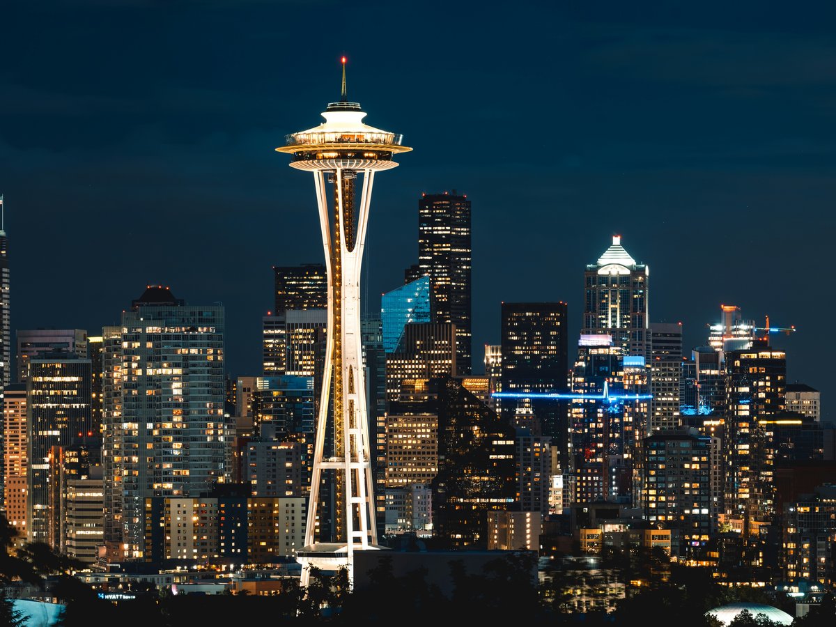
Seattle's free layer is mostly civic (parks, plazas, and one arboretum run by the University of Washington) and it rewards the visitor willing to walk between them rather than pay for a single ticketed anchor. The twelve below are all mapped and municipally documented, from a hillside park on 12th Avenue South to a downtown plaza half a block from the monorail. Some are green (arboretums, oldest-in-the-city commons, waterfront lawns); others are hard-surface (a lidded freeway park, a cobbled square in the old commercial core, a bus-stop-scale plaza). Together they trace the shape of the city more honestly than any paid attraction: where the money went, where the neighborhoods hardened, where the water is. This list is for the traveler who wants to spend a Saturday outside without buying a wristband, and for the resident showing a visitor around who is tired of defaulting to the same three names. Rank order roughly follows how much of an afternoon each one holds; several are better as a stop than a destination, and the notes say so.
-
1 Dr. Jose Rizal Park
1007 12th Avenue SouthBeacon Hill ridge with a full downtown-and-stadiums panorama
From 1007 12th Avenue South, the ridge falls away west toward the stadium district and the working port: the view locals bring first-time visitors to instead of the Space Needle queue. Dr. Jose Rizal Park sits on the Beacon Hill edge in Seattle, Washington, mapped at coordinates 47.5925, -122.3181 and run by Seattle Parks with its own municipal page. The free ridge beats the paid observation deck, and on a clear evening it is not a close call. Bring a jacket (the wind off Elliott Bay finds this hill) and time the walk for the hour before sunset, when the container cranes catch the last of the light. Wikidata carries it as Q7339078 if you want to cross-check the boundary before you go.
Hours: Mo-Su 04:00-23:30
-
2 Seattle Center
Harrison Street, Seattle, WA 98109The civic campus under the monorail: free to wander, ticketed anchors optional
The fountain plaza at Seattle Center hums under the monorail track from mid-morning onward, and the whole 74-acre campus at 47.6225, -122.3525 is free to walk even when its ticketed anchors are not. Officially cataloged as an arts, educational, tourism and entertainment center in Seattle, Washington, with its own program calendar at seattlecenter.com, this is the piece of the city most travelers pay to enter and locals cross for free. Skip the ticketed observation deck on a first visit and use the grounds instead: the International Fountain, the shaded lawns behind the Armory, the sightlines up at the Needle from below. Wikidata entry Q3044487 confirms the boundary. Come on a festival weekend and the campus does the entertainment for you.
-
3 Washington Park Arboretum
230 acres of curated planting run by the university, free at the gate
Managed as an arboretum at the University of Washington, the grounds at 47.6370, -122.2960 are the closest thing Seattle has to a botanical estate, and admission is nothing. The public information line at +1-206-543-8800 will confirm hours and closures on the day, and the university's own site at botanicgardens.uw.edu/washington-park-arboretum carries the trail maps. Skip the paid conservatories elsewhere on a first trip: this collection is bigger, quieter, and free at the gate. Wikidata records the site as Q7972107. Go on a weekday morning and the paths belong to dog walkers and graduate students; the azalea way and the Pacific Connections meadow are the two loops worth making time for, and the second is genuinely underused.
Dates from 1934
-
4 Lake Union Park
1002 Valley Street, Seattle, WA 98109The south-end lawn where the seaplanes take off
The seaplanes take off in front of the south lawn at Lake Union Park, mapped at 47.6264, -122.3366, and the whole shoreline is free to sit on. This is a park in Seattle, Washington, with the municipal page at seattle.gov/parks/find/parks/lake-union-park carrying event listings when the wooden boat centre is running its weekend programme. Skip the ticketed harbour cruise: the south lawn gives you the same view, the same working-lake soundtrack, and the room to sit as long as you like. Wikidata Q6478207 confirms the boundary if you want to check before crossing town. Bring coffee, bring a book, and stay for a takeoff.
Dates from 2010
Hours: 04:00-23:30
-
5 Seattle Japanese Garden
Lake Washington Boulevard East, Seattle, WA 98112A curated Japanese garden inside the arboretum footprint
In the Madison Park neighborhood of Seattle, the Seattle Japanese Garden sits at 47.6292, -122.2960: close enough to the arboretum entrance that most visitors do both in one afternoon without realising they've walked between two separate collections. The garden keeps its own programme and hours at seattlejapanesegarden.org, worth checking before you go: it is not always free, and the point of listing it here is that on the days it is, it is the most composed piece of ground in the city. Skip the paid conservatories downtown and time this one for a weekday morning instead. Wikidata records the entity as Q7442119. Move slowly; the garden was designed to be read at walking pace.
-
6 Freeway Park
700 Seneca Street, Seattle, 98101The Brutalist lid over Interstate 5: a park built on top of a highway
Concrete blocks tumble down the terraces at Freeway Park, and the noise you hear underfoot at 47.6097, -122.3310 is Interstate 5 running beneath the slab: this is a park in Seattle, Washington, USA, built on a lid over the highway and one of the more architecturally serious pieces of civic ground in the country. Locals know it as a lunch spot from the surrounding office towers, and it empties out on weekends, which is when it is best. Wikidata carries it as Q5501246. Skip the manicured downtown plazas and come here instead; the fountains and split-level courtyards reward slow attention, and the Brutalist concrete has aged better than its reputation suggests. Go on a bright day so the shadows do their work.
Dates from 1976
-
7 Occidental Park
South Main Street, Seattle, WA 98104The cobbled Pioneer Square commons under the London plane trees
Cobblestones underfoot and London plane trees overhead: Occidental Park at 47.6000, -122.3329 is a park in Seattle in the oldest surviving piece of the commercial core, and the free chairs stacked at the edges are the giveaway that it is meant to be used, not just walked through. Locals eat lunch here on weekdays and cross it at speed on weekend nights; time your visit for the middle hours and the park is a genuine commons. Skip the paid Pioneer Square tour: sit on a bench for half an hour with a coffee and you will pick up the neighbourhood shape on your own. Wikidata records the entity as Q7075692. Bring cash for the food carts that sometimes set up along the north edge.
Hours: Mo-Su 06:00-22:00
-
8 Westlake Park
4th Avenue, Seattle, WA 98101The downtown plaza at the monorail's south terminus
Foot traffic pours through Westlake Park all day: the plaza at 47.6111, -122.3370 is a public plaza in Downtown Seattle, sitting under the south terminus of the monorail and functioning as the city's default meeting spot. This is not a destination on its own; treat it as a hinge between the retail core and the Center. Locals use it as a lunch bench and a rally ground in equal measure, and both uses are visible on any given weekday. Wikidata carries it as Q7988988. Skip the ticketed observation decks a block away and use the plaza as a free anchor instead: five minutes here tells you what kind of downtown Seattle has, which is the honest answer to a question most visitors don't quite know how to ask.
Hours: 06:00-22:00
-
9 McGraw Square
1801 Westlake Avenue, Seattle, WA 98121A small triangular plaza in downtown Seattle: a stop, not a destination
Foot traffic drifts through McGraw Square at 47.6130, -122.3376 on the way to somewhere else, and that is the honest way to use this small triangular plaza in Seattle, Washington, United States. Don't make a trip for it; combine it with the surrounding downtown blocks and you'll get the point in five minutes. Locals treat it as a pause between errands, and the statue at its centre gives the pause a focal point. Wikidata records the entity as Q21016048. Come through on a walk between Westlake and the Center rather than crossing town on purpose: the value of a plaza this size is that it exists at all in a downtown grid, not that it holds an afternoon. Bring a coffee and give it three minutes.
Dates from 1913
-
10 Waterfront Park
The elevated deck over Elliott Bay with the ferry sightlines
Wind rolls off Elliott Bay onto the deck at Waterfront Park, 47.6067, -122.3414, and the whole elevated span is free to walk: this is a park in Seattle, the piece of central shoreline the city has kept in public hands. Skip the paid harbour cruises; the deck itself gives you the ferry sightlines, the working-bay soundtrack, and the room to sit as long as the light holds. Locals come for the last hour before sunset, when the water reflects the western sky and the outbound ferry becomes a piece of choreography worth watching on its own. Wikidata carries it as Q7974088. Go at the top of the ferry hour: the arriving boat sets the pace of the whole promenade, and the gulls arrange themselves accordingly. Bring a jacket; the wind off the bay is real, and it is the point.
Hours: 07:00-22:00
-
11 Westlake Square
Stewart Street, Seattle, WA 98101The pocket plaza on the site of a former downtown comfort station
Rattling past on the monorail overhead, most visitors never notice Westlake Square at 47.6136, -122.3370: a park and site of former comfort station in Downtown Seattle, and one of the smaller pieces of public ground in the retail core. It is a stop, not a destination; treat it that way and it earns its place on a walking loop between the monorail terminus and the Center. Skip the ticketed indoor attractions on the block for a first pass. Locals cross it without registering it, which is its own kind of endorsement: a plaza that works is a plaza you don't have to notice. Wikidata records the entity as Q16903149. Combine it with Westlake Park a block south and you will have a clean, free downtown loop in under an hour.
Dates from 1917
-
12 Denny Park
The oldest park in the city: a genuine civic anchor in South Lake Union
Dogs rustle through the leaf litter at Denny Park most mornings, and the trees are old for a reason: this is the oldest park in Seattle, Washington, U.S., sitting at 47.6192, -122.3403 in the middle of what is now the tech-office district. Locals come here because it predates the neighbourhood by roughly a century and reads that way underfoot: a proper civic square, not a leftover parcel. Skip the corporate courtyards a block in any direction; the shade here is real and free. Wikidata carries it as Q5259218. Come on a weekday lunch hour and it will be full of office workers; come on a weekend morning and it will be almost empty, which is the better version. Combine with Lake Union Park to finish the walk at the water.
Dates from 1883
Hours: 04:00-23:30
Last verified by automated review (v1.7.0_section-4g-seattle-attractions-free-2026-05-15) on . What is automated review?