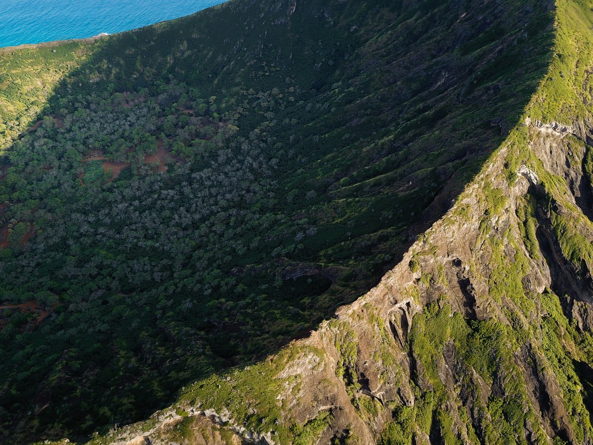
Big Island covers roughly 4,028 square miles, nearly twice the combined area of every other Hawaiian island. The terrain shifts from black lava shoreline along the Kona coast to the 13,796-foot summit of Mauna Kea, where an August dawn recently registered 12.6°C (about 55°F), a world apart from the warm beaches below. Hilo, on the eastern side, receives around 126 inches of rain a year. You can smell the damp earth and hear water running everywhere in town. The Kona side stays dry by comparison, with calm seas and the faint scent of coffee blossoms drifting through the upland farms above Kailua-Kona. Kilauea, one of the world's most active volcanoes, continues reshaping the island's southern flank. Saddle Road alone crosses arid lava desert, rolling ranch country near Waimea, and misty cloud forest between Mauna Kea and Mauna Loa. The island scores 7.8/10 for family friendliness (see the TTDI Family-Friendliness Index), partly because the pace of life tends to stay unhurried and the outdoor options run from wheelchair-accessible overlooks to technical summit ascents. Mind you, services thin out quickly beyond the two main towns, so a full gas tank and a cooler of water matter more here than on O'ahu.
Outdoor activities
-
Stargazing at Mauna Kea Visitor Information Station
The Visitor Information Station sits at about 9,200 feet, above much of the atmosphere's moisture and light pollution. Free public stargazing programs have historically run on clear evenings, with volunteer astronomers setting up telescopes pointed at Saturn's rings, the Orion Nebula, or whatever's prominent that season. The air feels thin and cold even in summer, often dipping into the mid-40s°F after dark. Bring layers, a headlamp with a red filter, and plan to arrive before sunset so your body can start adjusting to the altitude. Access rules for the upper mountain have been evolving under the Maunakea Stewardship and Oversight Authority, so check their current policies before driving up.
- Difficulty
- Easy (stargazing); Moderate (altitude adjustment)
- Duration
- 2-3 hours at the station
- Best season
- Year-round, though November through February tends to offer the darkest and clearest skies
-
Lava Viewing at Hawaii Volcanoes National Park
Kilauea's activity comes in cycles, and whether you'll see flowing lava depends on the volcano's mood during your visit. Even during quiet periods, steam rises from vents along Crater Rim Drive and the smell of sulfur hangs over the caldera. When the summit or rift zone is active, the orange glow against the night sky is visible from overlooks off Chain of Craters Road. The park charges $30 per vehicle for a 7-day pass. Worth noting, the landscape changes between visits, with new flows and collapses reshaping the terrain month to month.
- Difficulty
- Easy (overlook viewing); Moderate (longer walks to active flow areas)
- Duration
- Half day to full day
- Best season
- Year-round; drier months (May through September) make trail access more reliable
-
Horseback Riding in Waipio Valley
The valley floor sits about 900 feet below the lookout, accessible only by one of the steepest paved roads in the state. Several outfitters run guided rides along the black-sand beach and through taro farms, where the river braids across flat ground and the air smells like wet vegetation. You'll hear the horse's hooves, the surf, and birdsong echoing off 2,000-foot cliffs. Most rides last about 2 hours and don't require prior experience. The valley is sacred in Hawaiian tradition, so follow your guide's direction on where to go.
- Difficulty
- Easy to moderate (guided rides)
- Duration
- 2-2.5 hours
- Best season
- Summer months tend to be drier; the valley can flood after heavy rains on the Hamakua Coast
-
Cycling the Kohala Mountain Road
Highway 250 runs about 20 miles between Hawi and Waimea through open ranch country, climbing to around 3,500 feet at its highest point before dropping into the cool grasslands of Waimea. The road is paved, two lanes, and carries relatively light traffic outside commute hours. On clear mornings, views from the upper sections extend across Kohala pastures to the ocean. You'll feel the temperature shift as you gain altitude, from warm and breezy in Hawi to noticeably cooler near the road's summit. Bike rentals are available in Kailua-Kona, about 40 minutes south of Hawi.
- Difficulty
- Moderate to strenuous (sustained climbing)
- Duration
- 3-5 hours for the full route
- Best season
- Year-round; mornings tend to be clearest before afternoon clouds build over the mountain
-
Zip-lining Over the Umauma River
The North Hilo stretch of the Hamakua Coast has a few zip-line operations set above river gorges and waterfalls. The Umauma area, about 16 miles north of Hilo, runs lines that cross above a series of cascading falls surrounded by dense tropical canopy. You'll hear the water rushing below and feel mist on the longer traverses. Most courses include 7 to 9 lines and take about 2 to 3 hours, with weight and age restrictions that vary by operator. The rainforest setting is thick, humid, and loud with birdsong.
- Difficulty
- Easy to moderate (guided, no hiking required)
- Duration
- 2-3 hours
- Best season
- Year-round; drier months reduce the chance of weather delays
-
Exploring Kaumana Caves
This lava tube sits about 2 miles up Kaumana Drive from downtown Hilo. A staircase descends into the cave entrance, where the temperature drops noticeably and the air goes still. The tube extends in two directions, with the left branch generally more accessible. The floor is rough, uneven a'a lava, slippery in spots from moisture. Bring your own headlamp and wear closed-toe shoes with good grip. There are no guides on site and no fees. The cave formed during an 1881 Mauna Loa eruption that nearly reached Hilo.
- Difficulty
- Moderate (uneven footing, complete darkness)
- Duration
- 30-60 minutes
- Best season
- Year-round; the cave sits underground, so surface weather has little effect
Day hikes
-
Kilauea Iki Trail
The trail begins at the Kilauea Iki Overlook parking area in Hawaii Volcanoes National Park and descends through a canopy of ohia lehua and tree ferns into the Kilauea Iki crater. You'll cross the crater floor, which filled with lava during a 1959 eruption that sent fountains nearly 1,900 feet into the air. The surface is hardened pahoehoe, still warm in spots, with steam seeping through cracks. The loop covers about 4 miles with roughly 400 feet of elevation change. On the crater floor, the air is noticeably warmer and the sulfur smell sharpens near active vents.
- Difficulty
- Moderate
- Duration
- 2-3 hours
- Best season
- Year-round; May through September means less slippery footing on the forested descent
-
Pololu Valley Trail
The trail drops from the Pololu Valley Lookout at the northern tip of the Kohala Coast to a black-sand beach. The descent is steep, about half a mile one way with around 400 feet of elevation change. Footing is uneven, a mix of packed dirt and exposed roots. At the bottom, the beach is wild and usually empty, backed by ironwood trees. The surf tends to be too rough for swimming. Wind can be strong at the lookout. You'll find the trailhead about 9 miles past Hawi on Highway 270.
- Difficulty
- Moderate (steep descent and return climb)
- Duration
- 45 minutes to 1.5 hours round trip, depending on time at the beach
- Best season
- Year-round; mornings before 10 AM tend to have clearest light and fewer people
-
Kaawaloa Trail to the Captain Cook Monument
This trail descends roughly 1,300 feet over about 1.75 miles from the trailhead off Napoopoo Road to the shore of Kealakekua Bay. A white obelisk marks the spot where Captain James Cook was killed in February 1779. The terrain is dry, exposed scrubland with kiawe trees offering minimal shade, and the sun radiates off the bare rock on the climb back. The descent takes about an hour, the return closer to 2. The reward at the bottom is the snorkeling, which is likely the best shore access on the island, with clear water and spinner dolphins that frequent the bay. Carry at least 2 liters of water per person.
- Difficulty
- Strenuous (steep, exposed, hot on return)
- Duration
- 3-4 hours round trip including swim time
- Best season
- Year-round; morning starts are cooler and the bay is calmer before afternoon winds build
-
Mauna Kea Summit Trail (Humuula Trail)
The trail begins near the Visitor Information Station on Mauna Kea Access Road and climbs about 4,600 feet over roughly 6 miles to the summit, crossing cinder desert, alpine scrubland, and eventually barren volcanic rock above the cloud line. The round trip covers approximately 12 miles. Altitude is the real challenge. Headaches, nausea, and shortness of breath are common above 10,000 feet, and some hikers turn back well before the top. Temperatures near the summit can drop below freezing even in summer, and the thin atmosphere makes sunburn faster than you'd expect. Pack warm layers, high-SPF sunscreen, at least 3 liters of water, and calorie-dense snacks.
- Difficulty
- Very strenuous (altitude, distance, exposure)
- Duration
- 7-10 hours
- Best season
- June through September for the best weather window; winter brings snow and ice above 11,000 feet
-
Puu Loa Petroglyphs Trail
A flat, easy walk across a pahoehoe lava field in Hawaii Volcanoes National Park leads to one of the largest petroglyph fields in all of Hawaii. The site contains thousands of carvings made over several centuries by Native Hawaiian travelers passing between the coast and uplands. A boardwalk protects the most concentrated area, but petroglyphs appear scattered across the surrounding rock as well. The trailhead sits along Chain of Craters Road, about 20 miles from the park entrance. The lava surface reflects heat, so morning visits are more comfortable. You can feel the warmth radiating through your shoe soles by midday.
- Difficulty
- Easy (flat, well-marked)
- Duration
- 45 minutes to 1 hour round trip
- Best season
- Year-round; early mornings avoid the heat bouncing off the lava field
Water activities
-
Snorkeling at Two Step (Honaunau Bay)
Two natural lava steps at the water's edge serve as the entry point for what might be the most accessible shore snorkeling on the island. The reef starts within a few feet of the entry, with coral formations, tropical fish, and the occasional hawksbill turtle gliding past. Visibility tends to run 50 to 80 feet on calm mornings. The bay sits next to Puuhonua o Honaunau National Historical Park on the South Kona coast. Parking fills up by mid-morning on weekends, so arriving before 8 AM gives you the best shot at a spot and the calmest water. Bring reef-safe sunscreen and your own gear.
- Difficulty
- Easy to moderate (rocky entry, no sandy beach)
- Duration
- 1-2 hours
- Best season
- Year-round; calmest conditions from April through October
-
Kayaking and Snorkeling at Kealakekua Bay
Paddling from Napoopoo to the Captain Cook Monument on the far side of the bay covers about 1 mile of open water. The bay is a marine life conservation district, with dense coral cover and large schools of yellow tang along the monument's shore. Several Kona-based outfitters run guided tours that bundle the paddle and snorkel time. Conditions are generally glassy in the morning, but wind chop can build by early afternoon. Independent kayak access typically requires a permit reserved through the state in advance. The water clarity near the monument is consistently excellent, often 60-plus feet of visibility.
- Difficulty
- Easy to moderate (open water crossing)
- Duration
- 3-4 hours for a guided trip
- Best season
- Year-round; morning departures before trade winds build
-
Manta Ray Night Snorkel off Keauhou Bay
Tour operators anchor boats off the Keauhou coast at dusk, lower underwater lights that attract plankton, and manta rays with wingspans reaching 10 to 12 feet glide in to feed directly below you. You float on the surface holding a lit board while the mantas loop and barrel-roll through the plankton cloud, sometimes passing within arm's reach. The water stays warm, around 78 to 80°F even after dark, but the whole experience has a strange, slightly eerie quality. Most tours last about 2 hours including transit and briefing. Sightings are not guaranteed, though historical success rates have been above 90%.
- Difficulty
- Easy (floating on the surface, life vest provided)
- Duration
- 2 hours
- Best season
- Year-round; manta sightings are not strongly seasonal
-
Swimming at Hapuna Beach State Recreation Area
Hapuna Beach is a wide crescent of white sand along the Kohala Coast, about 30 miles north of Kailua-Kona. The beach stretches roughly half a mile and the water is typically clear turquoise over a sandy bottom. Summer months bring calm surf suited to swimming, while winter swells produce a strong shore break and dangerous currents that catch people off guard. Lifeguards are on duty. Facilities include restrooms, showers, and a shaded picnic area. A state parking fee applies for non-resident vehicles.
- Difficulty
- Easy (summer); Moderate to hazardous (winter shore break)
- Duration
- Open
- Best season
- May through September for swimming; winter for watching the surf from the sand
-
Deep-sea Fishing out of Honokohau Harbor
The Kona coast drops to depths exceeding 6,000 feet within a mile of the shoreline, which is why the area has a long-standing reputation as one of the world's premier blue marlin fisheries. Charter boats depart from Honokohau Harbor, between Kailua-Kona and the airport, for half-day or full-day trips targeting Pacific blue marlin, yellowfin tuna, mahimahi, and ono. The International Billfish Tournament has been running here since 1959. Expect to pay roughly $200 to $300 per person for a shared half-day trip, with private charters considerably more. The smell of diesel and bait at the harbor at 6 AM is part of the ritual.
- Difficulty
- Easy (charter crew handles rigging and boat)
- Duration
- Half day (4 hours) or full day (8 hours)
- Best season
- June through September tends to produce the largest marlin; smaller game fish bite year-round
Parks & gardens
-
Liliuokalani Gardens
FreeThis 24-acre Japanese garden sits on Banyan Drive in Hilo, overlooking Hilo Bay and Coconut Island. It was dedicated in 1917 and named for Queen Liliuokalani. Stone lanterns, arched bridges, pagodas, and koi ponds spread across manicured grounds shaded by mature banyan trees. The garden is quiet on weekday mornings, with the sound of gentle waves from the bay carrying through the grounds. It feels more like a neighborhood retreat than a tourist attraction.
Highlights: Stone bridges and pagodas, koi ponds, views of Coconut Island and Hilo Bay, mature banyan canopy
-
Hawaii Tropical Bioreserve and Garden
Located along scenic Onomea Bay about 7 miles north of Hilo, this 17-acre garden drops through a steep valley to the ocean. The collection includes over 2,000 species of tropical plants from around the world. A paved boardwalk winds through the canopy, past waterfalls, and along a stream bed. The air under the tree cover is thick and humid, and the smell of ginger and plumeria follows you along the lower trail. Admission runs around $25 for adults.
Highlights: Three waterfalls along the valley trail, Onomea Bay overlook, orchid collection, palm forest with over 200 species
-
Akaka Falls State Park
A short 0.4-mile paved loop through dense tropical vegetation leads to views of two waterfalls. Akaka Falls drops 442 feet into a gorge choked with monstera and bamboo. Kahuna Falls, visible from a second overlook along the same loop, is smaller but still worth the stop. The park sits about 11 miles north of Hilo off the Hawaii Belt Road. The trail is accessible and takes around 20 to 30 minutes. A state park vehicle fee and per-person entry fee apply.
Highlights: 442-foot Akaka Falls, Kahuna Falls overlook, giant bamboo groves and tree ferns along the loop
-
Wailoa River State Recreation Area
FreeA 43-acre park on the shore of Waiakea Pond in Hilo, connected to the bay by the Wailoa River. The park includes a war memorial, a tsunami memorial, and open lawns under large trees where locals fish and picnic. It feels like a neighborhood park, and that's part of the appeal. The pond holds tilapia and mullet, and you'll likely see people casting from the banks in the early morning light. Egrets stalk the shallows near the river mouth.
Highlights: King Kamehameha statue, Vietnam War memorial, Wailoa Center gallery, fishing from the pond banks
Practical tips
- Sun protection
- The UV index at sea level on Big Island regularly exceeds 11 during midday, and exposure intensifies at elevation. Wear SPF 50+ reef-safe sunscreen and reapply every 90 minutes. A wide-brimmed hat and UPF-rated shirt will do more than sunscreen alone on long hikes. The reflected heat off lava rock intensifies things further, so cover exposed skin even when you feel a breeze.
- Hydration on trails
- Most Big Island trails have no reliable water sources. The lava landscape is porous, so streams are rare outside the wet Hilo side. Plan on carrying at least 1 liter per hour for strenuous hikes. For exposed routes like the Captain Cook descent or the summit climb, 3 liters per person is the minimum. Fill up in town before heading out, as gas station stores on remote stretches may carry limited supplies.
- Footwear for lava terrain
- A'a lava is essentially sharp volcanic glass. Open-toed shoes on any lava trail will shred your feet and ankles. Sturdy closed-toe hiking shoes with good ankle support are worth the weight. For beach-to-reef snorkeling entries like Two Step, hard-soled reef walkers protect against sea urchins and coral cuts.
- Altitude acclimatization at Mauna Kea
- Ascending from sea level to the summit in a few hours is a genuine altitude risk. Spend at least 30 minutes acclimatizing at the Visitor Information Station before going higher. Anyone with heart or respiratory conditions should consult a doctor before attempting the climb. Common symptoms include headache, nausea, and disorientation. Descend immediately if they worsen.
- Vog awareness
- Volcanic smog, locally called vog, forms when sulfur dioxide from Kilauea reacts with sunlight and moisture. It tends to settle on the leeward Kona side when trade winds blow, creating hazy skies and a faint sulfur taste in the air. People with asthma or respiratory sensitivities should carry their medication and check the Hawaii Interagency Vog Dashboard before planning long outdoor days on the western coast.
- Ocean current safety
- North and west-facing beaches can produce dangerous shore break and rip currents during winter swells from November through February. Always check the Hawaii Beach Safety website for current conditions at your destination. Swim at lifeguarded beaches when possible. Protected bays along the south and west coasts tend to be calmer, but respect posted warnings even when the surface looks benign.
FAQ
When is the best time to visit Big Island for outdoor activities?
May through September generally offers drier weather on both sides of the island, calmer ocean conditions along the Kona coast, and the most reliable access to higher-elevation trails. The Hilo side sees rain year-round, though summer storms tend to be shorter and more predictable. Winter brings larger surf on the north and west shores, which limits swimming but draws experienced surfers. Humpback whale season peaks from January through March if you're interested in boat-based wildlife watching.
Do I need a 4WD vehicle on Big Island?
For most activities, a standard rental car handles the main highways and park roads fine. You'll want 4WD for the upper section of Mauna Kea Access Road and for the road down into Waipio Valley, which most standard vehicles shouldn't attempt. Many rental companies prohibit their cars on both roads, so check your contract before heading out. Saddle Road, now called Daniel K. Inouye Highway, is fully paved and no longer requires 4WD despite what some older guidebooks still claim.
Can I currently see active lava flowing on Big Island?
Kilauea erupts intermittently, and surface flows depend entirely on the volcano's current phase. Hawaii Volcanoes National Park posts daily eruption updates through the USGS Hawaiian Volcano Observatory website. Even during quiet periods, steam vents, sulfur banks, and the scale of past lava flows make the park worth a full day. When eruptions are active, the park sometimes extends evening hours so visitors can see the glow after dark.
Is Big Island safe for solo travelers?
Big Island scores 7.8/10 for solo-traveler safety (see the TTDI Solo-Safety Index). The main towns feel relaxed, and most trailheads see regular foot traffic during daylight hours. Standard precautions apply. Don't leave valuables visible in parked cars, especially at remote trailheads along Chain of Craters Road or the Hamakua Coast. If hiking alone, share your itinerary with someone and carry a charged phone, though cell coverage drops off in remote areas.
How welcoming is Big Island for LGBTQ+ visitors?
Big Island scores 8.5/10 for LGBTQ+ friendliness (sourced from TTDI's editorial rubric). Hawaii has strong statewide anti-discrimination protections, and the culture on Big Island tends to be live-and-let-live. Kailua-Kona and Hilo both have welcoming food and social scenes, though the island doesn't have the concentrated nightlife of Honolulu's Waikiki district. That said, the outdoor community here skews welcoming and low-key regardless of background.
What trail works best for someone who is not an experienced hiker?
The Puu Loa Petroglyphs Trail in Hawaii Volcanoes National Park is flat, well-marked, and about 1.5 miles round trip across hardened lava. The Akaka Falls loop north of Hilo is paved, under half a mile, and delivers a tall waterfall view with minimal effort. Both are manageable in regular sneakers, though proper hiking shoes give better grip on uneven surfaces. The petroglyphs trail gets hot by late morning, so an early start is more comfortable.
Last verified by automated review (v1.7.2) on . What is automated review?