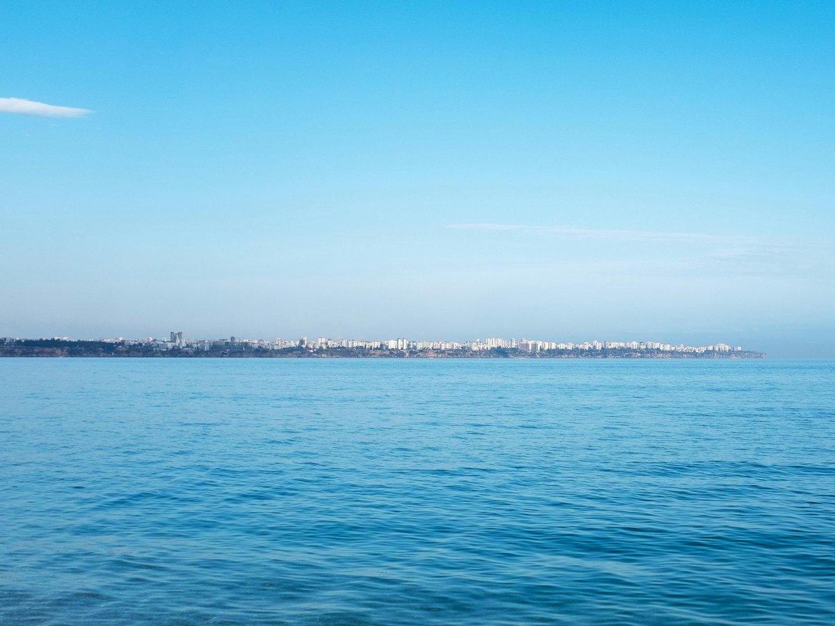
Antalya sits where the western Taurus Mountains drop roughly 2,300 metres into the Mediterranean over a distance of about 30 kilometres. That compression of altitude is the whole story of outdoor life here. You can swim at Konyaaltı Beach at sea level, drive 40 minutes to Saklıkent on the Beydağları range, and find yourself in pine forest with snow patches in April. The city itself sprawls along 50-odd kilometres of coastline between Lara in the east and Kemer in the southwest, with cliff-backed beaches, a couple of waterfalls inside the city limits, and the ancient port of Kaleiçi tucked into the old town. Summer heat is real, regularly north of 35°C from mid-June through September, which tends to push serious hiking into spring and autumn. But the water stays swimmable from May well into November, and the Taurus foothills catch enough breeze to make winter walks genuinely pleasant. Mind you, Antalya gets about 300 days of sunshine a year, so whenever you show up, you'll likely be outdoors more than you planned.
Outdoor activities
-
Whitewater Rafting on the Köprüçay River
Köprülü Canyon National Park lies about 90 kilometres northeast of Antalya, and the Köprüçay River runs through a limestone gorge that reaches 400 metres deep in places. The standard commercial rafting run covers roughly 14 kilometres with Class 2-3 rapids, passing under the 2nd-century Oluk Bridge partway through. Water temperature sits around 8-10°C year-round since it's spring-fed, so you'll feel it even in August. Several operators in Antalya run full-day trips including transport, lunch by the river, and gear. The run itself takes about 2 to 3 hours on the water.
- Difficulty
- Moderate (Class 2-3 rapids)
- Duration
- Full day including transport, 2-3 hours on the water
- Best season
- April through October, though May and June tend to have the strongest flow
-
Paragliding from Tahtalı Dağı (Mount Olympos)
Tahtalı Dağı rises to 2,365 metres above Kemer, roughly 60 kilometres southwest of central Antalya. Tandem paragliding launches happen from near the summit, and you fly over pine forests toward the coast, landing on the beach at Tekirova or Çamyuva after 20 to 40 minutes depending on thermals. The Olympos Teleferik cable car handles the ascent. On a clear day, you can see the curve of the Gulf of Antalya and the outline of the Beydağları range stretching northwest. Wind conditions are most reliable from May through October.
- Difficulty
- None for tandem passengers, operator handles the flying
- Duration
- 20-40 minutes flight time, plus cable car and transport
- Best season
- May through October for consistent thermals
-
Scuba Diving off Kemer and Kaş
The Mediterranean coast near Antalya has visibility that often reaches 25-30 metres between May and November. Dive sites off Kemer, about 45 kilometres southwest, include several reef walls and a few small wrecks at 15-30 metre depths. The water around Üç Adalar (Three Islands) near Tekirova tends to have grouper, moray eels, and the occasional loggerhead turtle. Water temperature ranges from around 17°C in winter to 28°C in late summer. PADI and SSI centres operate out of Kemer harbour and along Konyaaltı.
- Difficulty
- Beginner to advanced depending on site
- Duration
- Half-day for a 2-dive trip
- Best season
- May through November for warmest water and best visibility
-
Rock Climbing at Geyikbayırı
Geyikbayırı village sits about 25 kilometres northwest of Antalya at around 600 metres elevation, and it's become one of Turkey's most developed sport climbing areas. Over 900 bolted routes spread across limestone crags in a pine-forested valley. Grades range from 4a to 8c on the French scale, with a heavy concentration in the 5c to 7a range. The rock tends to be sharp featured with tufas and pockets. Several small pensions in the village cater to climbers, and a few have basic camping. The south-facing walls get too hot in summer, but the shaded sectors and north-facing crags stay climbable.
- Difficulty
- All levels, with most routes graded 5c to 7a (French)
- Duration
- Day trip or multi-day stays
- Best season
- October through April. Summer is too hot for south-facing walls, though shaded sectors work.
-
Mountain Biking in the Beydağları Range
Forest roads and singletrack in the Beydağları Coastal National Park, which stretches from Antalya southwest toward Kemer, offer routes from easy gravel grinds to steep technical descents through red pine forest. A popular loop starts near Göynük Canyon, climbs about 700 metres on forest road, and descends on narrower trails back toward the coast. Total distance runs around 30-35 kilometres. Rental bikes are available in Kemer and at a few shops along Konyaaltı, though serious riders should bring their own. Trail markings are sparse, so downloading GPX tracks beforehand is worth the effort.
- Difficulty
- Moderate to strenuous depending on route choice and elevation gain
- Duration
- 3-6 hours depending on route
- Best season
- October through May. Summer heat above 35°C makes serious climbing dangerous.
-
Canyoning at Göynük Canyon
Göynük Canyon cuts into the Beydağları range about 45 kilometres southwest of Antalya near the resort town of the same name. The lower canyon is a straightforward walk through shallow water between high walls, suitable for families. The upper canyon requires swimming through cold pools, scrambling over boulders, and some short rappels of 5-8 metres. Water depth varies by season but you'll be chest-deep in places by spring. Several local operators provide wetsuits, helmets, and harnesses for the upper section. The canyon walls narrow to about 2 metres in a few spots, with the limestone towering maybe 100 metres above.
- Difficulty
- Lower canyon easy, upper canyon moderate-strenuous (requires swimming and rappelling)
- Duration
- 2-3 hours for upper canyon route
- Best season
- May through October. Water levels can be high and cold in early spring.
Day hikes
-
Termessos Ancient City Trail
Termessos sits at about 1,000 metres elevation in the Güllük Dağı-Termessos National Park, roughly 30 kilometres northwest of central Antalya. The hike from the park entrance gate to the upper ruins gains about 400 metres over maybe 4 kilometres of rocky, uneven path. You pass through thick pine forest before emerging at the theatre, which perches on a cliff edge with a view down a long valley. Alexander the Great reportedly decided this city wasn't worth besieging, and when you see the terrain you'll understand why. The necropolis, scattered with toppled stone sarcophagi, lies further uphill. Rock tombs and cisterns are everywhere if you poke around the overgrown side paths. Summer heat makes this one miserable after 10am, so an early start matters.
- Difficulty
- Moderate. Uneven rocky terrain, 400m elevation gain, some route-finding needed in the upper ruins.
- Duration
- 3-5 hours round trip depending on how much you explore the ruins
- Best season
- March through May, and October through November. Summer mornings work if you start by 7am.
-
Lycian Way: Hisarçandır to Antalya Section
The Lycian Way (Likya Yolu) passes through Hisarçandır village, about 20 kilometres west of Antalya at roughly 1,000 metres elevation. This section descends through pine forest and Mediterranean scrubland toward the coast, eventually reaching the outskirts of Antalya. The trail is waymarked with the standard red and white blazes, though some sections have faded and you might need to backtrack once or twice. Total distance is around 15-18 kilometres one way with about 1,000 metres of descent. The forest smells of resin and thyme, and in spring the wildflowers along the open sections are genuinely thick. A dolmuş from Antalya to Hisarçandır runs a few times daily, making it logistically simple as a point-to-point.
- Difficulty
- Moderate-strenuous. Long descent is hard on the knees, some sections overgrown, waymarks occasionally unclear.
- Duration
- 5-7 hours one way
- Best season
- March through May, and October through November. Avoid July-August, the lower exposed sections are punishing.
-
Çıralı to Yanartaş (Chimera) Night Hike
From the small beach village of Çıralı, about 80 kilometres southwest of Antalya, a marked trail climbs roughly 250 metres over 3 kilometres to the Yanartaş site where natural gas seeps through the rock and burns in small, permanent flames. The fires have been alight for at least 2,500 years and were likely the origin of the Chimera myth. The hike is best done at dusk so you arrive as darkness falls and the flames become visible against the rock. The path is well-maintained stone steps for the first half, then rougher terrain. Bring a headlamp for the descent. The flames themselves are scattered across a rocky hillside, some knee-high, some small enough to heat a tea kettle, which people do.
- Difficulty
- Easy to moderate. Well-marked trail, 250m elevation gain, stone steps for much of the route.
- Duration
- 2-3 hours round trip, ideally timed for sunset arrival
- Best season
- Year-round, but spring and autumn evenings are most comfortable. Summer nights still warm at 25°C.
-
Güver Canyon (Güver Uçurumu)
Güver Canyon lies about 25 kilometres north of Antalya centre, near the Düzlerçamı area of the Beydağları range. The canyon itself drops maybe 100-115 metres, and a marked trail follows the rim for several kilometres through pine forest. The terrain is mostly flat along the rim path, making it one of the easier walks near Antalya, though the unfenced canyon edge demands attention. A separate trail drops into the canyon floor, which is steeper and requires better footwear. The forest up here feels distinctly different from the coast, cooler by 5-8°C even in summer, with taller pines and less scrubby undergrowth. There's a small picnic area near the main viewpoint.
- Difficulty
- Easy along the rim trail, moderate if you descend into the canyon.
- Duration
- 2-3 hours for the rim walk, add 2 hours for the canyon floor descent
- Best season
- Year-round. The elevation keeps it cooler in summer, and winter rarely brings snow below 1,200m here.
Water activities
-
Sea Kayaking along the Konyaaltı and Kaleiçi Coast
Paddling east from Konyaaltı Beach toward the old harbour of Kaleiçi takes you along the base of the cliff that holds up the old city. The water is deep and clear close to shore here, often that transparent teal colour where you can see the bottom at 5-6 metres. A few small sea caves and rocky inlets appear along the cliff face. Morning paddles tend to be calmer before the afternoon onshore breeze picks up. Several outfitters along Konyaaltı rent sit-on-top kayaks for about 200-400 TL per half day, and a couple run guided tours that loop around to the Roman harbour. The water stays warm enough for comfortable paddling from mid-May through October.
- Difficulty
- Easy to moderate depending on wind conditions
- Duration
- 2-4 hours
- Best season
- May through October. Morning sessions for calmest water.
-
Swimming at Phaselis Coves
The ancient Lycian-Roman city of Phaselis occupies a pine-forested headland about 60 kilometres southwest of Antalya, with three small bays. The north harbour beach has coarser gravel and tends to be the emptiest. The main harbour beach, tucked between the ancient walls, has the warmest and calmest water. The south beach faces open sea and picks up more swell. Pine trees come right down to the shoreline, so you can swim and then dry off in genuine shade, which is uncommon on the Antalya coast. The entry fee for the archaeological site (around 200 TL as of 2025) includes beach access. Water temperature hits 25-28°C by July.
- Difficulty
- Easy. Sheltered bays with gentle entry.
- Duration
- Half day to full day
- Best season
- May through October for swimming. June through September for warmest water.
-
Rafting and Swimming on the Köprüçay River
Beyond the commercial rafting section of Köprülü Canyon, there are calmer stretches of the Köprüçay upstream where you can swim in deep, cold pools between the rapids. The water runs a milky turquoise from dissolved limestone, and the temperature hovers around 8-10°C even in August, which is a shock after the 38°C air temperature. Several riverside restaurants along the canyon road let you swim from their platforms for the price of lunch. The combination of ice-cold river water and a plate of alabalık (trout) grilled over charcoal at one of these spots is one of the better afternoons you can have near Antalya.
- Difficulty
- Easy for swimming at riverside restaurants, moderate for independent river exploration
- Duration
- Half day to full day with transport
- Best season
- May through September. River flow is strongest in spring.
-
Stand-Up Paddleboarding at Olympos Beach
Olympos beach stretches for about 3 kilometres at the mouth of the Olympos valley, backed by the ruins of the ancient Lycian city and thick oleander groves. The eastern end near the ruins tends to be calmer and shallower, good for SUP beginners. Rental boards are available from a couple of operators at the beach entrance for around 150-250 TL per hour. The Olympos stream enters the sea at the western end, and paddling upstream into the valley for a few hundred metres is possible when water levels allow. The beach faces east, so morning light on the water is particularly good and the afternoon wind shadow from Musa Dağı (which rises to about 2,300m behind the valley) keeps conditions manageable later than at more exposed beaches.
- Difficulty
- Easy in calm conditions, moderate when afternoon wind picks up
- Duration
- 1-3 hours
- Best season
- May through October. Mornings are calmest.
-
Boat Trip to Suluada Island
Suluada sits about 6 kilometres off the coast near Adrasan, roughly 100 kilometres southwest of Antalya. Tour boats depart from Adrasan harbour and the trip takes about 30-40 minutes each way. The island has several small coves with water that's genuinely turquoise over white sand, which is unusual for this stretch of coast where most beaches are pebble. There's no infrastructure on the island, so bring everything you need. Snorkelling around the rocky points is decent, with sea urchins, small wrasse, and the occasional octopus in the shallows. Day trip boats typically cost 500-800 TL per person including a basic lunch. The island gets crowded in July and August, so June or September is the better bet.
- Difficulty
- Easy. Boat-accessed swimming and snorkelling.
- Duration
- Full day
- Best season
- June and September for fewer crowds. May through October for swimmable water.
Parks & gardens
-
Karaalioğlu Park
FreeThis long, narrow park runs along the cliff edge south of Kaleiçi for about a kilometre, with views straight down to the sea maybe 30-40 metres below. Old stone paths wind between mature pine trees and flower beds that the municipality replants seasonally. The park dates to the early Republic period and still has a quiet civic dignity to it, the kind of green space where retired couples sit on benches reading Hürriyet and cats sleep on warm stone walls. At the far end stands the Hıdırlık Tower, a 2nd-century Roman structure that may have been a lighthouse or a tomb, depending on which local you ask.
Highlights: Hıdırlık Tower at the southern end, cliff-edge walking paths with sea views, mature Mediterranean pine canopy, seasonal flower plantings
-
Upper Düden Waterfall Park (Düdenbaşı)
The Upper Düden Waterfall sits about 10 kilometres northeast of the city centre in a park built around the point where the Düden River drops into a cave system. The falls are roughly 15 metres high. Behind the main cascade there's a cave you can walk into, which puts you directly behind the curtain of water. The spray keeps the temperature noticeably cooler than the surrounding city, and on summer weekends local families pack the picnic tables. The park has tea gardens where you'll pay 30-40 TL for a çay and simit. Worth noting that the Lower Düden Waterfall, where the same river drops 40 metres directly into the sea at Lara, is a separate site about 15 kilometres south.
Highlights: Walk-behind cave passage, the falls themselves (roughly 15 metres), tea gardens, connected walking paths along the river channel
-
Atatürk Park (Konyaaltı)
FreeA strip of parkland running along the back of Konyaaltı Beach, between the road and the pebble shore. Palm-lined paths, a few playgrounds, exercise stations, and a long jogging track that locals use heavily in the early morning and after sunset. The park connects to the Konyaaltı Beach Park complex at its eastern end, where you'll find restaurants and the Antalya Aquarium. It's not a destination park in the way Karaalioğlu is, but it's the social spine of Konyaaltı neighbourhood, and in the cooler months the whole seafront promenade fills with walkers, runners, and families on rental bikes.
Highlights: Seafront promenade and jogging track, beach access points, evening social atmosphere, views toward the Beydağları range behind the city
-
Dokuma Park
FreeBuilt on the site of the old Antalya textile factory (Dokuma Fabrikası) in the Kepez district, this park opened after a 2018 renovation and now covers about 50,000 square metres. It's more of a civic commons than a garden. There's a public library, exhibition spaces in the old factory buildings, playgrounds, and open lawns. The industrial architecture has been kept intact in places, so you get this interesting mix of brick factory walls and new landscaping. Locals from Kepez use it as a daily outdoor room, which gives it a neighbourhood feel that the tourist-facing parks along the coast don't quite have.
Highlights: Restored industrial architecture from the textile factory, public library, large open lawns, community events and weekend markets
-
Kepez Kent Ormanı (Kepez Urban Forest)
FreeA forested hillside park on the northern edge of the city in Kepez district, covering several hundred hectares of Mediterranean maquis and pine woodland. Gravel paths loop through the trees, and there are picnic areas with built-in barbecue spots that fill up on weekends. The elevation gives you a vantage point over the sprawl of Antalya stretching toward the sea. It's rougher and less manicured than the coastal parks, which is part of the appeal. Bird activity is noticeable in spring, particularly around the small seasonal creek beds.
Highlights: Pine and maquis woodland walks, elevated views over Antalya, picnic and barbecue areas, spring birdwatching along creek beds
Practical tips
- Sun Protection
- Antalya's UV index reaches 10-11 in summer, which means sunburn in 15-20 minutes for fair skin. Factor 50 sunscreen, a wide-brimmed hat, and a long-sleeve UV shirt are not optional for any activity longer than an hour. The reflected glare off limestone and sea is worse than it feels. Reapply sunscreen after swimming, even if the bottle says water-resistant. Pharmacies in Antalya stock Avène and La Roche-Posay, which tend to hold up better in heavy sweat than some cheaper brands.
- Water and Hydration
- Carry at least 2 litres per person for any hike over 2 hours, and 3 litres if you're heading to Termessos or the Lycian Way sections in warm months. Tap water in Antalya is technically treated but most locals drink bottled or filtered. Şok and BİM discount markets sell 1.5L bottles for about 8-10 TL. On longer hikes, there are no reliable water sources above the villages, so carry everything you need. Electrolyte sachets from the pharmacy (look for Berocca or local equivalents) are worth packing for sweaty summer days.
- Footwear and Gear
- The Lycian Way and Termessos trails are rocky limestone with loose scree in sections, so proper hiking boots with ankle support matter. Trail runners work on the flatter coastal paths and the Güver Canyon rim walk. For canyoning at Göynük, operators provide neoprene boots, but bring quick-dry shorts and a synthetic top, not cotton. If you're climbing at Geyikbayırı, the nearest gear shop with a decent rack selection is in Antalya centre near the tram line. Decathlon in the Terracity or Deepo shopping centres stocks basic hiking and water sport gear at reasonable Turkish prices.
- Getting to Trailheads
- Dolmuş (shared minibus) services connect Antalya's central otogar to Hisarçandır, Kemer, Göynük, and Çıralı, typically running every 30-90 minutes depending on the route. Termessos has no public transport to the park gate, so you'll need a rental car or taxi (expect 300-500 TL each way from the city centre, negotiable). For Köprülü Canyon, most rafting operators include Antalya pickup in the price. Rental cars start around 800-1200 TL per day in summer. The Antalya-Kemer highway (D400) is well-maintained, but the mountain roads above 800m narrow to single-lane in places.
- Trail Conditions and Timing
- Start early. By 10am in summer the temperature on exposed trails can hit 30°C, and by noon the stone paths at Termessos radiate heat like an oven. Spring (March-May) and autumn (October-November) are the real hiking seasons. The Lycian Way markers fade and get overgrown in less-trafficked sections, so carry a downloaded GPX track on your phone. AllTrails and Wikiloc both have reliable Lycian Way routes uploaded by locals. Winter hiking is possible at lower elevations, but trails above 1,500m may have ice patches from December through February.
- Safety Considerations
- Loose rock is the main hazard on Taurus mountain trails. Test handholds before committing your weight. Scorpions shelter under flat rocks at lower elevations from May through October, so watch where you put your hands. Wild boar are present in the forests around Termessos and the Beydağları range. They're shy but can be aggressive if surprised with piglets, particularly at dawn and dusk. Mobile phone signal drops out in the deeper canyons and above 1,500m on some approaches. Tell someone your planned route and expected return time, particularly for solo hikes on the less-trafficked Lycian Way sections.
FAQ
What is the best time of year for outdoor activities in Antalya?
October and November are probably the sweet spot. The summer crowds thin out, sea temperature still sits around 22-24°C, and daytime air temperature drops to a comfortable 20-25°C for hiking. Spring (March through May) is equally good for trails, with the bonus of wildflowers on the Lycian Way, though the sea is still cool at 18-20°C. July and August work for water activities but are too hot for serious hiking unless you start before 7am.
Can I hike the Lycian Way without a guide?
You can, and many people do. The trail is waymarked with red and white blazes along its full 540-kilometre length from Fethiye to Antalya. That said, some sections near Antalya have faded markers, and the trail occasionally routes through overgrown scrubland where the path disappears for 50-100 metres. A downloaded GPX track on your phone handles this. Solo hiking is common on the well-trafficked sections near Çıralı and Olympos. For the more remote mountain stages, a hiking partner is sensible since mobile signal can be unreliable.
Is the Köprüçay River rafting suitable for beginners and children?
The standard commercial run on the Köprüçay is Class 2-3 rapids, which is manageable for most adults with no experience. Operators provide all gear including life jackets and helmets. Most companies set a minimum age of 10-12 years, and children under 14 typically need to be in the same raft as a parent. The water is cold (8-10°C) regardless of the air temperature, so even in summer you'll want the wetsuit they offer. Non-swimmers can participate with the life jacket, though swimming ability obviously adds a safety margin.
Where can I rent outdoor gear in Antalya?
Decathlon has two locations in Antalya, at Terracity and Deepo shopping centres, with decent stock of hiking boots, dry bags, snorkelling gear, and basic camping equipment at Turkish prices. For climbing gear, a few specialist shops operate near the Konyaaltı tram stops. Kayak and SUP rentals are available directly at Konyaaltı Beach and at Olympos. For mountain bikes, rental shops in Kemer have better trail-appropriate bikes than the city rental spots, which tend to stock city bikes. Bring your own harness and shoes if you're climbing at Geyikbayırı, as village rentals are limited.
How do I get from Antalya to the main outdoor activity areas?
Kemer (45 min), Göynük Canyon (50 min), Phaselis (60 min), and Çıralı/Olympos (90 min) are all reachable by dolmuş from Antalya's main bus station for 40-120 TL. Termessos National Park has no public transport, so budget for a taxi or rental car (30 min drive). Köprülü Canyon operators typically include hotel pickup from Antalya in the trip price. A rental car gives the most flexibility, especially for early-morning trailhead starts when dolmuş services haven't begun yet. The coastal D400 highway handles most destinations.
Are there any outdoor activities available in Antalya during winter?
Quite a few,. Rock climbing at Geyikbayırı peaks in winter since the cooler temperatures (10-15°C daytime) suit the south-facing walls that bake in summer. Lower-elevation hikes to Termessos and along the coast are comfortable from November through February, with daytime highs around 12-18°C. The sea drops to about 17°C by January, still swimmable for the determined. Saklıkent ski centre on Bakırlıdağ, about 50 kilometres from the city, operates a small resort above 1,800m when snow conditions allow, typically January through March. The Lycian Way's coastal sections remain hikeable year-round.
Outdoor experiences in Antalya
 Free cancellation
 Antalya Quad Safari Experience with Free Hotel Transfer
Outdoor experience: free cancellation.
via Viator Free cancellation
 Rafting at Koprulu Canyon with Zipline Incl. Lunch f/Antalya
Outdoor experience: 10 hours, free cancellation.
via Viator Free cancellation
 Antalya Waterfall Boat Tour With Lunch And Soft Drinks Transfer
Outdoor experience: free cancellation.
via Viator Free cancellation
 Relaxing Boat Tour with Lunch, Soft Drinks & Transfer in Alanya
Outdoor experience: 5 hours, free cancellation.
via Viator Free cancellation
 ATV Adventure Antalya with Hotel Pick-Up
Outdoor experience: free cancellation.
via ViatorLast verified by automated review (v1.7.2) on . What is automated review?