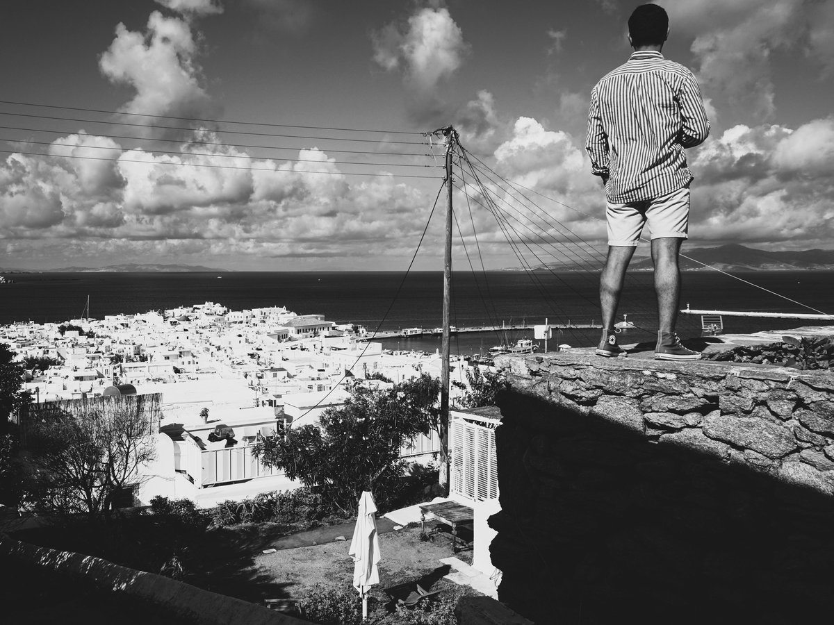
Mykonos sits about 150 km southeast of Athens in the Cyclades, a granite-and-gneiss island of roughly 85 square kilometers. The landscape is dry, wind-sculpted, and mostly treeless. Low stone walls crisscross brown hillsides, and whitewashed chapels dot ridgelines where the meltemi wind can hit 50 km/h in July. Most visitors come for the beaches and nightlife, which is fair enough, but the island's interior and coastline reward anyone willing to lace up proper shoes and carry enough water. The highest point, Profitis Ilias Vorniotis, tops out at around 341 meters. That's modest, but the terrain is rocky and exposed, and the heat from June through September is serious. Old mule paths still connect villages and monasteries, and the coastal stretches between remote beaches feel surprisingly empty even in peak season. The Aegean dominates everything here. You smell salt constantly, and the light has that particular Cycladic quality, sharp and white, that flattens distances and burns skin faster than you'd expect.
Outdoor activities
-
Windsurfing and Kitesurfing at Ftelia Beach
Ftelia, on the north coast about 5 km from Chora, catches the meltemi wind head-on and has become one of the better-known windsurfing spots in the Cyclades. The beach faces northwest, so when the meltemi blows from the north in summer, you get consistent side-shore conditions. Korfos Beach nearby offers similar exposure. Several rental operations set up on the sand from May through October, and gear rental tends to run 40 to 70 euros for a half day. The wind can be genuinely strong in July and August, 25 to 35 knots on a stiff day, which is not beginner-friendly. If you're learning, May or late September likely offers more manageable 15-knot conditions.
- Difficulty
- Intermediate to advanced in peak meltemi (July-August); beginners should target shoulder season
- Duration
- Half day to full day sessions
- Best season
- May through October, with strongest wind July and August
-
Mountain Biking on Inland Tracks
The network of dirt roads connecting inland farms, chapels, and Ano Mera village makes for decent mountain biking, though 'trail' might be generous for some of the rougher sections. A popular loop runs from Chora south toward Ornos, then cuts inland past old farming terraces and stone walls toward Ano Mera, roughly 20 km round trip. The terrain is hilly but not steep, mostly packed dirt and loose gravel. Several shops in Chora rent bikes starting around 15 to 20 euros per day. Mind you, there's almost no shade on any of these routes, and the wind resistance on north-facing stretches in summer can turn a casual ride into real work. Bring more water than you think you need.
- Difficulty
- Moderate. Terrain is uneven, and wind adds significant effort in summer.
- Duration
- 2 to 4 hours depending on route
- Best season
- April through June, September and October
-
Scuba Diving off the South Coast
Several dive operators run out of Paradise Beach and Kalafatis, offering sites along the southern and eastern coasts where the meltemi wind creates less chop. Visibility in the Aegean around Mykonos tends to reach 20 to 30 meters on calm days. You'll find underwater rock formations, small caves, and the usual Mediterranean marine life, grouper, moray eels, octopus, and occasional barracuda. Water temperature ranges from about 16°C in April to 26°C in August. A two-dive package typically costs 90 to 130 euros including gear. The wreck of the Anna II near the southeast coast is one of the more interesting sites. Worth noting that north-coast sites are often inaccessible in July and August due to wave conditions.
- Difficulty
- Beginner-friendly intro dives available; advanced sites require Open Water certification
- Duration
- Half day including boat time
- Best season
- May through October, with warmest water in August and September
-
Rock Scrambling at Armenistis Lighthouse
The area around Armenistis Lighthouse on the northwest tip of the island has exposed granite formations that allow for some informal scrambling. This is not organized climbing with bolted routes. It's more about picking your way along the rocky headland where the terrain drops toward the sea. The lighthouse itself dates to 1891 and sits at roughly 40 meters above sea level. The wind up here can be fierce, which is part of the appeal. Sunset from Armenistis is genuinely impressive, with views toward Tinos across a 2 km strait. Getting there requires either a 5 km walk from Tourlos or a short drive on a paved road.
- Difficulty
- Easy to moderate scrambling, no technical gear needed
- Duration
- 1 to 2 hours exploring the headland
- Best season
- Year-round, though summer evenings are best for light and temperature
-
Horseback Riding in the Island Interior
A couple of operators near Ano Mera offer trail rides through the interior of the island, passing old farmsteads, stone walls, and scattered chapels. Routes typically head toward the less-developed northeast coast or south through scrubby hills toward Kalafatis. The horses are accustomed to the rocky terrain and the wind. A 90-minute ride runs about 80 to 100 euros. The landscape on horseback feels different from on foot. You cover more ground and the elevated perspective shows the patchwork of old agricultural terracing that's hard to appreciate from the road.
- Difficulty
- Beginner rides available; longer trail rides suit experienced riders
- Duration
- 1 to 3 hours
- Best season
- April through June and September through November
Day hikes
-
Chora to Ano Mera via Old Mule Path
The old path connecting Mykonos Town to the inland village of Ano Mera runs roughly 7 km one way through the island's dry interior. The route passes stone-walled agricultural plots, at least a dozen small chapels, and the occasional abandoned farmstead. The terrain is mostly packed earth and loose rock, with some sections overgrown where modern roads diverted traffic away from the old path. You'll gain and lose only about 150 meters of elevation total. The interior smells of dried thyme and sage in summer, and the silence away from the coast is striking. Ano Mera has tavernas where you can eat before catching a bus back to Chora. The bus runs regularly in summer for about 2 euros.
- Difficulty
- Easy to moderate. The footing is uneven but the elevation gain is minimal.
- Duration
- 2.5 to 3.5 hours one way
- Best season
- March through May and October through November for comfortable temperatures
-
Ano Mera to Fokos Beach
Fokos is a remote, undeveloped beach on the north coast, reachable from Ano Mera by a roughly 4 km walk on a mix of dirt road and path. The beach has a single seasonal taverna and no sunbeds, which sets it apart from the organized south-coast beaches. The walk passes through typical Mykonian scrubland, phrygana vegetation of low thorny shrubs and aromatic herbs. The approach gives you a view down to the beach from above, with the Aegean stretching north toward Tinos. The beach itself has coarse sand and some pebbles, and the water tends to be rougher here due to the meltemi exposure. Swimming is fine in calm conditions but can be risky when the wind picks up.
- Difficulty
- Easy. Mostly flat dirt road with one moderate descent to the beach.
- Duration
- 1 to 1.5 hours one way
- Best season
- May through June, September through October. The beach can be windswept in July and August.
-
Profitis Ilias Vorniotis Summit Walk
The highest point on Mykonos at roughly 341 meters. You can drive partway up on a paved road, but walking from Ano Mera adds about 3 km each way and gives a better sense of the terrain. The summit has a small chapel and a radar installation. The views on a clear day extend to Naxos, Paros, Syros, and Tinos. There's no marked trail for the final approach, you follow the road and then pick your way up rocky terrain for the last 100 meters or so. The wind at the top can be powerful enough to make standing difficult in summer. That's not an exaggeration. Bring a windbreaker even in July.
- Difficulty
- Moderate. Short but steep final approach on loose rock, with significant wind exposure.
- Duration
- 1.5 to 2.5 hours round trip from the nearest road approach
- Best season
- April through June and September through November
-
Kalafatis to Agia Anna via Coastal Path
A coastal walk from Kalafatis Beach on the southeast coast, heading south along a rough track toward the small Agia Anna beach, roughly 2 km each way. The path follows low cliffs and passes above small rocky coves. The coastline here is less developed than the south, and the rocky terrain shows the island's geological character, folded gneiss and granite interspersed with scrub. You'll see fishing boats anchored in the coves and possibly a monk seal if you're very fortunate, as they have been spotted in the wider area. The walking surface is uneven rock and packed earth. Not suitable in sandals.
- Difficulty
- Easy to moderate. Short distance but rocky footing throughout.
- Duration
- 1 to 1.5 hours round trip
- Best season
- Year-round, but most pleasant March through June and September through November
Water activities
-
Sea Kayaking along the South Coast
The south coast from Ornos to Kalafatis is sheltered from the meltemi, making it the most reliable stretch for sea kayaking. Guided trips typically launch from Ornos or Platis Gialos and follow the coast east, stopping at small beaches and rocky coves that are inaccessible by road. Expect to paddle 8 to 12 km on a half-day trip. The water along this stretch tends to be calm and remarkably clear, turquoise over sand and deep blue over rock. You might spot sea urchins and small fish through your kayak's shadow. Guided trips run about 50 to 80 euros per person and usually include snorkeling stops. Solo rental is harder to find but some operators offer it to experienced paddlers.
- Difficulty
- Beginner-friendly on the sheltered south coast; north coast requires experience
- Duration
- Half day (3 to 4 hours) for guided trips
- Best season
- May through October, with calmest water in June and September
-
Swimming at Agios Sostis Beach
Agios Sostis on the north coast is one of the few beaches on Mykonos with no sunbed rentals and no beach bar since Kiki's taverna nearby closed its original location. The beach is about 6 km from Chora by road. The sand is coarse and golden, and the water drops off fairly quickly. On calm days the swimming is excellent, with water temperatures reaching 25°C or so by August. On meltemi days, waves build quickly and a current runs along the beach. Locals tend to check conditions before heading out. The walk down from the road is about 5 minutes on a dirt path. No facilities means no fresh water or shade, so bring both.
- Difficulty
- Easy swimming in calm conditions; moderate to hazardous when the meltemi blows
- Duration
- Allow a half day to enjoy it properly
- Best season
- June through September for water temperature; avoid peak meltemi days
-
Stand-Up Paddleboarding at Ornos Bay
Ornos, about 3 km south of Chora, sits in a sheltered bay that rarely sees significant waves. This makes it probably the best spot on the island for stand-up paddleboarding, particularly for beginners. Several operators rent boards from the beach for around 20 to 30 euros per hour. Early mornings before the wind picks up are best. The bay is shallow enough that you can see the sandy bottom for a good distance out, and the water has that clear pale green color typical of Cycladic sand-bottom bays. More confident paddlers sometimes round the headland east toward Platis Gialos, a stretch of about 1.5 km along low cliffs.
- Difficulty
- Beginner-friendly in the bay; rounding the headland requires intermediate skill
- Duration
- 1 to 3 hours
- Best season
- May through October, mornings before wind builds
-
Boat Trip and Swimming at Rhenia (Rineia) Island
Rhenia is the uninhabited island immediately west of Delos, about 5 km from Mykonos's west coast. Tour boats from the old port in Chora run day trips that combine a pass by Delos with swimming stops in Rhenia's sheltered coves, where the water is often calmer and clearer than anything on Mykonos itself. The island has no permanent structures or facilities. Swimming off the boat into empty turquoise water with nothing but rock and scrub on shore feels like a different century. Trips typically cost 50 to 90 euros and include lunch. Some operators anchor in a cove on Rhenia's east side where the bottom is visible at 8 to 10 meters depth.
- Difficulty
- Easy. Swimming from an anchored boat in calm water.
- Duration
- Full day (typically 10am to 5pm)
- Best season
- May through September
-
Snorkeling at Kapari Beach
Kapari is a small, somewhat hard-to-reach beach near Agios Ioannis on the west coast. The rocky edges of the cove create good conditions for snorkeling, with underwater rock formations, sea urchins, small wrasse, and damselfish. The access path from the road is steep and involves some scrambling over rocks for the last 30 meters. This tends to keep crowds down even in August. Bring your own mask and snorkel, there are no rentals here. The water on the west coast catches afternoon sun and can feel noticeably warmer than the north-facing beaches. Mind your footing getting in, the entry is rocky.
- Difficulty
- Easy snorkeling; moderate access path with some scrambling
- Duration
- 2 to 3 hours
- Best season
- June through September for water temperature and visibility
Parks & gardens
-
Manto Mavrogenous Square (Plateia Manto)
FreeThe main square at the old port in Chora, named for the heroine of the Greek War of Independence who was born on Mykonos in 1796. This is not a lush garden by any stretch. A few mature tamarisk trees provide shade, and there are benches and low plantings. It's the closest thing Chora has to a public green space, and it functions more as a gathering point than a park. That said, the tamarisks are genuinely old and the square offers shade and a breeze off the harbor, which in August counts for a lot.
Highlights: Bronze bust of Manto Mavrogenous, old tamarisk shade trees, harbor views toward Tinos
-
Panagia Tourliani Monastery Gardens, Ano Mera
FreeThe 16th-century monastery in Ano Mera, about 7 km east of Chora, maintains a small courtyard garden with bougainvillea, jasmine, and potted herbs. The monks tend it carefully, and it feels remarkably green compared to the surrounding dry landscape. The marble fountain in the courtyard stays cool even in midsummer. The monastery itself has an ornate carved marble iconostasis from Florence that dates to 1775. You might notice the scent of thyme drifting in from the hillside, mixed with whatever the monks are growing. Modest dress is required for entry.
Highlights: Bougainvillea-covered courtyard, 18th-century Florentine marble iconostasis, herb plantings tended by monks
-
Boni Windmill Area and Viewpoint
FreeThe hill above Chora where the Boni windmill stands is less a formal park and more an open hillside with wild vegetation, low scrub, dried grasses, and the occasional caper bush growing out of stone walls. But the municipality has placed benches and improved the path. The 360-degree view from the top takes in Chora's roofline, the old port, the channel to Delos, and on clear days, Syros and Paros. Wildflowers carpet the slope in April and May. To be fair, calling it a 'park' is generous, but for Mykonos, where formal green space is scarce, it's a genuine spot to sit and look at something other than a cocktail menu.
Highlights: Restored windmill, 360-degree views of Chora and neighboring islands, spring wildflowers in April
Practical tips
- Sun Protection
- The Cycladic sun is more intense than it feels, especially with the meltemi creating a cooling breeze that masks UV exposure. SPF 50 is not overkill here. Reapply every 90 minutes if you're sweating. A wide-brimmed hat and a lightweight long-sleeve shirt for hiking are worth their weight. The light-colored stone and whitewashed buildings reflect UV upward, so you burn from below too. Sunglasses with polarized lenses help significantly on the water and on bright-stone paths.
- Water and Hydration
- Mykonos has no natural freshwater rivers, lakes, or springs accessible to hikers. The island relies on desalination. Carry at least 1.5 liters per person per hour of activity in summer. There are no water fountains or taps along trails. In Chora and Ano Mera, small shops and periptera (kiosks) sell water for about 0.50 to 1 euro per bottle. Dehydration sneaks up quickly because the wind evaporates sweat before you notice it.
- Footwear and Gear
- The terrain on Mykonos is rocky and uneven nearly everywhere outside paved roads. Sandals are fine for organized beaches, but for any walking on coastal paths or interior tracks, you want closed-toe shoes with decent grip. Light hiking shoes or trail runners work well. Full hiking boots are overkill for the island's modest elevation. Bring a windbreaker regardless of season. The meltemi arrives without much warning and can drop the felt temperature 10°C in minutes, even in August.
- Trail Conditions and Navigation
- Mykonos does not have a formal marked trail network like you might find on Naxos or Andros. Old mule paths exist but are inconsistently maintained. Some have been partially reclaimed by vegetation or cut by new roads. A downloaded offline map is essential since phone signal drops in parts of the interior and northeast coast. The Anavasi 1:25,000 topographic map of Mykonos is the best paper option. Start early in summer, by 7am if possible, to avoid the midday heat and the afternoon wind peak.
- Meltemi Wind Awareness
- The meltemi (northern wind) blows from roughly late June through early September, peaking in July and August. It can sustain 30 to 40 km/h for days at a time. North-facing beaches become unswimmable, kayaking on the north coast becomes dangerous, and exposed hilltops require serious wind protection. Check the Windy app or Poseidon forecasts (the Hellenic Centre for Marine Research) before planning water activities. The south coast and sheltered bays are your best options during strong meltemi episodes.
- Best Overall Season for Outdoor Activities
- Late April through mid-June is the sweet spot. Temperatures range from 18°C to 28°C, wildflowers are out, the sea is warming up past 20°C, and the meltemi hasn't started yet. September through mid-October is the second-best window, with warm sea temperatures around 23°C to 24°C and diminishing wind. July and August are hot (32°C or higher), crowded, and very windy. Winter months (December through February) see rain, cooler temps around 12°C to 15°C, and limited tourist infrastructure, but hiking on clear winter days can be genuinely pleasant.
FAQ
Is Mykonos a good island for hiking compared to other Cycladic islands?
Honestly, if hiking is your primary goal, Naxos and Andros have more developed and varied trail networks. Naxos has marked routes from the coast to over 1,000 meters at Mount Zas. Andros has the Andros Route network with well-maintained paths. Mykonos has shorter, less formal walks that are more about coastal exploration and reaching quiet beaches than serious hill-walking. That said, the trails you do find on Mykonos tend to be empty, which is not something you can say about its beaches in July.
Do I need to rent a car to access hiking and outdoor activities on Mykonos?
A car or ATV makes things significantly easier, especially for reaching trailheads on the northeast coast like Fokos or the Armenistis area. Public buses connect Chora to Ano Mera, Ornos, Platis Gialos, and several other beaches for about 2 euros per ride, and the summer schedule runs roughly every 30 minutes on main routes. But buses don't reach the more remote beaches or the interior dirt tracks. A rental car runs about 40 to 70 euros per day in summer. An ATV is cheaper, around 25 to 40 euros, but less safe on the island's narrow roads.
Are there any freshwater swimming spots on Mykonos, like rivers or lakes?
No. Mykonos has no permanent rivers, lakes, or freshwater swimming holes. The island receives only about 350 mm of rain per year, and what water collects evaporates quickly or is captured for agricultural use. All swimming is in the Aegean Sea. The island depends on desalination plants for its drinking water. If you want freshwater swimming in the Cyclades, you would need to look at larger islands like Naxos, where there are some seasonal streams, though even those are not reliable for swimming.
How dangerous is the meltemi wind for water sports?
It's a real hazard, not a minor inconvenience. The meltemi can sustain 35 to 45 km/h with gusts higher, creating 2 to 3 meter waves on exposed northern coasts within a few hours. Kayakers and SUP paddlers get blown offshore. Swimmers face strong lateral currents on north-facing beaches. Every summer, the coast guard rescues people who underestimated it. Stick to the south coast during strong meltemi episodes. Check the Poseidon marine forecast from the Hellenic Centre for Marine Research before any water activity. Experienced windsurfers and kitesurfers seek out the meltemi on purpose, but they know what they're getting into.
What should I wear for hiking on Mykonos in summer?
Lightweight, breathable, light-colored clothing that covers your shoulders and legs. A sun hat with a chin strap is not optional given the wind. Trail runners or light hiking shoes with good grip for rocky terrain. Sunglasses, ideally polarized. A thin windbreaker that packs small. You'll want it at elevation or if the meltemi kicks up. Skip cotton, it holds sweat and chafes. Synthetic or merino fabrics dry faster. And despite the heat, long sleeves save you from both UV damage and scratches from thorny phrygana scrub along overgrown path sections.
Can I visit Delos as part of an outdoor day trip from Mykonos?
Delos is a 30-minute ferry ride from Mykonos's old port, with boats running several times daily from around April through October. The round-trip ticket costs approximately 22 euros, and the archaeological site entry is 12 euros. The island is an open-air archaeological site covering about 1.3 square kilometers, and walking it thoroughly takes 3 to 4 hours in full sun with almost no shade. Bring a hat, sunscreen, and at least 2 liters of water, as the small site cafe has limited stock and high prices. The last boat back is typically around 3pm to 5pm depending on the season, so check the schedule carefully.
Outdoor experiences in Mykonos
 Free cancellation
 Authentic Jeep Adventure Tour
Outdoor experience: 5 hours, free cancellation.
via Viator Free cancellation
 Mykonos Sailing Tour to Rhenia Uninhabited Island+Free Transfers
Outdoor experience: 5 hours, free cancellation.
via Viator Free cancellation
 Mykonos 6hrs sailing cruise: Delos Rhenia with lunch & transfer
Outdoor experience: 6 hours, free cancellation.
via Viator Free cancellation
 Mykonos Wild Experience Tour
Outdoor experience: 5 hours, free cancellation.
via Viator Free cancellation
 Discover Mykonos ATV Tour with 650cc Quads
Outdoor experience: 3 hours, free cancellation.
via Viator Free cancellation
 Private Mykonos Sightseeing Experience with a Local
Outdoor experience: 4 hours, free cancellation.
via Viator Free cancellation
 Private Bike and Hike Tour in Naxos
Outdoor experience: free cancellation.
via ViatorLast verified by automated review (v1.7.2) on . What is automated review?