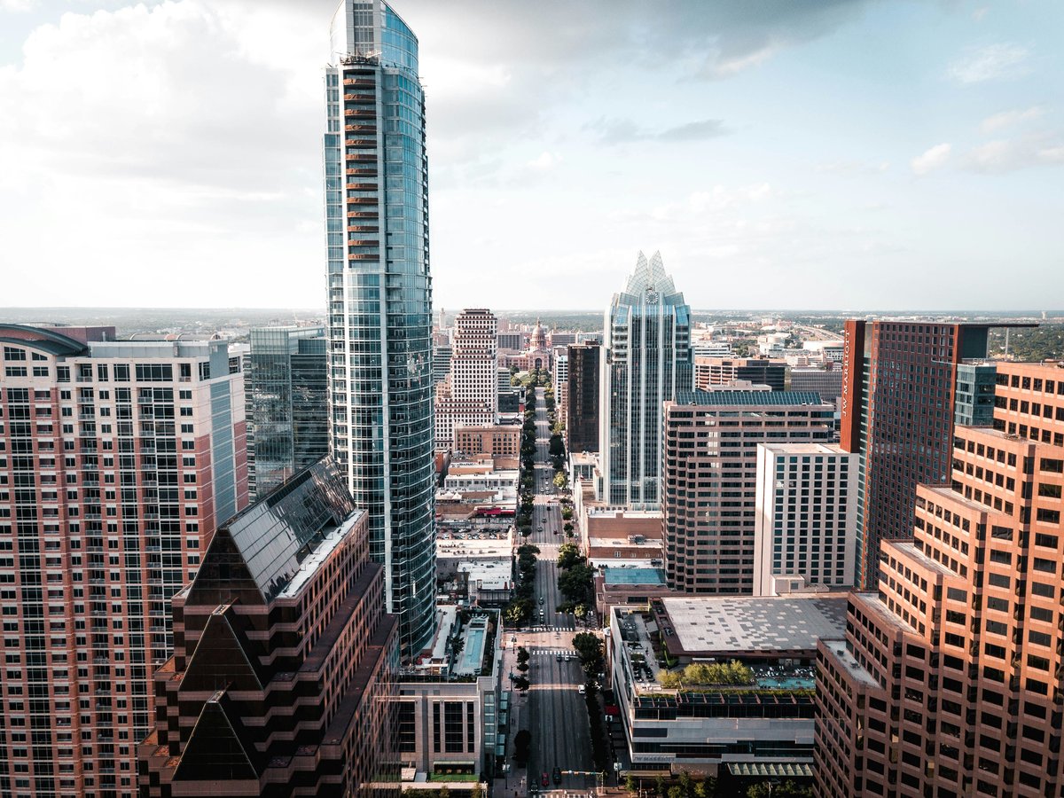
Austin's free layer is mostly green: state park, city park, greenbelt, botanical garden, wildflower research center; the kind of civic inventory a visitor can string together for a week without opening a wallet. What follows is not a checklist of every mowed lawn inside the loop; it is ten places that Wikidata records as actual, mapped destinations in Travis County and its immediate southeast and northwest edges, ranked in the order a first-time visitor should meet them. Some sit downtown on Guadalupe and Barton Springs Rd; others require a short drive out past the airport or into the hills northwest of town. Skip the paid attractions on the first pass: Austin's most defensible entertainment has always been its parkland, and the free tier is deep enough that you can spend three full days outside without repeating a coordinate. Bring water. Bring sun cover. The rest of this list assumes you did.
-
1 Wooldridge Park
Guadalupe St.A downtown pocket park on Guadalupe, walkable from the Capitol and the central library.
On Guadalupe St., Wooldridge Park is the downtown block most visitors walk past without registering: a structure in Austin, Travis County, catalogued at 30.2724, -97.7456 and entered in Wikidata as Q14711414. Skip the paid downtown attractions on your first afternoon; the locals treat this square as a shortcut and a bench-lunch, and it works better as an on-foot orientation than as a destination. It is small, it is quiet on a weekday, and the trees do most of the editorial work. Come, sit for 20 minutes, get your bearings, and move on to the bigger green to the west. That is the correct use of it.
-
2 Zilker Park
Barton Springs Rd. Austin, TexasThe city's flagship park, the anchor of Austin's free tier.
At Barton Springs Rd. in Austin, Texas, Zilker Park is the park in Austin, Texas, United States of America that everything else on this list is measured against: Wikidata Q8071899, sitting at 30.2636, -97.7767. The locals treat it as the default weekend answer, and they are right to; skip the ticketed downtown alternatives and give Zilker a full afternoon before you go anywhere else. It is large enough to disappear into and central enough that you will not need a car to reach it. Bring a blanket, bring a book, and let the geography do the rest. This is the one item on the list a first-time visitor cannot honestly skip.
-
3 Zilker Botanical Garden
Zilker Botanical Garden, Austin, Texas, U.S.A botanical garden inside Zilker, catalogued separately for a reason.
Zilker Botanical Garden at 30.2689, -97.7714 is a botanical garden in Austin, Texas, U.S. with its own Wikidata entry, Q8071897, and its own website at zilkergarden.org. Don't bother lumping it in with the larger park next door: the garden is a separately mapped destination and rewards a separate visit. The locals know to check the site before they come; hours and programming shift with the season, and zilkergarden.org is the one authoritative place to confirm. Give it 60 to 90 minutes on a mild morning, before the sun turns the paths into a slog. This is the item on the list where slowing down is the whole point.
-
4 Pease Park
Pease Park, Austin, TexasAn urban park north of downtown, catalogued as its own destination.
At 30.2851, -97.7541, Pease Park is an urban park in Austin, Texas, entered in Wikidata as Q7158432 and mapped just north of the downtown grid. The locals prefer it to the flagship on a weekend when Zilker gets loud; skip the crowded riverside on a busy Saturday and take the walk up here instead. It is smaller, it is calmer, and the trees carry the shade you want in July. Bring a book, bring a friend, bring the dog if you have one along for the trip. This is the park that rewards a second visit more than a first; the first pass shows you the geography, the second shows you why residents keep coming back.
-
5 Rosewood Park
Rosewood Park, Austin, Texas, United StatesAn East Austin park, mapped east of downtown.
Rosewood Park at 30.2722, -97.7142 is a park in Austin, Texas, United States catalogued in Wikidata as Q18157795. The locals head east when the downtown parks fill up, and this is one of the reasons; skip the tourist-heavy riverside on a Sunday and let the coordinates carry you a mile east instead. It is a neighborhood park in the honest sense of the word: mapped, named, on the civic ledger, and doing its job without asking for attention. Give it 45 minutes on a walk, or an hour on a blanket, and move on. The point of this stop is not spectacle; it is the reminder that Austin's free tier runs well past the downtown loop.
-
6 McKinney Falls State Park
McKinney Falls State Park, southeastern edge of Austin, Texas, USAA Texas state park inside the city limits, with its own TPWD page.
At 30.1808, -97.7219, McKinney Falls State Park is a state park located at the southeastern edge of Austin, Texas, USA: Wikidata Q6801971, with an official page at tpwd.texas.gov/state-parks/mckinney-falls. The locals swear by the drive out here when the in-town parks feel too small; skip the crowded central greenbelt on a weekend and put this one on the schedule instead. It is a real state park, not a city block dressed up as one, and the Texas Parks and Wildlife page at tpwd.texas.gov/state-parks/mckinney-falls is the authoritative source for the day's conditions. Check before you drive. Give it a half day, minimum, and pack more water than you think you need.
-
7 Bailey Park
Bailey Park, Texas, United States of AmericaA neighborhood park on Austin's north side.
North of the central grid at 30.3026, -97.7466, Bailey Park is a park in Texas, United States of America, entered in Wikidata as Q4848382 and quietly doing its job at the top of the map. Skip the packed weekend crowds down at the flagship park; the locals who live north come here for the same reason you should: the geography is calmer, the parking is easier, and the point of the visit is the walk, not the show. It is small. It is honest. It is on the civic ledger, and that is enough. Come for 30 minutes on the way in from the north side of town, or an hour if the weather is right. Don't try to make it more than it is.
-
8 Barton Creek Greenbelt
Barton Creek Greenbelt, Austin, TexasA public greenbelt, mapped southwest of the downtown grid.
The Barton Creek Greenbelt rolls southwest through Austin at 30.2450, -97.7990, a public park in Austin, Texas catalogued as Q4865617. The locals prefer this to a manicured park on any weekend the weather cooperates; skip the crowded lawns and put on shoes you don't mind soaking. It is a linear greenbelt, which means the visit is a walk, not a picnic: plan the route before you start, and pick an access point that matches how far you want to go. Bring water. Bring sun cover. This is the item on the list where the geography does the editorial work; the greenbelt is long enough that a first-time visitor can pick a mile and call it a full afternoon.
-
9 Lady Bird Johnson Wildflower Center
Lady Bird Johnson Wildflower Center, TexasA botanical garden and arboretum southwest of the city.
The Lady Bird Johnson Wildflower Center at 30.1853, -97.8706 is catalogued in Wikidata as Q2645392, a botanical garden and arboretum in Texas, with its own site at wildflower.org. The locals know to check the official page before they drive; skip the assumption that a botanical garden is a botanical garden, and let wildflower.org tell you what is in bloom on the week you visit. It is a specialist destination, not a general one: the mission is native Texas flora, and the reward is proportional to how much you care about that. Give it a full morning, take the paths seriously, and pack the same water you brought to the state park.
-
10 Emma Long Metropolitan Park
Emma Long Metropolitan Park, northwest Austin, TexasA municipal park in northwest Austin, catalogued by the city.
Emma Long Metropolitan Park at 30.3350, -97.8300 is a municipal park in northwest Austin, Texas, entered in Wikidata as Q5372889. The locals drive out here when they want space the in-town parks cannot give them; skip the crowded downtown greenspace on a holiday weekend and point the car northwest instead. It is a municipal park, catalogued and mapped, and the trip is a commitment, not a stroll off the hotel steps. Bring what you would bring to a state park: water, sun cover, a plan for how many hours you intend to be out. This is the last item on the list because it is the furthest, and the last item on the list because the reward, for the right visitor, is the largest.
This is an early version of the Austin list. We add picks as we test more places.
Last verified by automated review (v1.7.0_section-4g-austin-attractions-free-2026-05-15) on . What is automated review?