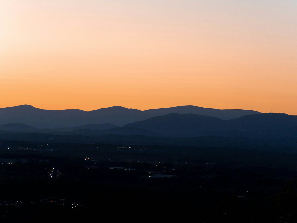
Lynchburg sits where Virginia's Piedmont tilts upward into the Blue Ridge foothills, straddling the James River at roughly 800 feet of elevation. The city itself sprawls across seven hills, which means even a walk downtown involves some climbing. Within a 30-minute drive you're on the Blue Ridge Parkway, and the James River corridor cuts right through the middle of town. The outdoor culture here tends to be understated. You won't find a packed gear district or a weekend scene like Charlottesville's. What you will find is a surprisingly dense trail network threading through forested ravines inside the city limits, plus legitimate mountain hiking less than an hour away. Summers run hot and humid, regularly pushing past 90°F from June through August. Spring and fall are the sweet spots, with October delivering the kind of Blue Ridge leaf color that pulls people off the Parkway to stare. Winters stay mild by mid-Atlantic standards, with occasional ice storms that can make trails treacherous for a week or two.
Outdoor activities
-
Mountain Biking on the Blackwater Creek Trail System
The Blackwater Creek trails wind through a forested corridor that cuts across Lynchburg's south side. The paved Bikeway section runs about 9 miles and stays mostly flat, good for an easy spin. Off the pavement, singletrack spurs branch into the surrounding natural area with roots, short climbs, and enough technical bits to keep intermediate riders interested. The trail system connects to several city neighborhoods, so you can ride from your door if you're staying near downtown. Local riders tend to favor early mornings in summer when the canopy still holds cool air.
- Difficulty
- Easy to Moderate
- Duration
- 1-3 hours depending on route
- Best season
- April through November
-
Road Cycling the Blue Ridge Parkway
Cyclists use the Parkway access points near Lynchburg for long hill climbs with relatively low traffic, especially on weekday mornings. The section between Otter Creek (milepost 63) and Peaks of Otter (milepost 86) involves sustained climbing with grades that occasionally hit 6-8%. You'll share the road with cars, but the 45 mph speed limit and wide shoulders help. The pavement quality is generally good, though frost heaves appear in spring. Bring enough water for the full ride because services on the Parkway are sparse.
- Difficulty
- Moderate to Strenuous
- Duration
- 3-5 hours for a 40-50 mile loop
- Best season
- May through October
-
Rock Climbing at Craigs Creek
About 45 minutes northwest of Lynchburg in the Jefferson National Forest, Craigs Creek offers sandstone sport climbing routes in the 5.6 to 5.12 range. The crag sits along a wooded hillside and stays shaded through most of the afternoon, which matters in July. It's not a destination crag, but it fills the gap if you're in the area and need vertical rock. Bring your own draws and a 60-meter rope.
- Difficulty
- Moderate to Advanced
- Duration
- Half day
- Best season
- March through May, September through November
-
Trail Running at Percival's Island
Percival's Island Natural Area is a 100-acre island in the James River connected to the city by pedestrian bridges. The flat gravel trail that runs its length covers about 1.5 miles one way. Trail runners use it for tempo work or as a connector to the Blackwater Creek system. The island floods after heavy rain, so check conditions if it's been a wet week. Great blue herons are a constant presence along the banks, and in spring the wildflowers along the old railroad bed are worth slowing down for.
- Difficulty
- Easy
- Duration
- 30-60 minutes
- Best season
- Year-round, best March through November
-
Disc Golf at Ivy Hill Park
Ivy Hill Park on the city's east side has an 18-hole disc golf course that winds through mixed hardwood forest with enough elevation change to make shot selection interesting. Hole distances range from about 200 to 400 feet. The course plays longer than it looks because several fairways bend around mature oaks. Free to play, and there's parking right by hole 1.
- Difficulty
- Easy to Moderate
- Duration
- 1-2 hours
- Best season
- Year-round
Day hikes
-
Sharp Top at Peaks of Otter
The signature hike in the Lynchburg area, about 30 miles north via the Blue Ridge Parkway at milepost 86. The trail climbs roughly 1,500 feet in 1.6 miles to a rocky summit at 3,875 feet. The upper section involves scrambling over large boulders, and the final approach requires some hands-on-rock moves. On a clear day, the summit views extend across the Piedmont to the east and into the Shenandoah Valley to the west. The trailhead parking lot fills early on fall weekends, so arrive before 9 AM in October. Worth noting, a shuttle bus runs to the summit seasonally, but the hiking trail is the real experience.
- Difficulty
- Strenuous
- Duration
- 2.5-3.5 hours round trip
- Best season
- April through November, peak color in mid-October
-
Flat Top Trail at Peaks of Otter
Starting from the same Peaks of Otter area, Flat Top rises to 4,001 feet over about 2.2 miles. The grade is more consistent than Sharp Top, without the boulder scrambling, which makes it technically easier despite the higher summit. The upper portions pass through stunted oak forest and open into rocky clearings. It tends to draw fewer people than Sharp Top, so you might have the summit to yourself on a weekday. The Peaks of Otter Lodge at the base serves meals if you want lunch after.
- Difficulty
- Moderate to Strenuous
- Duration
- 3-4 hours round trip
- Best season
- April through November
-
Apple Orchard Falls Trail
Accessed from the Blue Ridge Parkway near milepost 78, about 20 miles north of Lynchburg. The trail descends roughly 2,000 feet over 3.4 miles to a 200-foot cascading waterfall. That descent means you're climbing the whole way back, which catches people off guard. The falls run strongest in spring after snowmelt and rain. By late August, the cascade can thin to a trickle in dry years. The forest along the trail shifts from high-elevation hardwoods to rhododendron-lined hollows as you descend.
- Difficulty
- Strenuous (due to return climb)
- Duration
- 4-5 hours round trip
- Best season
- March through June for water flow, October for foliage
-
Harkening Hill at Peaks of Otter
A less-traveled trail in the Peaks of Otter complex, Harkening Hill tops out at 3,372 feet after a 1.5-mile climb from the Abbott Lake area. The trail passes through open forest with good views of Sharp Top and Abbott Lake below. It's the quietest of the three main Peaks of Otter hikes and works well if you've already done Sharp Top and want a different perspective.
- Difficulty
- Moderate
- Duration
- 2-2.5 hours round trip
- Best season
- April through November
-
Blackwater Creek Loop
Right inside Lynchburg, you can piece together a 5-6 mile loop using the paved Bikeway and the unpaved singletrack trails that climb the ridges on either side of Blackwater Creek. The unpaved sections involve short steep pitches through the forest, but nothing exposed or technical. This is the go-to option when you want a walk in the woods without driving anywhere. The trail stays shaded most of the day thanks to dense canopy.
- Difficulty
- Easy to Moderate
- Duration
- 2-3 hours
- Best season
- Year-round
Water activities
-
Kayaking the James River through Lynchburg
The James River section through Lynchburg offers Class I-II water depending on recent rainfall and the specific put-in you choose. The stretch from Percival's Island downstream moves at a moderate pace with a few riffles and small ledges. Local outfitters like Twin River Outfitters (based near the area) rent sit-on-top kayaks for day trips. The river bottom is rocky, so a boat with some hull thickness holds up better than ultralight touring kayaks. Water temperature stays swimmable from June through September, typically reaching the mid-70s°F by July.
- Difficulty
- Easy to Moderate
- Duration
- 2-4 hours depending on section
- Best season
- May through September
-
Tubing the James River
Summer tubing on the James is a Lynchburg tradition. Most people float a 2-3 mile section downstream from access points near Percival's Island. The current does most of the work, but you'll bump over a few shallow riffles. Weekends in July and August get crowded. Wear water shoes because the river bottom is all rock, and you'll need to wade at put-ins and take-outs. Bring your own tube or rent from a local outfitter.
- Difficulty
- Easy
- Duration
- 2-3 hours
- Best season
- June through August
-
Fishing on the James River
The James through Lynchburg holds smallmouth bass, channel catfish, and sunfish. Smallmouth fishing picks up in spring when water temperatures rise above 55°F, typically around late April. Wade fishing works along the shallows near Riverside Park and Percival's Island. A Virginia freshwater fishing license is required and costs $23 for residents or $47 for non-residents as of recent years. The stretch below the Reusens Dam historically produces good smallmouth catches in the 12-16 inch range.
- Difficulty
- Easy to Moderate
- Duration
- Half day to full day
- Best season
- April through October, best smallmouth action May through June
-
Paddleboarding on Smith Mountain Lake
Smith Mountain Lake sits about 45 minutes south of Lynchburg and covers over 20,000 acres with 500 miles of shoreline. The lake's coves stay calm enough for stand-up paddleboarding even when the main body has boat chop. Several marinas rent SUP boards by the hour. Morning sessions before 10 AM tend to have the flattest water. The lake water is warm enough for swimming from late May through September, and water clarity runs 4-6 feet on average.
- Difficulty
- Easy
- Duration
- 1-3 hours
- Best season
- May through September
-
Swimming at Smith Mountain Lake
Smith Mountain Lake has public swim areas and a state park beach at Smith Mountain Lake State Park. The park charges a $10 parking fee on weekends during summer. The beach area has a roped swimming section with a sandy bottom, which is a welcome change from the rocky James River access points. The drive from Lynchburg takes about 50 minutes via Route 24. The park also has boat launches and campgrounds if you want to make a full day or overnight trip of it.
- Difficulty
- Easy
- Duration
- Half day to full day
- Best season
- Memorial Day through Labor Day
Parks & gardens
-
Percival's Island Natural Area
FreeA long, narrow island in the James River, connected to the Lynchburg trail system by bridges at each end. The main trail follows the old Virginia Blue Ridge Railway bed, flat and wide enough for side-by-side walking. The east bank faces the river's main channel, and you can hear the water moving over rocks the entire length. In warmer months, turtles stack up on logs along the quieter western channel. The island flooded badly in 2018 and the rebuilt trail sits a bit higher now.
Highlights: James River views from both banks, bird watching along the western channel, spring wildflower displays on the old rail corridor, pedestrian bridges at both ends
-
Blackwater Creek Natural Area
FreeOver 300 acres of wooded ravine running through the middle of Lynchburg, following Blackwater Creek from near Langhorne Road south to the James River. The paved Bikeway trail parallels the creek, and unpaved singletrack branches off into steeper terrain on either side. The forest canopy keeps this corridor noticeably cooler than the surrounding streets in summer. You might notice the stone ruins of old mills along the creek, remnants of 19th-century industry.
Highlights: 9-mile paved Bikeway trail, singletrack side trails, historic mill ruins, diverse forest canopy, creek crossings
-
Miller Park
FreeMiller Park sits on a hillside near downtown and has been a Lynchburg gathering spot since the early 1900s. The park's small lake supports a population of ducks and geese that local kids feed year-round. Mature trees provide shade across most of the grounds, and stone walls from WPA-era construction still line several paths. The park hosts community events through the warmer months.
Highlights: Historic WPA stone structures, small lake, mature tree canopy, playground, picnic shelters
-
Riverside Park
FreeStretched along the James River on the city's north side, Riverside Park offers open playing fields and direct river access. The park connects to the trail system that runs toward Percival's Island. On summer evenings, you'll find people fishing from the bank or wading in the shallows. The park tends to be less crowded than Percival's Island, which makes it a quieter option for a riverside walk.
Highlights: James River bank access, fishing spots, connection to Percival's Island trail, open playing fields, river wading areas
-
Old City Cemetery and Arboretum
FreeThis 1806 cemetery doubles as an accredited arboretum with labeled tree specimens spread across 27 acres of hilly ground. Five small museums sit on the property, covering topics from mourning customs to Civil War medicine. The grounds hold Confederate, Union, and civilian graves from the 1800s, and the mature plantings include magnolias, dogwoods, and old boxwoods. It feels more like a botanical garden than a burial ground, and locals walk the paths regularly.
Highlights: Labeled arboretum specimens, 5 on-site museums, Civil War-era graves, historic magnolia and dogwood plantings, hilltop views of the city
Practical tips
- Water and Heat Management
- Virginia humidity makes summer exertion deceptively draining. Carry at least 2 liters of water for any hike over 2 hours, and 3 liters for the Peaks of Otter trails where there's no reliable water source on the route. The combination of 90°F air and 70% humidity in July means you'll sweat through more than you expect. Starting hikes before 8 AM in summer avoids the worst heat.
- Footwear and Trail Conditions
- Blackwater Creek and Percival's Island trails are well-maintained and fine in trail runners. Sharp Top and Apple Orchard Falls have enough loose rock and root exposure that ankle-supporting boots earn their weight. After rain, the unpaved singletrack in Blackwater Creek gets slick clay patches that stay muddy for 2-3 days. The Parkway trails drain faster due to elevation and rocky substrate.
- Sun Protection
- The Peaks of Otter summits are fully exposed above treeline, and UV intensity at 3,800-4,000 feet is noticeably stronger than in the valley. Sunscreen and a hat matter on Sharp Top even on hazy days. The Blackwater Creek and Percival's Island trails stay shaded under canopy, so sun protection is less critical there. On the James River, water reflection doubles your exposure, so waterproof sunscreen rated SPF 30 or higher is worth the effort.
- Seasonal Trail Closures and Conditions
- The Blue Ridge Parkway closes sections during winter weather, sometimes with little advance notice. Check the National Park Service's Parkway alerts page before driving up, especially November through March. Ice lingers on north-facing Parkway trails into early April some years. The James River access points flood after heavy rain and may be impassable for 1-2 days following a major storm event. Percival's Island closes during flood conditions.
- Ticks and Insects
- Lone star ticks and deer ticks are present in the Lynchburg area from April through October. The Blackwater Creek ravine and brushy areas near the James River tend to be the worst spots. Treat clothing with permethrin and do tick checks after every hike. Mosquitoes peak at dawn and dusk near standing water, particularly along the quieter stretches of Blackwater Creek. DEET or picaridin-based repellent works better than citronella in this climate.
- Gear and Supplies
- Lynchburg has a few outdoor retailers, including a local outfitter and the usual chain stores along Wards Road. For specialized climbing or paddling gear, Roanoke (60 miles west on Route 460) has more options. If you're renting kayaks or tubes for the James River, book weekend rentals a few days ahead in July and August. Cell service is reliable on the Blackwater Creek and Percival's Island trails but gets spotty on the Blue Ridge Parkway, especially in hollows between Otter Creek and Peaks of Otter.
FAQ
What is the best time of year for outdoor activities around Lynchburg?
Mid-April through early June and September through late October offer the most comfortable conditions. Spring brings wildflowers, moderate temperatures in the 60-75°F range, and good water flow for the James River and Apple Orchard Falls. Fall delivers the Blue Ridge leaf color that peaks around mid-October near the Peaks of Otter. Summer works fine for water activities on the James and Smith Mountain Lake, but hiking above 3,000 feet gets hot and hazy. Winter is manageable for in-town trails, though Blue Ridge Parkway access becomes unreliable.
Are the trails around Lynchburg suitable for beginners?
The in-town trails are very beginner-friendly. Percival's Island is flat, well-marked, and only about 3 miles round trip. The paved Blackwater Creek Bikeway works for anyone who can walk on a sidewalk. Sharp Top at Peaks of Otter is a different story. Despite being only 1.6 miles to the summit, the steep grade and boulder scrambling at the top make it genuinely strenuous. Flat Top and Harkening Hill fall in between. Start with the city trails and work up to the Parkway hikes.
Do I need a permit for kayaking or fishing on the James River?
Kayaking and tubing on the James River do not require a permit. Fishing requires a valid Virginia freshwater fishing license, which you can purchase online through the Virginia Department of Wildlife Resources or at local sporting goods stores. Non-resident annual licenses cost $47, though short-term options exist. Smith Mountain Lake follows the same licensing requirements. No separate launch fees apply at most James River access points in the Lynchburg area.
How do I get to the Peaks of Otter trailheads from Lynchburg?
Take Route 501 North from Lynchburg for about 20 miles until you reach the Blue Ridge Parkway. Turn south (right) onto the Parkway and the Peaks of Otter area is near milepost 86, roughly a 35-40 minute drive total. The Sharp Top trailhead has a dedicated parking lot that fills quickly on fall weekends. Flat Top and Harkening Hill trails start near the Peaks of Otter Lodge and Abbott Lake. There is no entrance fee for the Blue Ridge Parkway itself.
Is it safe to swim in the James River at Lynchburg?
People swim in the James regularly during summer, but use common sense. The river has strong currents in certain sections, especially after rain when water levels rise. Stick to the calmer areas near Percival's Island and Riverside Park where the water is shallower. Water quality has improved significantly over the past two decades, though the city occasionally posts advisories after heavy rainfall when stormwater runoff increases bacterial counts. Check local water quality reports if you're concerned, and avoid swimming within 48 hours of a major rainstorm.
Are dogs allowed on the trails in and around Lynchburg?
Dogs on leash are allowed on the Blackwater Creek trails and Percival's Island. The Blue Ridge Parkway trails, including Sharp Top and Flat Top, also permit leashed dogs, though the rocky terrain on Sharp Top's upper section is tough on paws. Bring water for your dog on any Parkway hike, as there are no reliable water sources along the trail. Smith Mountain Lake State Park allows leashed dogs but not on the swimming beach. Some in-city parks have off-leash areas, but verify current rules at each location.
Last verified by automated review (v1.7.2) on . What is automated review?