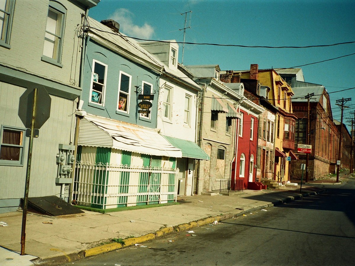
Louisville sits in a bend of the Ohio River, and the city's layout still reflects its 19th-century growth pattern. Downtown hugs the waterfront along Main Street and Market Street, with the oldest neighborhoods fanning south and east from there. Interstate 64 cuts an east-west line that roughly separates the urban core from the South End. Interstate 65 runs north-south and splits downtown from the West End. Most of the neighborhoods visitors care about fall within a 4-mile radius of the intersection of 4th Street and Broadway. The cultural and commercial gravity pulls east along Bardstown Road and Frankfort Avenue, two corridors that function almost like small towns stitched end to end. West of I-65, Portland and the Russell neighborhood have deep history but fewer visitor services at the moment. The short version. If you're staying 3 nights, you'll likely spend your time in a loose triangle between downtown, NuLu, and the Highlands, with day trips south to Old Louisville or east along Frankfort Avenue. TARC bus routes 17 and 23 connect most of these areas, though Louisville remains a car-friendly city with $5-$10 parking lots still common downtown on weekends.
Neighborhoods
-
Downtown / Main Street
Louisville's downtown still feels like a mid-sized river city that hasn't been fully polished for tourists. The blocks along Main Street between 1st and 9th hold a run of cast-iron facades from the 1870s and 1880s. Some of these buildings house bourbon bars now, but others sit half-occupied. The Humana Building on 5th Street, designed by Michael Graves in 1985, towers over the block in pink granite and still looks like nothing else in the city. At night, 4th Street Live draws a college-age crowd with cover bands and chain restaurants, while Whiskey Row on Main between 1st and 2nd has settled into a more interesting groove with places like Evan Williams Bourbon Experience and the Old Forester Distilling Co. The riverfront itself reopened as Waterfront Park in 1999, and on a warm Saturday the Big Four Bridge pedestrian crossing to Jeffersonville, Indiana fills up with walkers by 6 p.m.
- Best for
- First-time visitors who want walkable access to bourbon distilleries, the Louisville Slugger Museum on 8th and Main, and the Muhammad Ali Center on 6th Street
- Key streets
- Main Street between 1st and 9th for the Whiskey Row distillery corridor. West Main for the museum row. 4th Street south to the Theater District around the Kentucky Center for the Performing Arts. River Road for Waterfront Park access.
-
NuLu (East Market District)
NuLu runs along East Market Street roughly from Shelby to Baxter, maybe 6 or 7 blocks in total. The name stands for New Louisville, coined around 2010 when galleries and restaurants started filling the old warehouses east of downtown. The buildings are mostly 2- and 3-story brick from the late 1800s, and the ground floors now hold places like Royals Hot Chicken (Nashville-style, opened 2015) and Feast BBQ. On Saturdays between April and November the street fills with an outdoor market. The area has gotten noticeably more polished since 2018 or so, with boutique hotels like the Grady Hotel opening in restored buildings. It can feel a bit curated on weekend afternoons, to be fair. But walk a block north to Jefferson Street and the residential edges still have a rougher, more lived-in character.
- Best for
- Couples and food-focused travelers who want to walk between restaurants, galleries, and small shops without needing a car
- Key streets
- East Market Street is the spine. Shelby Street at Market anchors the west end near the Butchertown Grocery building. The alley between Market and Main around the 700 block has a cluster of galleries.
-
Old Louisville
Old Louisville sits south of the University of Louisville campus, roughly between I-65 and Brook Street, from Breckinridge south to the Iroquois Park area. It holds what is likely the largest collection of Victorian residential architecture in the United States. The houses along 3rd Street and 4th Street between Ormsby and Hill are massive, some 4,000 to 6,000 square feet, built between 1880 and 1910 for Louisville's merchant class. St. James Court, a private street with a central fountain built for the 1883 Southern Exposition, still hosts an art fair every October that draws 300,000 people over a single weekend. The neighborhood has a slower pace than NuLu or the Highlands. You'll hear screen doors and birdsong more than traffic. Some blocks are meticulously restored, others still show deferred maintenance. Central Park, the Frederick Law Olmsted-designed green space at 4th and Magnolia, anchors the center.
- Best for
- Architecture enthusiasts, history buffs, and visitors who prefer quiet residential streets to commercial corridors. Budget travelers too, since Airbnb rates in Old Louisville tend to run 30-40% below downtown.
- Key streets
- 3rd Street and 4th Street between Ormsby Avenue and Hill Street for the densest Victorian housing stock. St. James Court and Belgravia Court for the private gated streets. Magnolia Avenue near Central Park for the Olmsted connection.
-
The Highlands (Bardstown Road)
Bardstown Road runs southeast from the edge of downtown all the way past Bashford Manor, but the stretch locals mean when they say the Highlands falls between Baxter Avenue and Douglass Boulevard, roughly 2 miles of commercial strip. This is Louisville's default hangout neighborhood. The sidewalks are cracked in places, the storefronts are a mix of 1920s two-story commercial buildings and the occasional Victorian house converted to a restaurant. Ear X-tacy, the legendary record store, closed in 2011, and the building sat empty for years before a Panera took over. That transition tells you something about the pressure on the corridor. But places like the Bardstown Road Farmers' Market (Tuesdays, May through October) and Carmichael's Bookstore at 1295 Bardstown Road, open since 1978, still hold. The food runs from Ramsi's Cafe on the World (Mediterranean-ish, been there since 1994) to Pho Ba Luu for Vietnamese. Noise level depends on the block. Near Baxter and Bardstown the bars get loud after 10 p.m. South of Eastern Parkway it quiets down considerably.
- Best for
- 20- and 30-somethings who want walkable nightlife, independent restaurants, and a neighborhood that doesn't feel manufactured. Also good for longer stays, since the commercial strip means you can handle groceries and errands on foot.
- Key streets
- Bardstown Road from Baxter Avenue to Eastern Parkway for the densest stretch of bars and restaurants. Bonnycastle Avenue east of Bardstown for the quieter residential blocks. Baxter Avenue itself between Broadway and Bardstown for the cluster around Baxter Avenue Theatres.
-
Butchertown
Butchertown sits north of East Market Street between I-65 and Mellwood Avenue, named for the slaughterhouses that lined Beargrass Creek in the 1800s. The creek still runs through, though it's cleaner now than it was in the meatpacking era. The neighborhood has a mix of small shotgun houses from the 1880s and new construction from the 2010s. The Butchertown Market building near Story Avenue anchors the commercial activity. Copper and Kings brandy distillery opened on East Washington Street in 2014 and brought a different crowd. The smell of roasting coffee from Sunergos at the corner of Shelby and Payne drifts across the sidewalk on weekday mornings. It's still a neighborhood in transition. Some blocks feel fully gentrified, others have vacant lots.
- Best for
- Visitors who want proximity to NuLu and downtown without the hotel prices, and anyone interested in the distillery scene beyond bourbon
- Key streets
- Story Avenue for the residential core and the approach to the Butchertown Market. East Washington Street for Copper and Kings and the newer restaurant openings. Mellwood Avenue for the Mellwood Art and Entertainment Center, a converted 350,000-square-foot Fischer Meat Packing plant.
-
Germantown / Schnitzelburg
South of Bardstown Road and east of I-65, Germantown and Schnitzelburg blur together along Goss Avenue and Burnett Avenue. The German immigrant families who built these blocks in the 1870s through 1900s left behind rows of narrow shotgun houses and a few surviving social halls. Check's Cafe on Burnett Avenue has been open since 1945 and still serves the kind of plate lunch where fried fish comes with two sides for $9. The World Championship Dainty Contest, a local tradition held at Hauck's Handy Store on Goss Avenue every July, involves throwing a frozen slab of suet as far as possible. The event has been running since 1953. Goss Avenue has picked up more new restaurants since 2016 or so, including places like Eiderdown (Appalachian-influenced gastropub) and Naive, a chef-driven spot with a seasonal menu that changes weekly.
- Best for
- Food-focused visitors who want to eat where locals eat, away from the tourist infrastructure. Also a solid pick for budget-minded travelers since accommodation rates run lower than the Highlands or downtown.
- Key streets
- Goss Avenue between Shelby Street and Hickory Street for the restaurant and bar cluster. Burnett Avenue between Schiller and Texas for the old-school neighborhood feel. Eastern Parkway for the boundary with the Highlands.
-
Frankfort Avenue / Crescent Hill
Frankfort Avenue runs northeast from the Clifton neighborhood through Crescent Hill and into the edge of Indian Hills. The stretch between Pope Street and Ewing Avenue, maybe a mile and a half, has become Louisville's second major restaurant corridor after Bardstown Road, but with a slightly older and quieter crowd. The buildings are smaller scale than downtown, mostly 1- and 2-story storefronts from the 1920s and 1930s. The Silver Dollar at 1761 Frankfort Avenue does Southern food with a whiskey-bar backbone. Brendon's Catch and Grill at 2300 Frankfort serves some of the best fried catfish in the metro area. Peterson's Dumpling House opened in 2019 and there's still usually a 30-minute wait on Friday nights. The residential streets on either side of Frankfort Avenue are tree-heavy, with Craftsman bungalows and the occasional Tudor. Crescent Hill itself takes its name from the crescent-shaped ridge visible from the old reservoir, now the Crescent Hill Reservoir Park, which opened as a public green space in 2015.
- Best for
- Visitors over 35 who want good restaurants and a walkable commercial strip but don't want the bar noise of Bardstown Road. Families with kids will find the pace here more manageable.
- Key streets
- Frankfort Avenue from Pope Street to Ewing Avenue for the main commercial strip. Stilz Avenue and Peterson Avenue for the residential character. Reservoir Park off Brownsboro Road for the green space.
-
Portland
Portland sits on the western bank of the Ohio River, cut off from downtown by I-64 and a stretch of industrial land along the waterfront. Before the Portland Canal was built in 1830, this was a separate town. The neighborhood still has that slightly detached feeling. The housing stock is a mix of small brick shotgun houses from the 1850s through 1880s and postwar rehabs. Portland Avenue runs the length of the neighborhood and holds a few surviving storefronts. The Portland Museum at 2308 Portland Avenue tells the area's history from its founding as a river port. The neighborhood has experienced significant disinvestment over the past 50 years, and you'll see that on some blocks. But the Portland Investment Initiative has put money into streetscape improvements since 2018, and a few new businesses have opened along the main road. The views of the river from Northwestern Parkway are some of the best in the city, particularly at sunset.
- Best for
- History-minded visitors comfortable with neighborhoods that are still working through revitalization, and anyone who wants a view of Louisville from an angle most tourists never see
- Key streets
- Portland Avenue for the commercial core and the Portland Museum. Northwestern Parkway along the river for views and the Olmsted-designed greenway. 26th Street for the approach to Shawnee Park.
-
Clifton
Clifton sits between Crescent Hill to the east and the Highlands to the south, centered on the stretch of Frankfort Avenue near Clifton Center. The neighborhood is quieter than either of its neighbors. The residential blocks along Payne Street and Clifton Avenue have a mix of shotgun houses, foursquares, and the occasional Victorian, most built between 1890 and 1920. Heine Brothers' Coffee on Frankfort Avenue, a Louisville chain that opened its first location in Clifton in 1994, still serves as an unofficial community living room. The Clifton Center itself, a renovated 1870s church at 2117 Payne Street, hosts concerts, community meetings, and the occasional wedding. Foot traffic is lighter here than on Bardstown Road, and parking is rarely a problem.
- Best for
- Visitors who want a residential Louisville experience with easy access to both the Frankfort Avenue restaurant strip and the Highlands, without being directly on either commercial corridor
- Key streets
- Frankfort Avenue through Clifton for the cafes and Heine Brothers. Payne Street for the Clifton Center and the residential blocks. Mellwood Avenue at the northern edge for the approach to Mellwood Art Center in neighboring Butchertown.
FAQ
What is the safest neighborhood for tourists in Louisville?
Downtown, NuLu, the Highlands, Old Louisville, and Crescent Hill all see regular tourist foot traffic and have low rates of visitor-targeted crime. Standard city awareness applies. Old Louisville can feel quiet after dark on residential blocks, which some visitors find unsettling even though the crime rate on those particular streets is low. The Highlands around Bardstown Road stays active until midnight or later, which tends to make people feel more comfortable. Portland and some West End neighborhoods have higher property crime rates, and visitor infrastructure there is limited, so they're better as daytime excursions.
Where should I stay if I want to walk to bourbon distilleries?
Downtown along Main Street between 1st and 9th puts you within walking distance of Evan Williams Bourbon Experience, Old Forester Distilling Co., Angel's Envy on East Main, and Michter's Fort Nelson Distillery at 801 West Main. The Omni Louisville Hotel on South 2nd Street and the 21c Museum Hotel on West Main both sit inside this corridor. NuLu adds Rabbit Hole Distillery on Jefferson Street as a walkable option. Budget pick would be an Airbnb in Butchertown, which is a 10- to 15-minute walk to most of the Whiskey Row distilleries.
Is Louisville walkable or do I need a car?
Downtown, NuLu, and the Highlands are each internally walkable, meaning you can spend a full day on foot within any one of those neighborhoods. Getting between them is another matter. Downtown to NuLu is about a 15-minute walk, easy enough. Downtown to the Highlands is 2.5 miles, manageable but not casual. A car or rideshare opens up the rest of the city. TARC bus route 17 connects downtown to Bardstown Road, and route 15 runs along Frankfort Avenue. Service runs every 20-30 minutes on weekdays, less frequently on weekends. Rideshare costs between downtown and the Highlands typically run $8-$12.
Which Louisville neighborhood has the best food scene?
The Highlands along Bardstown Road has the most options per block, with probably 40-plus restaurants between Baxter Avenue and Douglass Boulevard. NuLu is more curated and trends upscale. Frankfort Avenue in Crescent Hill has been gaining ground since 2017 and currently has the best ratio of quality to wait times. Germantown along Goss Avenue is the pick if you want to eat at places where the crowd is 90% local. For a single meal, the Mayan Cafe downtown on East Market and Naive on Goss Avenue tend to show up on most local food writers' short lists.
How long does it take to get from Louisville to the Kentucky Bourbon Trail?
Maker's Mark in Loretto is about 60 miles south, roughly a 75-minute drive. Woodford Reserve near Versailles is 70 miles east, around 80 minutes. Jim Beam in Clermont is the closest major trail stop at 35 miles south, about 40 minutes. The Urban Bourbon Trail, which covers distilleries within Louisville city limits, requires no driving if you're staying downtown. Most visitors spend 1 day on the urban trail and 1 full day driving to 2 or 3 of the rural distilleries.
When is the best time of year to visit Louisville?
The Kentucky Derby runs the first Saturday in May, and the 2-week festival leading up to it fills hotels at 2-3 times normal rates. September and October tend to be the sweet spot. Temperatures sit in the 65-75F range, humidity drops from the summer peak, and events like the St. James Court Art Show in Old Louisville (first weekend of October, free admission, 700-plus artists) give you a reason to be outside. Summer in Louisville means 90F days with 80% humidity. It's not unbearable, but walking Bardstown Road at 2 p.m. in July will test your enthusiasm.
Last verified by automated review (v1.7.2) on . What is automated review?