
Toronto keeps its civic pride outdoors, and the best way to read the city without spending money is to walk its squares, parks and gardens. This list starts with the downtown plazas built for crowds and ends with quieter greens where a dog walker is often the loudest thing around. Allan Gardens, the oldest pick here, dates from 1858, the plaza in front of City Hall from 1965, and High Park carries an Area of Natural and Scientific Interest designation. Biidaasige Park is mapped as open 24/7, so it suits early risers and night owls alike. The list is for walkers, for families filling a long afternoon, and for anyone who would rather spend a morning watching a city use its public space than stand in a ticket queue. Bring comfortable shoes and a transit pass, and check each official site before you set out.
-
1 Sankofa Square
1 Dundas St E, Toronto, ONA public square right in the city's pedestrian flow, the best free spot for watching people
At 1 Dundas St E, Sankofa Square is the public square that most visitors cut across on their way somewhere else, and that is a mistake. Skip the paid viewpoints: the better show is at ground level, where the whole city seems to cross on foot. Take a seat at the edge, give it twenty minutes, and the place sorts itself into regulars, office workers and the lost. It has no grand monument to look at and needs none. The official site still runs at ydsquare.ca, so check it before you come and you might land on a day when the square is busy with something more than foot traffic.
-
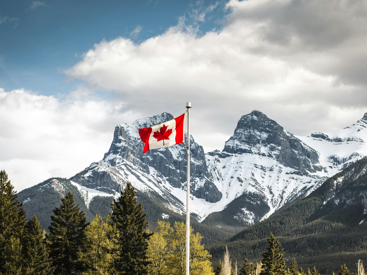
2 High Park
1873 Bloor Street West, Toronto, OntarioAn urban park designated an Area of Natural and Scientific Interest
Walk in from 1873 Bloor Street West and High Park soon makes clear it is more than lawns and benches: it holds an Area of Natural and Scientific Interest designation. That label is the reason to come. This is an urban park in Toronto that still asks you to look closely, at the ground, the canopy and whatever is moving in it. Don't bother with the manicured strip near the gate; keep walking until the paths narrow and the traffic noise falls away. Give it a whole morning rather than squeezing it in. The city's parks department keeps the official page at toronto.ca, and it's worth a look for seasonal notices before you go.
Area of Natural and Scientific Interest
-
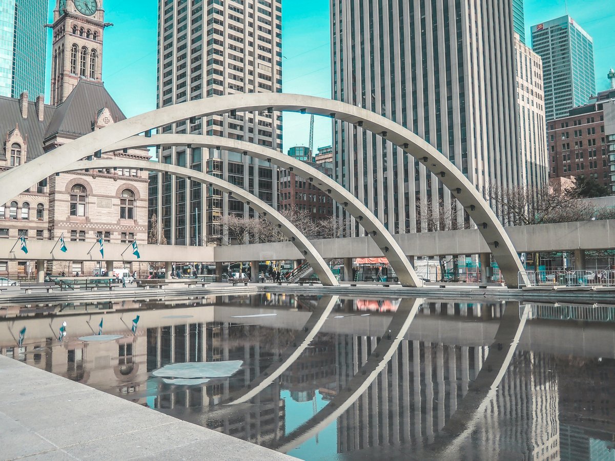
3 Nathan Phillips Square
100 Queen Street WestThe plaza in front of Toronto City Hall, there since 1965
Since 1965, Nathan Phillips Square at 100 Queen Street West has been the plaza in front of Toronto's City Hall, and it is still the place the city comes to be photographed. The mid-afternoon tour-group crush at the front edge is easy to sidestep: come early or after dark, when the square clears and you can read how its open plan works as civic theatre, a broad flat stage set directly before local government. Stand in the middle and turn slowly. Few places in Toronto spell out so plainly how the city wants to see itself, and you take it all in without paying anything except attention.
Dates from 1965
-
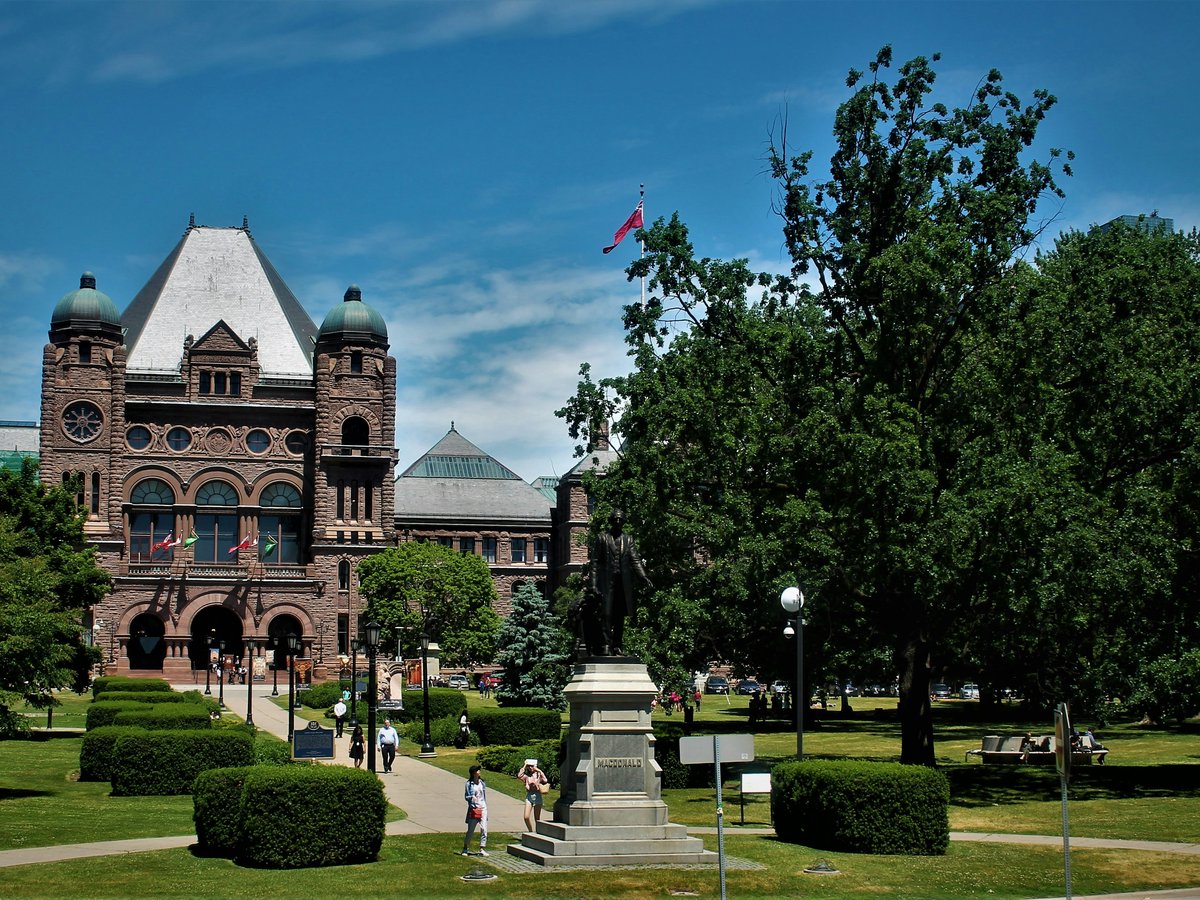
4 Queen's Park, Toronto
An urban park sitting just north of Ontario's Legislative Building
North of the Ontario Legislative Building, Queen's Park is an urban park in Downtown Toronto that puts provincial politics and an ordinary afternoon stroll side by side. Skip the hurried photo from the front steps of the legislature and walk round to the green behind it, where the pace drops and the benches fill with people reading, eating, and arguing quietly. It is an easy place to rest between downtown errands, and an even better one to sit and watch the city's political life from a polite distance. The city keeps a facilities page for the park at toronto.ca, worth checking for notices before a longer visit.
-
5 Allan Gardens
160 Gerrard Street East, Toronto, OntarioA public park and conservatory dating from 1858
Dating from 1858, Allan Gardens at 160 Gerrard Street East pairs a public park with a conservatory, and the conservatory is the reason to come. On a grey Toronto day it offers the most useful free hour in the city: step inside, let your glasses fog, and remember what warmth feels like. There is no point trekking to a paid attraction for the same fix when this is sitting downtown. Outside, the park is plainer and more lived-in, a working neighbourhood green rather than a showpiece. Check the city's conservatory page before you set out, because a glasshouse runs on its own calendar.
Dates from 1858
-
6 Christie Pits
750 Bloor Street West, Toronto, OntarioA public recreational area in use since 1909
Christie Pits at 750 Bloor Street West is a public recreational area that has been in use since 1909, and a century-plus of neighbourhood life shows in how unselfconscious the place feels. Nobody here is performing for visitors. Skip the stadium seats downtown and spend an afternoon on the grass watching whatever game happens to be on; it costs nothing, and you'll come away with more of the city than any ticketed attraction gives you. Bring a blanket and something to eat, and let the neighbourhood carry on around you. The city's facility page lists what the site offers, which is worth a look if you're travelling with kids who need to burn off energy.
Dates from 1909
-
7 Mel Lastman Square
5100 Yonge StreetA civic square on Yonge Street, well away from the downtown crowds
Mel Lastman Square at 5100 Yonge Street is a square in Toronto that most first-time visitors never reach, which is reason enough to go. Don't compare it with the postcard plazas: what you get here is a public square used the way the people who live nearby use it, at a slower pace and with no selfie sticks. Sit for a while with a coffee and watch how this part of the city spends its lunch hour. It makes a natural pause on a longer walk along Yonge, and it shows you a Toronto that has nothing to do with the tourist trail.
-
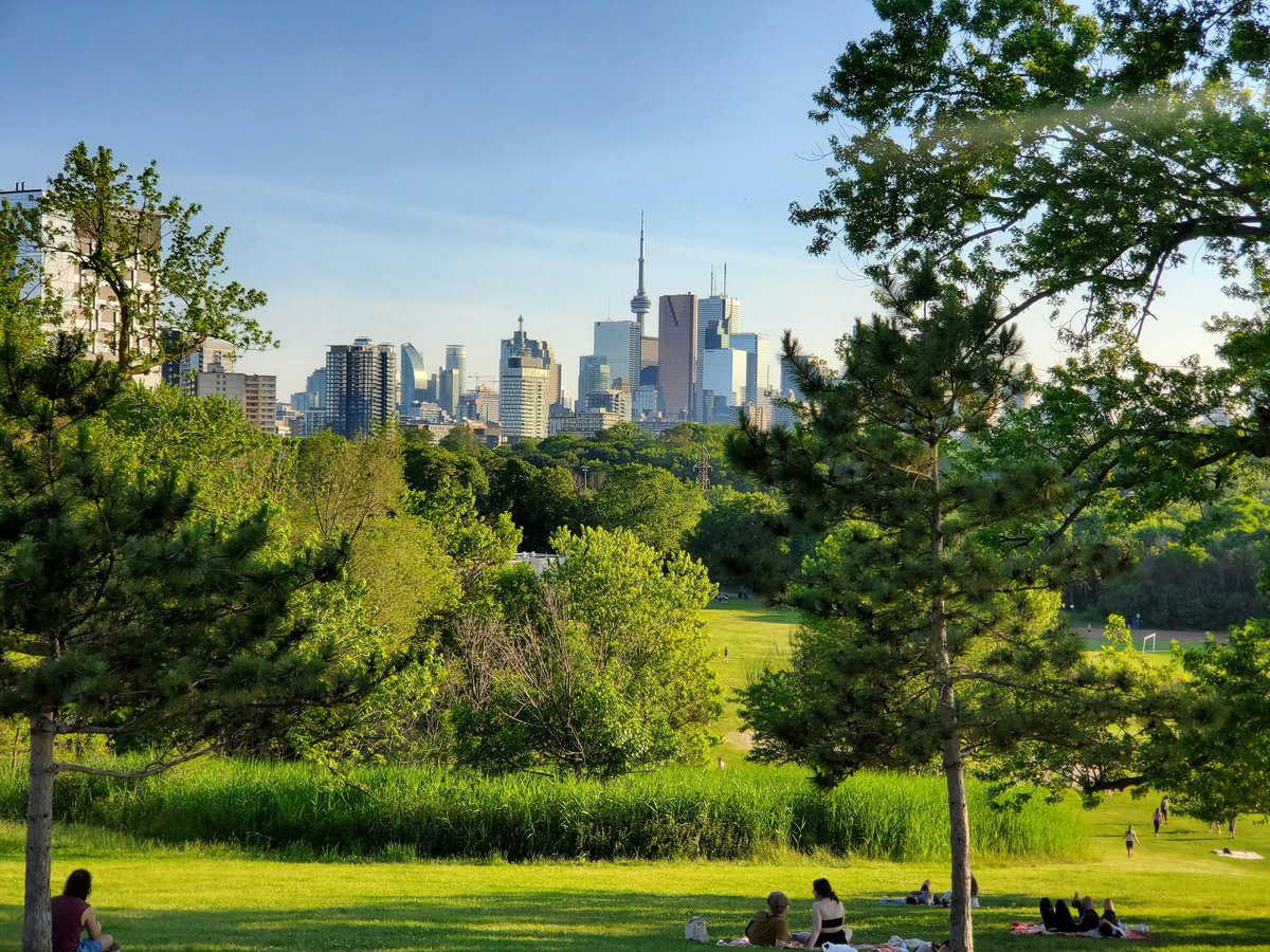
8 Toronto Sculpture Garden
115 King Street East, TorontoA small public park devoted to sculpture since 1981
The Toronto Sculpture Garden on King Street East has operated as a public park since 1981, doing a gallery's job without a gallery's door. Give the admission queues at the big art institutions a miss for one afternoon and start here instead: it is outdoors, it is quick, and the work is meant to be met in weather and daylight. Go slowly, walk all the way around each piece, and come back at a different hour if one of them stays with you. The garden's own site, torontosculpturegarden.com, is where you find out what is installed right now.
Dates from 1981
-
9 Biidaasige Park
39 Commissioners Street, Toronto, OntarioA park mapped as open 24/7
Open 24/7, Biidaasige Park on Commissioners Street is the pick on this list for travellers whose day doesn't fit park hours. Come for a dawn walk before an early flight, or a late stroll after dinner when the rest of the list has gone quiet. Skip the crowded waterfront promenades at peak hour; this park in Toronto rewards anyone willing to go a little out of their way. The city's official page has the visitor details, and reading it before you arrive means no surprises when you get there.
Hours: 24/7
-
10 Toronto Botanical Garden
Leslie StreetA botanical garden run as a public park
Gardeners who make the trip to Leslie Street find the Toronto Botanical Garden laid out as a public park in Toronto, so you can wander with no fixed route. The locals prefer it for an unhurried look at planting ideas over any glossy show garden, and they come back season after season to see what has changed. Bring a notebook if you grow things at home; this is a place you leave with ideas. Check torontobotanicalgarden.ca before you go for what is in season and anything happening on the day.
-
11 Kew Gardens
2075 Queen Street East, TorontoA neighbourhood public park on Queen Street East
At 2075 Queen Street East, Kew Gardens is a public park in Toronto that shares its name with a far grander garden overseas, and is all the better for being nothing like it. Skip the hunt for a famous lawn; this is a neighbourhood park, used hard and loved for it. Come on a weekend morning with a coffee from the street and watch the families, dogs and slow walkers settle into their routines. It makes an easy, unhurried stop on a longer walk along Queen Street East, and the city's parks page lists the facilities if you need specifics.
-
12 Grange Park
Beverley Street, Toronto, OntarioA downtown park with its own dedicated community website
Of the parks on this list, Grange Park on Beverley Street is one of the few that keeps a website of its own, grangeparktoronto.ca, which says something about how much the people around it care. It is a park in Toronto at a scale you can take in at a glance, which makes it ideal for a short break between downtown sights. When your feet give out, skip the chain coffee terraces; buy something to take away and find a bench here instead. Sit long enough and you will see the same faces go by twice. A good last stop, and an honest one.
Last verified by automated review (v1.7.2_fame1017d-1015-1362-20261017135539) on . What is automated review?